Brad Maguire: GIS Instructor at Vancouver Island University
GoGeomatics: Welcome to the GoGeomatics Canada community. First off, can you tell us about where you are from and where you have lived throughout your GIS career?
Brad Maguire: Thanks very much. I grew up outside of Vancouver, British Columbia, and I have lived in Saskatchewan, the Northwest Territories, Saskatchewan, Nova Scotia and New Brunswick at various times. I’ve been back in British Columbia since 1993, living in Vancouver and Nanaimo.
GoGeomatics: Where did you go to get your Geomatics education?
Brad Maguire: I started my GIS career at the University of Victoria, and then took the GIS program at COGS in Nova Scotia. I returned to school in 2002 to complete my Master’s degree at UBC, and now I’m finishing my Ph.D. there. In addition to my formal education, I’ve had years of on-the-job training, working for different levels of government and in the private sector.
GoGeomatics: Tell us about your first job in Geomatics.
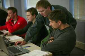
Brad Maguire: I went straight from COGS in Nova Scotia to work at Universal Systems Limited (later CARIS), in Fredericton, New Brunswick. I was hired to do Technical Support, and staffed the phone lines for a few years, answering obscure technical questions and honing my troubleshooting skills. This was a great opportunity to learn the innermost details of how a GIS worked. In hindsight, the informal training that I received at USL, reproducing hundreds of technical problems for programmers to fix, has been very helpful throughout my career. I still use these skills today in the classroom if something goes wrong with a lab assignment, which gives me the opportunity to show my students that almost any problem can be reasoned through, given a cool head and some focus on the problem.
GoGeomatics: How would you describe your Geomatics career thus far? How have you got to be where you are now as a GIS instructor in Vancouver?
Brad Maguire: It’s been a long and meandering road. In addition to working in Technical Support, I’ve done stints in GIS sales, consulting, development, and entrepreneurship. About half of my work has been within the Forestry industry, and the rest has been quite varied in subject. This breadth of experience is one of the things that helped me to get into GIS education.
GoGeomatics: You have been a instructor at Vancouver Island University since 2005. How have you seen GIS evolve over this time period? How have you adapted your teachings?
httpv://www.youtube.com/watch?v=0gMtkk9CoQs&feature=player_embedded#!

Brad Maguire: The biggest change over the past seven years has been the rise of Neogeography (e.g.Google Maps, Google Earth, Open Streetmap, Location-Based Services, and Crowdsourcing). These new technologies offer new capabilities, but it is also clear that the people developing these often make naïve mistakes. On the other hand, “traditional” forms of GIS need to be more responsive. Combining these areas of expertise positions our students so that they can use both sets of technologies effectively in the workplace. I have been constantly increasing the amount of Neogeographical concepts in my lectures and labs, and expect to continue doing so for the near future.
GoGeomatics: In your opinion, what makes an excellent GIS program?
Brad Maguire: A great GIS program must offer a combination of strong and up-to-date technical skills, and a willingness to look at where the technology can take us. Being responsive to our practicum sponsors and thoroughly understanding their applications helps us to identify the technologies to focus on.
It’s impossible to teach the students absolutely everything that they need to know in the workforce. This isn’t simply because technology is advancing so quickly, but also because students want to graduate in a reasonable amount of time. To address this, we work closely with the students to build up their technical skills, and show them how to tackle new problems with confidence.
GoGeomatics: How do you, as GIS Faculty, make sure that what you are teaching and imparting to new GIS students is giving them the skills and the problem solving they will need for the work force?
Brad Maguire: As part of our practicum program, we are constantly talking with GIS employers and enquiring about their needs. Their suggestions are incorporated into our program, usually for the next intake of students.
We focus on delivering our content using the latest available software at our disposal, which causes us a lot of pain when major software releases occur! On the positive side, this means that our students enter the workforce with current skills, and they can often help people at their place of work upgrade their skills.
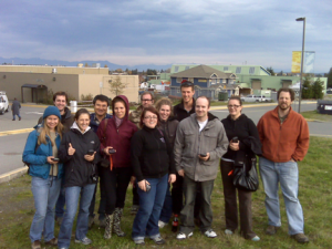
Students begin our face-to-face program by installing ArcGIS on their own laptops, and by the time they graduate, they are quite used to the bumps and bruises that come with working on the newest technology. They’ve been working with real datasets on real problems, and when things don’t go right, they are able to work out a solution or find a workaround. We emphasize that there are multiple ways to solve problems in GIS, and having this perspective makes for an employee who is a problem solver and isn’t afraid to take on new tasks.
GoGeomatics: In terms of GIS concepts, what is the most difficult item for you to teach?
Brad Maguire: Every student has his or her own background and strengths, so students tend to find different aspects of the program, such as programming or cartography difficult. The one exception to this is map projections, which seems to be a challenge for everybody! Ideally, we would have an entire course dedicated to geodesy and map projections, but it is difficult to focus this closely on one technical area when there are so many others to address.
GoGeomatics: What are some real examples of what you are teaching that achieves this? Do you have any assignments you could share with GoGeomatics?
Brad Maguire: We address the issues around map projections with multiple lectures in different classes, so that students get the message in different ways from different instructors. In my introductory class, we have a detailed assignment which examines different map projections, issues with those projections (issues of area, scale, shape and direction distortion), and commonly used map projections in British Columbia and Canada.
GoGeomatics: What does Vancouver Island University look for in a prospective student for your program?
Brad Maguire: We look for students who have a strong background in one or more other fields, as well as strong learning skills and some evidence that they have perseverance. An amazing number of our applicants are “Renaissance People,” and this diversity makes for some interesting classroom discussions.
GoGeomatics: Do you have any student portfolios that you would like to share with us? Some that might give other prospective students an idea of what to expect if they were to come to study with you?
Brad Maguire: Yes, Steve Platt graduated from the ADGISA Program in 2006.
 Before Steve entered the Vancouver Island University’s Advanced Diploma in GIS program, he worked as a Forest Development Engineer for 8 years. He always enjoyed the mapping and GIS projects he was involved with and when the forest industry slowed, he took the opportunity to change his career path and obtain an Advanced Diploma in GIS. After graduating in April 2006, he obtained work with Strategic Forest Management Inc. Strategic was a small, but growing natural resource consulting firm based in Port McNeill and Campbell River, BC. He started with operational mapping and support, but as the company grew, he quickly gained more responsibility and experience. Within a few years, he was managing projects and staff. Currently, Strategic has a GIS department that employs 15 full time staff. Steve is now managing a Remote Sensing Program and focuses on expanding the use of LiDAR in the natural resource sector.
Due to the nature of the GIS consulting business and the diverse client base that Strategic has, Steve has had the pleasure of working on a wide variety of projects and working with a wide variety of software platforms. His expertise now includes GNSS processing and management, 3D visual rendering, modelling and simulation, LiDAR processing and analysis, wildlife habitat modelling, wildfire hazard and risk modelling, and wildfire Infrared Hotspot Detection and Mapping.
Steve has also been able to participate in training programs, has spoken at conferences and in front of many clients. He recently spoke at an ESRI Regional User Conference (Victoria 2012).
The VIU ADGIS program gave Steve the foundation he needed to grow and excel in the fast-paced world of GIS. With the knowledge and skills he developed within the program, Steve has found a career that he is excited about and a career that allows him to continually better himself and grow with the industry.
GoGeomatics: What makes your program stand out from all the other programs out there? Why should someone go to Vancouver Island University?

Brad Maguire: Our program focuses on GIS Applications, specifically, the customization of the ESRI suite of GIS Software (ArcGIS) to meet the needs of GIS users. If you are interested in helping an organization become better established, developing a GIS department, and building a career, then the ADGISA program at VIU might be of interest to you.
GoGeomatics: Is there anything about Nanaimo (on Vancouver Island, which is a 1 1/2 hour ferry ride from Vancouver) that entices prospective students?
Brad Maguire: Nanaimo is a small city (population 84,000) that has most of the benefits (plenty of shopping and services), but few of the drawbacks (traffic, high rent) of larger cities. We are located on the East Coast of Vancouver Island, directly across the Strait of Georgia from Vancouver. The city
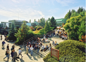 has many parks and numerous opportunities for outdoor recreation, such as hiking, mountain biking, skiing, and kayaking. Nanaimo has a vibrant arts community and a strong nightlife in the downtown core.
Of course, in our online program, students never need to leave their hometown, which is attractive for many students in remote parts of Canada and abroad.
GoGeomatics: What are the job prospects like for graduates of your program?
Brad Maguire: Our aim is to produce GIS technicians who are ready to start entry-level positions in the GIS industry. Because the industry continues to experience strong growth, there are always new opportunities for our students. In a recent survey of our graduates, all of the 2012 graduates had found work. Our students have found employment at a wide variety of organizations, including government, industry, and NGOs.
GoGeomatics: We appreciate you taking the time to talk to GoGeomatics Canada and showing us what your GIS Applications Advanced Diploma program at Vancouver Island University has to offer.
Brad Maguire: Thanks very much for speaking with me.


