
Canadian Geospatial Briefing for November 23rd: Mapping corridors for drones; RAMMS technology to map Lake Huron; Indigenous mapping workshop; InDro Robotics working with Rogers & UBC; 5th Pan-Canadian SDI Summit
Canadian startup AirMatrix maps air corridors for drones
AirMatrix is working on mapping out corridors in the sky to create drone “highways”. Manned and unmanned air traffic are becoming more common and creating a model like AirMatrix will allow for designated and efficient UAV routes.
Users and cities stand to benefit from these highways in the sky in three key ways:
- Creation of a safe and efficient infrastructure ready for the drone surge
- Gain the ability to control, monitor, and regulate the new sky roads
- Gain expert support in local task forces shaping regulations
https://dronedj.com/2020/11/13/canadian-startup-airmatrix-maps-air-corridors-for-drones/
Fugro deploys latest RAMMS technology to map Lake Huron for Canadian Hydrographic Service
Fugro is using its Rapid Airborne Multibeam Mapping System (RAMMS) to acquire 3147 km2 of high-resolution bathymetry data over Lake Huron for the Canadian Hydrographic Service (CHS). This is expected to take 6 months to complete and will support CHS’ ongoing nautical charting updates in the Great Lakes region.
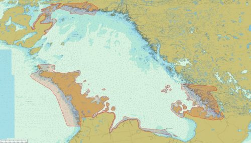
Fugro has using RAMMS in other projects throughout North America, the Caribbean and Europe. Their innovative technology will enable the efficient and accurate data acquisition of Lake Huron despite the lake’s multiple challenges: extensive areas of shallow water, complex coastlines and sparse coastal infrastructure.
‘Maps are stories made visual’: Indigenous mapping in Sask. part of international virtual workshop
Last week, the Indigenous Mapping Workshop took place online. The workshop was hosted by the Firelight Group, the First Nations University of Canada and other Indigenous organizations.
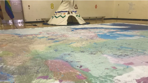
The annual workshop helps participants map out landscapes using high-end technology and understand the significance they have to Indigenous history, knowledge and culture. They also serve to start dialogues between Indigenous mappers and provide hands-on training for people who want to incorporate technology in their mapping. More than 900 people from 35 different countries registered this year, much more than when the event first launched in 2014.
https://www.cbc.ca/news/canada/saskatchewan/indigenous-mapping-in-sask-1.5803460
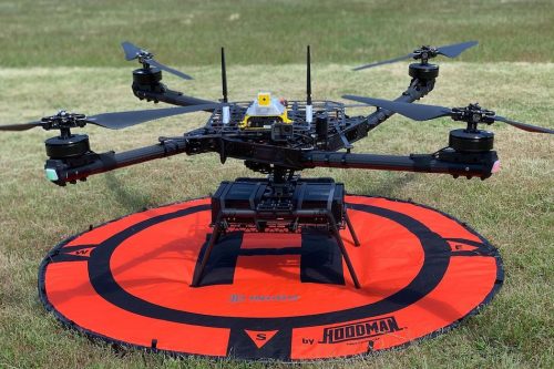
InDro Robotics Working With Rogers, UBC to Find 5g Applications For Drone Technology
A drone startup based in Salt Spring Island, British Columbia called, InDro Robotics, has partnered with Rogers and the University of British Columbia (UBC) to research future 5G use for drone technology. Usually drones are operated using radiofrequency. InDro Robotics will be the first done company in Canada to move to cellular network connectivity instead. This approach will allow drones to be controlled at greater distances than now. Using Rogers’ cellular network, their drones currently have a range of over 50 km. They hope to increase this range to 200 km.
InDro Robotics is also looking into applications for drones that will have positive impact on society. Examples include: agriculture sensors to reduce pesticide use and wildfire prevention sensors.
5th Pan-Canadian Spatial Data Infrastructure (SDI) Summit

GoGeomatics is pleased to announce the 5th Pan-Canadian Spatial Infrastructure (SDI) summit. This year’s theme is: Responding to the Needs of Northern and Remote Communities. Northern and remote communities have limited infrastructure which can result in problems accessing tools and information that affect decisions in areas such as land use planning and emergency planning. These limitations will be discussed at the summit along with highlighting the innovations and opportunities to advance geospatial data discovery, access, use and much more.
The summit will take place online on December 2nd and 3rd. Spread over two days, thought provoking presentations and an interactive panel discussion will be held. Keynotes will be given by Dr. Peter Pulsifer (Carleton University) and Dr. Nadine Alameh (OGC CEO).
Registration is now open and it’s free!
https://gogeomatics.ca/5th-pan-canadian-spatial-data-infrastructure-sdi-summit/

