Cansel Discusses Innovations in LiDAR: Latest Technologies Across Industries
On April 5, 2022, LiDAR COMEX 2022 held a live stream presentation by Cansel.
The topic of “Scan to BIM Solutions for AEC, BIM & VDC Applications” was presented by Amar Kalsi, Cansel Segment Manager – Terrestrial Scanning. Jean-Michel Dupé, Cansel Segment Manager Rail/Monitoring presented, “Scanning challenges in a tunnel/rail environment.” The next speaker from Cansel was Segment manager, Aerial and Terrestrial Imaging, David Laflamme. He spoke about “Lidar data collection using drone and vehicle-based systems. Laflamme was followed by Stephen Vickers, Cansel MGIS and Software Solutions Manager, who presented the topic of “Multibeam Bathymetric Survey.”

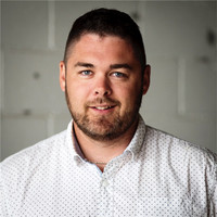
Amar Kalsi, Cansel Segment Manager – Terrestrial Scanning.

Jean-Michel Dupé, Cansel Segment Manager Rail/Monitoring
For tunnel and rail industry scanning, challenges include long linear features that challenge the accuracy of registration, often requiring survey crews and additional equipment, live traffic, limited maintenance time, and the need to have equipment capable of handling tunnel designs. The solution to these issues is using a high-quality LiDAR hybrid, allowing more control in a specific area and point cloud already tied to a survey network. The need to register at an office is eliminated. Trimble SX12 was mentioned.
In topo surveying and volumetric calculation, challenges are human resources, security, and conventional equipment limitations. The solution is a mounted drone on a LiDAR system with high accuracy. This is a quick, safe, and easy way to collect data on the ground without anyone having to be there. It allows point cloud data, and data is attained within minutes on site.

Stephen Vickers, Cansel MGIS and Software Solutions Manager

David Laflamme, Cansel Segment manager, Aerial and Terrestrial Imaging
Road surveying and engineering industry challenges include human resources, security, and short time limits. The technology involved in the solution is a vehicle-mounted, highly-accurate mapping system. Driving at 100 km, this system is quick, easy, and safe. It collects a large amount of various data all at one time.
In the Bathymetric industry, the challenges of vehicle cost, safety, and accessibility, as well as efficient and integrated workflows arise. The solution involves multibeam echosounders and unmanned automated systems. These can quickly, easily, and safely collect large quantities of data from the seafloor, and can be integrated with above-waterline data.
A Q and A followed the presentation.
A heartfelt thank you goes out to Cansel for being a Silver Sponsor for LiDAR COMEX 2022.
You can watch the presentation in full on YouTube below.


