

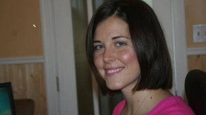
Emily MacDonald – Co-Founder of Integral Geomatics
 GoGeomatics got the chance to talk to Emily MacDonald, and share her story with you, our readers. She is the co-founder of Integral Geomatics, a geospatial consulting company located in Cape Breton Island, Nova Scotia.
I would first like to thank you for taking the time to take part in this interview for the GoGeomatics magazine. Would you like to start by telling us a little bit about yourself?
Emily MacDonald: I am from beautiful Cape Breton Island and I believe I have developed many personality traits as a result of island living. I am a family orientated person who loves cooking and sharing meals with family and friends. I love being outside, especially in the summer months, lounging on the gorgeous beaches of Cape Breton.
GoGeomatics Canada: What university did you attend and what have you studied?
Emily MacDonald: I have a Bachelor of Science in Biology from Cape Breton University, an advanced diploma from the Fisheries and Marine Institute of Memorial University, and a master of science in Coastal Zone Management from the University of Ulster, Ireland.
GoGeomatics Canada: In what way did your education influence you to pursue a career in Geomatics? Were there other influences aside from your education?
Emily MacDonald: During my advanced diploma I was introduced to remote sensing and geographic information systems, the ability to visualize such grand amounts of information blew my mind. I was amazed at the potential of the technology to help us manage our environments. Besides my education, my Mother encouraged me to start my own company. She is a very forward thinking woman.
GoGeomatics Canada: What was your first GIS position, and with what company? What did you do?
Emily MacDonald: My first GIS position was as a student. The instructor, who was excellent at his job, had us writing up responses to actually requests for proposals. He was a very supportive man and taught us a lot about GIS but also about the industry and how we could find employment opportunities in it.
GoGeomatics Canada: Did it ever cross your mind that you would head a business, more specifically a geospatial consulting company? How did this come about?
Emily MacDonald: I have certain technical and communication skills that absolutely lend to managing a company. But it is important to highlight my age (27) and my generation (Y I think we are called haha) it’s an entrepreneurial world out there. We have to be creative in this economy!
GoGeomatics Canada: What type of software is utilized most commonly at Integral Geomatics?
Emily MacDonald: ESRI’s ArcGIS 10.0
GoGeomatics Canada: We all know that Geomatics is a field that changes at a rapid pace. What is something that you would like to learn and pursue next?
Emily MacDonald: I would like to learn some programming. As well as another language, perhaps Spanish. I would like to work in South America someday.
GoGeomatics Canada: How does Integral Geomatics remain competitive both locally and internationally?
Emily MacDonald: We try to remain as visible as possible- attending tradeshows/expo’s/networking events.
GoGeomatics Canada: Are there any examples of past or present work that you would be willing to share with us, and provide us with an explanation? What makes these maps so special to you?
Emily MacDonald: Unfortunately, our recent work is research based, and I am not able to share to products.
GoGeomatics Canada: Going to work everyday, what do you find most rewarding and challenging about your career?
Emily MacDonald: I guess maintaining a positive outlook on your career and life is a lot of work! Absorbing the highs and lows is both the reward and the challenge. Staying focused yet being as creative as possible! It’s a fun balancing act.
GoGeomatics would like to express our sincere thanks to Emily for partaking in our segment on Canadian Women in Geomatics for International Women’s Day 2013. We appreciate her sharing her personal thoughts and experiences with us and the geomatics community.


