
Facing further challenges in Toronto’s urban growth
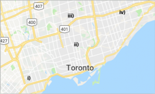
The four areas of study in the City of Toronto. i) Etobicoke Centre, ii) Yonge-Eglinton Centre, iii) North York Centre, and iv) Scarborough Centre. Image courtesy of Google Maps.
In my last article I examined the use of GIS technology to track land use change in three downtown Toronto districts, an area representing one of the urban growth centres designated by the Places to Grow Act.
This article will look at four Toronto urban centres slated to undergo land use change: Etobicoke Centre, Yonge-Eglinton Centre, North York Centre, and Scarborough Centre. GIS technology such as ArcMap and reference information from Emporis, GoogleMaps, Urban Toronto, and SkyscraperPage are instrumental in projecting the incoming changes, challenges and opportunities. One corner of Dundas Street West and Shorncliffe Boulevard currently occupied by commercial buildings and parking lots will be redeveloped into a community featuring nine residential towers, commercial office space, street level retail, and a new public park.

3D land use change of Etobicoke Centre between 2018 (a) and the near future (b). Land use classes: Red –Residential, Purple – Commercial, Green – Greenspace, Light Green – Parking, Yellow – Under Construction, and Light Blue – Other. i) Pinnacle Etobicoke, and ii) Kip District.
Next to the development, construction of another community—the Kip District—will consist of five modern towers, retail, and greenspace. Both developments will combat urban sprawl, but they aren’t without their infrastructure challenges: For instance, their proximity to the Kipling subway station would compound overcrowded trains and subway platforms, especially during rush hour. A solution might be to increase GO train service on the rail line adjacent to the subway station, providing an alternative transit route for residents travelling throughout the region.

3D land use change of Yonge – Eglinton Centre between 2018 (a) and the near future (b). Land use classes: Red – Residential, Purple – Commercial, Green – Greenspace, Light Green – Parking, Pink – School, Yellow – Under Construction, and Light Blue – Other. i) Plaza Midtown.
In the Yonge-Eglinton Centre, several tower-in-the-park communities are set to be redeveloped. One project called Plaza Midtown is replacing two parking lots with residential towers and new green-space spanning the centre of the complex. At one intersection on Yonge Street, two residential towers are set to replace low-rise commercial buildings that occupy the site, with one already under construction. These developments add residential density and more inclusiveness to isolated tower-in-the-park communities, but they also encounter issues like school capacity: with only two schools in the area, more condominiums will push these institutions to overcapacity, forcing students to attend other schools at further distances. Such issues can be resolved by creating large additions or rebuilding existing schools.

3D land use change of North York Centre between 2018 (a) and the near future (b). Land use classes: Red –Residential, Purple – Commercial, Green – Greenspace, Light Green – Parking, Yellow – Under Construction, and Light Blue – Other. i) Ellie Condos.
North York Centre will install several surface parking lots and residential towers with retail space. One project called Ellie Condos will feature an office tower along with residential and retail. However, the current street network, previously built for the automobile in mind, has not adapted to the increased residential and commercial density. Many residents and workers are currently forced to cross six lanes of traffic on Yonge Street with cars, trucks, and buses travelling at high speeds. This is unlikely to change soon as Toronto City Council voted to defer a motion that would see separated bike lanes and widened sidewalks on that part of Yonge Street, but the remake would be a step towards pedestrian safety.

3D land use change of Scarborough Centre between 2018 (a) and the near future (b). Land use classes: Red –Residential, Purple – Commercial, Green – Greenspace, Light Green – Parking, and Light Blue – Other. i) 675 Progress Avenue
A large commercial property in Scarborough Centre is anticipated to become a mixed-use community complete with four residential towers, retail and office space, and a community park. This development, call 675 Progress Avenue, brings significant change to an area once characterized by expansive parking lots and low-rise commercial buildings. However, like the new communities at Etobicoke Centre, Scarborough Centre would face transit crowding for local bus service and the Scarborough RT. Installing more protected bike lanes on arterial roads and increasing bus service are crucial towards making Scarborough Centre more pedestrian and transit friendly.
The next article in this series will move beyond the City of Toronto and concentrate on the land use changes occurring in growth centres in York Region.