
Geoscience BC Launches Largest Airborne Magnetic Survey in its History
Vancouver, BC — Geoscience BC announced the launch of its largest airborne magnetic survey to date — the Search Phase II survey which will produce high-resolution maps used to identify hidden mineral potential in west-central British Columbia.
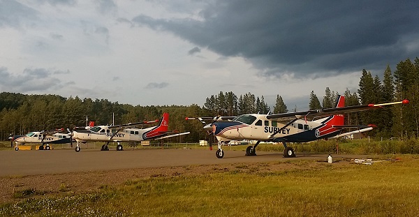
The Search Phase II project will run through to September 2016 with aircraft flying out of the Burns Lake and Smithers airports. Three Cessna Super Caravan planes outfitted with sensitive magnetometers will be flying over a 24,000 square kilometer grid that extends from Fort Fraser to Smithers — an area equivalent to 75 per cent the size of Vancouver Island. The magnetometer detects and records local disturbances in the earth’s magnetic field that are caused by magnetic minerals in the upper regions of the earth’s crust. These magnetic signatures are then mapped for explorers to analyze and focus their on-the-ground work.
Results from the Search Phase II survey will bridge the gap between Geoscience BC’s Search Phase I survey completed last year and the TREK survey in 2013. Together, these three adjoining surveys will provide continuous high-quality magnetic data covering a 55,500 square kilometer area — equivalent to the size of Nova Scotia.
Results from the Search Phase II project will be publicly available in 2017 through Geoscience BC’s website on the data release page and on its Earth Science viewer.
This year Geoscience BC has initiated 13 new minerals-related projects, including Search Phase II, representing an investment of $2.5 million in earth science research.
For additional information, please contact :
Martin Livingston
Geoscience BC
Cell: 604-657-8234
Email: martin.livingston@ymail.com


