International Geospatial Briefing Dec 6: 1. GPR Painting New Pictures of the Past; 2. Satellite Imagery to Support Clean Water for All; 3. Summer Heat and Environmental Inequality in Albuquerque; 4. Remote Sensing Keeping an Eye on Deforestation; 5. Educating a Skilled Geospatial Workforce in Somalia; 6. Announcing The Virtual Subsurface Utility Mapping Strategy Forum Conference
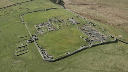
Ground Penetrating Radar Providing New Insights for Archaeologists
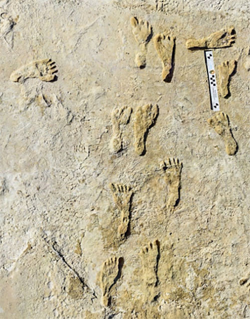
New applications of ground penetrating radar (GPR) are allowing archaeologists to gain deeper insights into ancient settlements. A team with the national park service has used GPR to discover fossilized human footprints that date back 23,000 years. The use of this technology is allowing researchers to gain a better picture of ancient settlements and make sub-surface discoveries, creating a clearer picture of how our ancestors lived. GPR adds to the complement of geospatial tools that are changing the way archaeologists work around the world, where they have already had great success using LiDAR.
To read the full story, check it out here.
Satellite Imagery to Support Clean Water for All
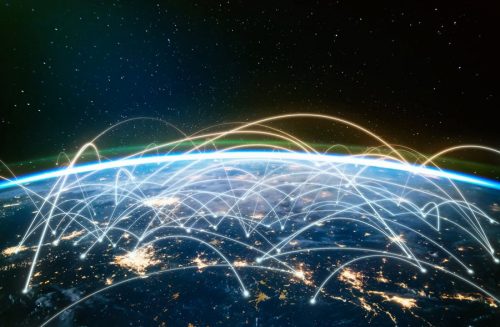
To meet the UN’s Sustainable Development Goals will require dedication and cooperation on a massive international scale. One of their important goals is to achieve clean water and sanitation for all by 2030, and geospatial technology has been tapped as a tool to help make this happen. Through determining the availability of water using remote sensing techniques as well as proximity analysis to see where vulnerable populations are in relation to clean, reliable water sources, a road map can be created to deliver the infrastructure in communities that need it the most. A recent study in Rwanda found that only 60% of the population was within an optimal distance to water collection points, and in Zambia, more than 77% of the population lived beyond the government’s prescribed distance to an improved water point.
To read the full story, check it out here.
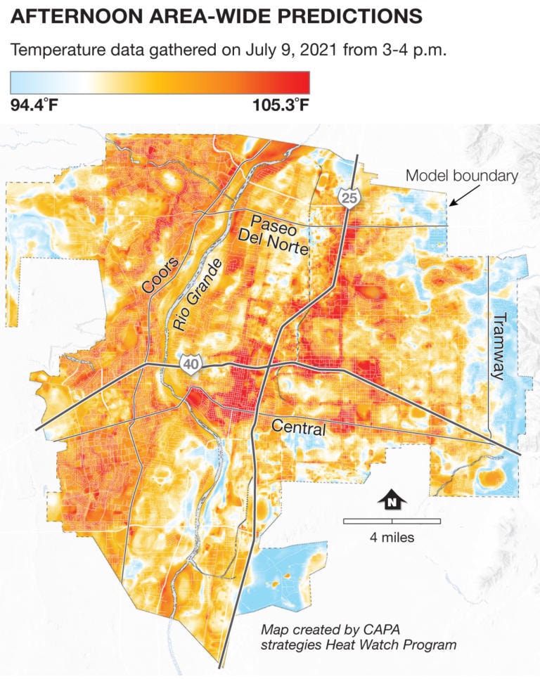
Mapping Summer Heat in Albuquerque
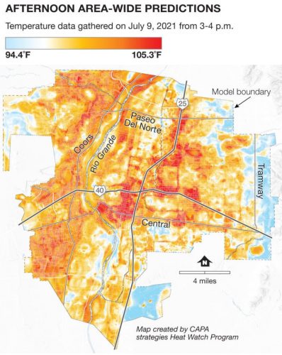
Researchers and volunteers teamed up in Albuquerque, New Mexico to create a citywide heat map. Through mapping out different neighbourhoods, they found staggering differences in afternoon temperatures of as much as 17 degrees across the city. The project is part of a focus on assessing social vulnerability and climate change adaptation, where the results will be used to support efforts to make the city more resilient in extreme heat events. Tree planting and other shade producing projects can be targeted to the most affected areas, often lower-income neighbourhoods, in an effort to raise environmental equality across the city.
To read the full story, check it out here.
Remote Sensing Analysis: An Important Tool to Fight Deforestation
Remote sensing analysis is finding that many countries aren’t living up to the commitments they made to halt global deforestation by 2030 back in 2014 at a UN climate summit. Over 100 countries, including Canada, have recently renewed their commitments at the COP26 summit that took place in Glasgow last month. A very lofty goal, the studies found that deforestation rates have actually increased by roughly 40% since the initial agreement was made back in 2014. Organizations like the Global Forest Watch continue to rely on remote sensing to monitor progress in the fight against deforestation. Although initial commitments have not been kept, hopefully, the monitoring and tools developed like those from GFW will hold countries accountable for their goal. While deforestation can be a hotly debated topic, new research is supporting the claims that forest growth and health is one of our most reliable allies in the fight against anthropogenic climate change.

To read the full story, check it out here.
Geospatial Education Providing Skills to Respond to Crisis in Somalia
Training initiatives have begun in the parts of Somalia that were hardest hit by recent events such as COVID-19 and Cyclone Gati. In response to the global pandemic and a slew of natural disasters, officials in the region have sought to strengthen data ecosystems in the country, with a focus on infrastructure, population, and public awareness. By developing a skilled workforce, they have been able to create resources such as a data visualization hub that aided in COVID-19 decision making which also proved critical in response to the catastrophic Cyclone Gati. The Somalia National Bureau of Statistics and GRID3 are continuing their collaboration by expanding these skills nationally.
To read the full story, check it out here.
Announcing The Virtual Subsurface Utility Mapping Strategy Forum Conference
Building off the success of the inaugural Canadian Underground Forum that took place at GeoIgnite 2021, GoGeomatics is thrilled to announce the Virtual Subsurface Utility Mapping Strategy Forum Conference which will take place from March 22-25th, 2022. Be sure to stay tuned to the GeoIgnite and GoGeomatics websites for more details on this event as they are made available.
Check out the SUMSF website for all of the latest updates here.
JM