

International Geospatial Briefing July 12th, 2021: Mapping the hot hotspots in the world; Esri’s book calling for action for conservation; June ArcGIS Living Atlas Updates; Telecomm giant maps climate resilience; Map the graveyards and trace you family tree; LiDAR to stop texting and driving; Digital Twin of the News
Mapping the hottest temperatures around the world
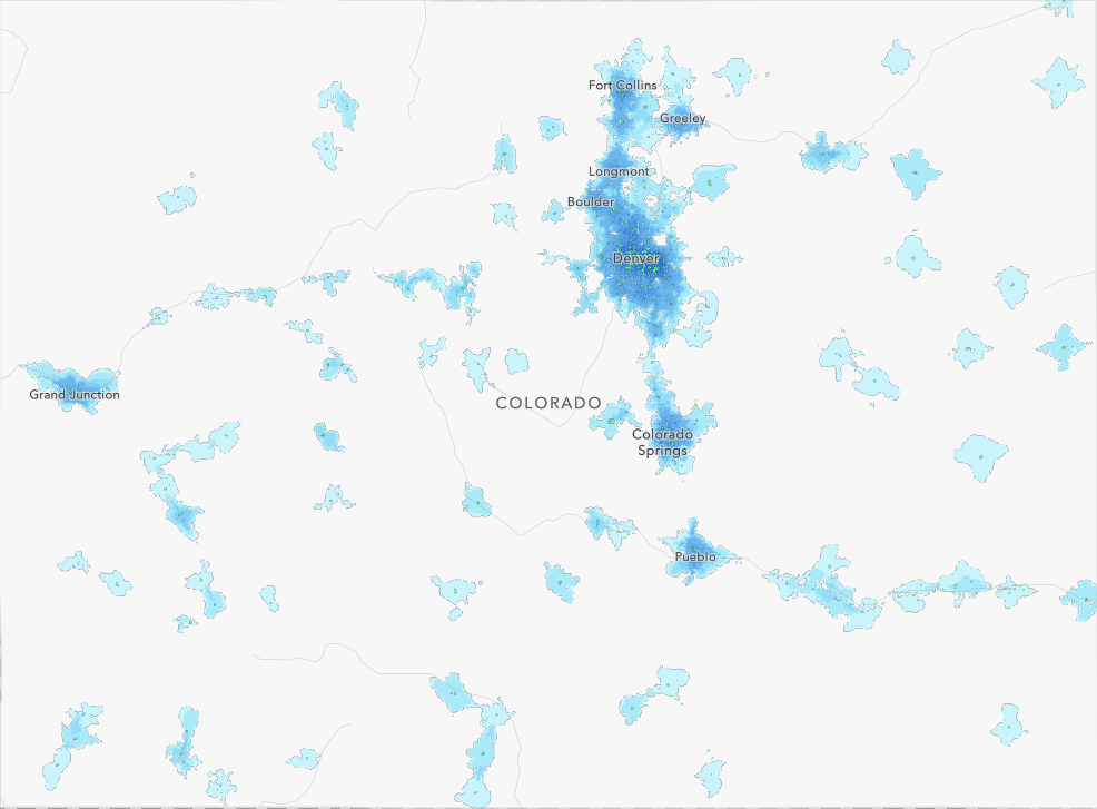
June was an exceptionally hot month for several countries in the northern hemisphere. A “heat dome”, where high pressure traps the heat, is being blamed for the excessively high temperatures in western North America. In Canada, Lytton, BC hit 49.6 °C, breaking the highest temperature records in Canada. Portland hit 46.6 °C, also breaking a 50-year-old record. In the Middle East, multiple countries have recorded over 50 °C, including Nuwaiseeb, Kuwait saw the highest temperature on Earth in 2021, reaching 53.2 °C. The following map stunningly shows the heatwave being observed in the Middle East.

https://www.aljazeera.com/news/2021/7/1/interactive-mapping-hottest-temperatures-around-world
Esri Releases Book That Is a Call to Action for Conservation
Author and conservation strategist Breece Robertson addresses the need for a common language and a platform to connect all the great conservation work that’s being done—and will be done—around the globe. The book shows how organizations can more effectively manage operations, grow partnerships, and engage the community while communicating more convincingly with supporters and with policy makers.
https://gisuser.com/2021/07/esri-releases-book-that-is-a-call-to-action-for-conservation/
ArcGIS Living Atlas June News
ArcGIS Living Atlas is a great collection of curated maps, apps and data layers from the user community. The analysis-ready data layers and tools are integrated across the ArcGIS platforms. The recent update has brought us exciting features, including the USA Current Wildfires live feed which is updated every 15 minutes, geospatial deep-learning models such as Ship Detection (Using SAR) and an app featuring the Grocery Store Access. A lot of interesting things to explore on the newly-patched Living Atlas!
AT&T mapping the way to climate resilience
AT&T, being the largest telecommunication company in the States commits to become carbon-neutral in 2035. With the help from Esri, the telecom giant visualizes how the use and analysis of spatial data can transform the corporation to combat climate change. Geospatial tools are used to analyze and prepare for problems like extreme weather.
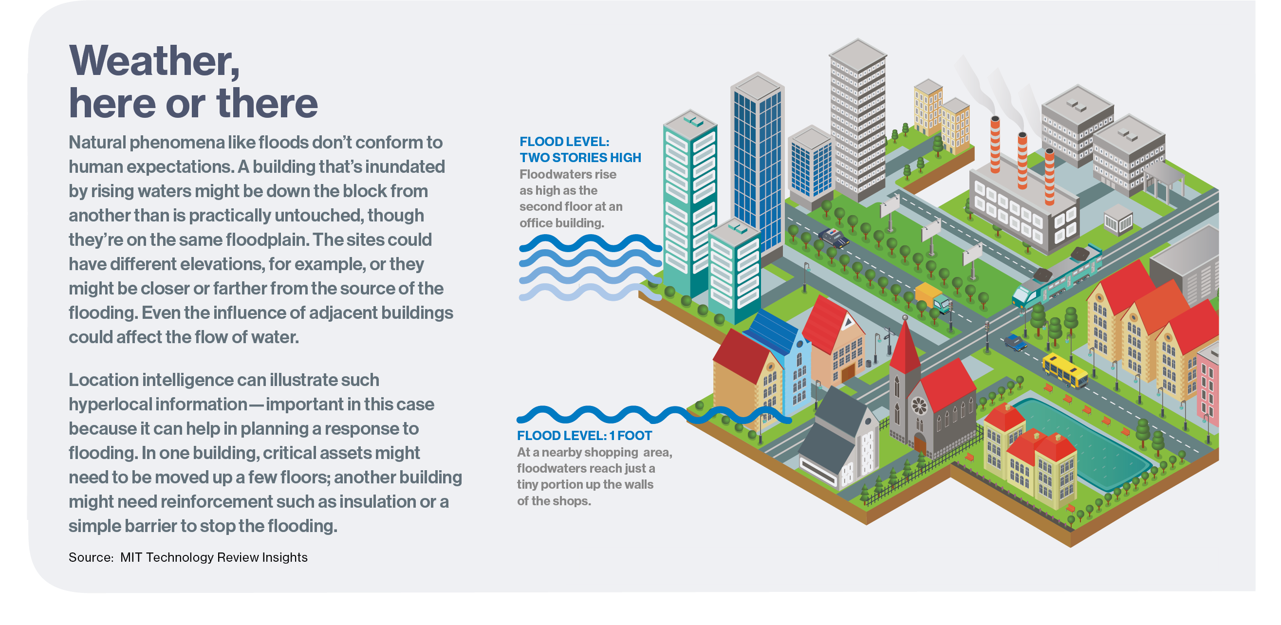
Download the full report.
https://www.technologyreview.com/2021/06/29/1027176/mapping-the-way-to-climate-resilience/
Penrith firm’s world first technology to transform tracing your family tree
Atlantic Geomatics from England is using geospatial technology to map the country’s burial grounds. With the development of new technology, the company seeks to map all the graveyards of the Church of England and record paper church documents to construct a comprehensive database for the studies of genealogy for the nation.
LiDAR sensor trials to identify traffic hazards in Australia
The Victorian Government of Australia has erected LiDAR sensors at intersections in the city. Not only the sensor can detect the movement of road users, a new tech that combines high-definition cameras and AI can detect offending drivers using their phone illegally behind the wheel. Day and night, the double camera set up can catch those who text while driving.
https://www.geospatialworld.net/news/lidar-sensor-trials-to-identify-traffic-hazards-in-australia/
Digital Twin of the News — AI enhanced news and EO data just a few clicks away
A digital twin, a virtual representation of a physical entity, aims to mimic the behaviour of its real-world counterpart in a digital environment. Digital Twin of the News (DToN), the entity is the Earth and the natural processes focus on extreme natural events such as wildfires, volcanic eruptions, floods, droughts, or air pollution events.
The app captures natural event news from around the globe, the Digital Twin of the News then processes the satellites images of the event location before and after the date. The product presents a swipe map showing the changes of the Earth.


