

Introducing New GoGeomatics Online Community Managers : Tanya, Celso, Paul, Rosette and Elizabeth
GoGeomatics Canada is over 7000+ subscribers strong with over 1,000 published articles. Our community managers are passionate and committed to keep the website updated with engrossing geospatial stories and content, recent job postings, meetups and events. Spread across the country, we all meet virtually once a week to discuss international and Canadian geospatial stories.
We are pleased to welcome four new members to our team, as online community mangers. Please say hello and connect with Tanya, Celso, Paul, Rosette and Elizabeth.
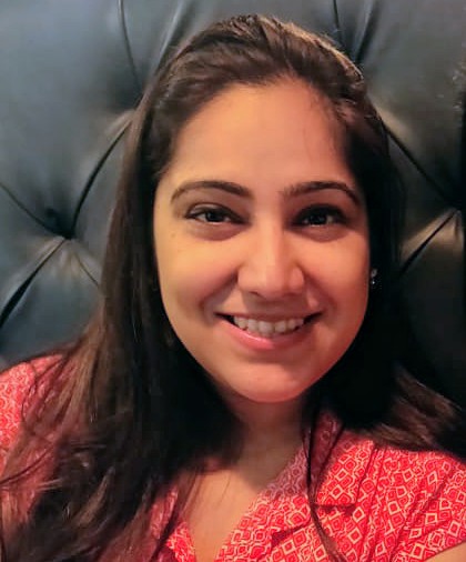
Tanya Tejassvi is a GIS Analyst and Developer. She holds a Master’s degree in Geo-Information Science and Earth Observation from ITC, University of Twente, Netherlands. Her professional experience includes spatial data development and analysis for catastrophe models, location analytics, geo-visualizations and web development. Also a software engineer, she is experienced with various programming languages and relational databases. In her free time, Tanya volunteers for humanitarian web mapping projects, and she is an active member for Women In Geospatial and Women in GIS groups.
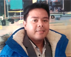
Celso Isidro is a full stack JavaScript Development Student at ComIT, Canada and a reviewer at Elsevier, respectively. He has 9 years of experience with Remote sensing and GIS Technologies and their applications to base metal mining operations, quarry materials extraction and environmental management. He concentrates on satellite and LiDAR imaging of land use and land cover changes, spatial modelling of inland water qualities, topographic and mine exploration drilling surveys and monitoring of mine rehabilitation. He holds an M.Phil degree in Applied Geomatics Engineering and Hydrology from The University of Queensland, Australia. He is also an alumnus of University of Philippines where he earned M.Sc Environmental Engineering and B.Sc Mining Engineering.
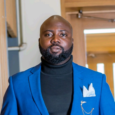
Paul Ajayi is a GIS Analyst and is passionate about helping organizations maximize the power of location technology. He has 5 years of experience with consultancy firms and municipal organizations, where he has leveraged GIS and spatial data science technologies towards Public and Environmental Health, Urban and Regional Planning, Land Use and Land Cover change modelling, Asset and Utility management. Paul’s recent experience involves remotely supporting an international NGO to efficiently respond to COVID outbreak in Southern Africa through the development of: data cleaning algorithms, mobility data mining, interactive spatio-temporal spread visualizations, spatial analysis and ArcGIS operations Dashboard development.

Rosette Frimpong works as a research assistant at the University of Saskatchewan’s School of Environment and Sustainability. She has studied remote sensing, Geomatics, GIS, and environmental management. With her bachelor’s degree in Geomatics, she has worked as a surveyor where she performed duties such as setting up and operating survey equipment, recording and processing field data, cadastral surveys, open-pit surveys, preparing site plans, AutoCAD, and creating of maps using ArcGIS. Rosette has been an avid fan of sustainability. Her aspiration for the future is to develop a higher understanding of the environmental problems we experience and to enhance and promote a sustainable, environmentally friendly world.

Elizabeth McCready is a dedicated volunteer with over 14,500 volunteer hours mostly with environmental & education organizations in special events, long-term positions, and serving on two nonprofit board of directors. She’s currently changing careers into IT and Geospatial. As a dual Canadian and New Zealand citizen, Elizabeth has chosen to take two concurrent programs online at Massey University in New Zealand – a postgrad in geospatial sciences, and an undergrad diploma in science and technology focusing on IT, data science, and agriculture. She graduated from University of Calgary with a B.A. in Social Anthropology and Geography, and a B.Sc. in Sciences from Lakehead University. Her experience also includes summer work in geospatial and environmental fields (including forest regeneration surveying) for the Ontario Ministry of Natural Resources.


