NavVis Changes the Game with Dynamic Mobile Mapping
NavVis, “Bringing spatial intelligence to every building.”
During a LiDAR COMEX 2022, live stream on April 5, 2022, participants heard Marek Koltun, Senior Account Executive – Enterprise and Partners for NavVis, speak on the topic of “Changing the game with Dynamic Mobile Mapping.”
Koltun discussed the progression of mapping from the 1980’s digital total station, followed by the 2000’s terrestrial laser scanner, to 2015 and beyond with mobile mapping. He said a breakthrough happened in 2020, with the development of NavVis VLX. This tool offers continuous mapping to capture millions of points.

Marek Koltun, Senior Account Executive – Enterprise and Partners for NavVis
Koltun expressed the idea that developing this tool was not about competing, but about using the right tool for the job, and sometimes that means using more than one tool. He said the companies that understood this idea were often the most successful.
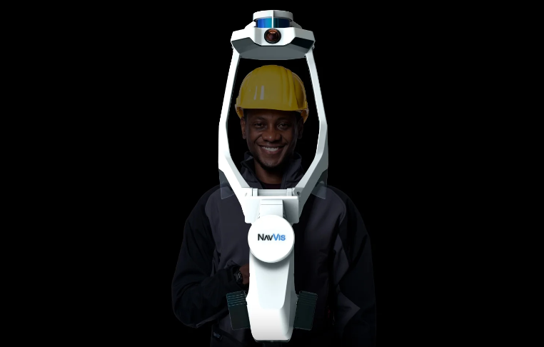
The NavVis VLX Second Generation is a wearable device that is accurate, versatile, and robust. It is powered by SLAM technology. He talked about the benefits of dynamic scanning, and how NavVis VLX plays its part as it is optimized for both indoor and outdoor use.
Benefits of the Navis VLX include its stable and robust SLAM, its IP42 rating for dust and moisture protection, and its ability to capture high-quality cloud points and panoramas in several different environments.
Koltun showed a brief video demonstrating the speed and effectiveness of the NavVis VLX Second Generation compared to other tools. He discussed how data capturing continues to improve and get faster. NavVis VLX can be combined with current equipment including drones, total systems, terrestrial laser scanners, and GNSS/GPS Rovers. By combining tools with NavVis VLX, workflows can be extended and optimized.
A heartfelt thank you to NavVis for being a Platinum Sponsor for LiDAR COMEX 2022.
You can watch the presentation on YouTube below.