NV5 Geospatial Supports Natural Resources Canada in Topobathymetric Lidar Survey of South and North Saskatchewan Rivers
Over the last decade, a growing number of municipal and regional governments across North America have invested in topobathymetric lidar surveys of lakes, rivers and watersheds. Regional governments often commission new lidar survey projects, along with environmental monitoring by natural resource departments, to mitigate impacts of major flooding events, better understand changing geospatial conditions and to inform evidence-based water management strategies.
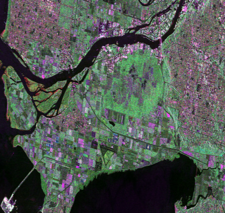
Natural Resources Canada (NRCan), the federal department responsible for the management of Canada’s natural resources as well as mapping and remote sensing, solicited its first topobathymetric lidar contract in June 2021. Rather than a large urban survey, the project instead focused on the South and North Saskatchewan Rivers, which have a combined length of over 2,500 kilometers, running through agricultural areas of Alberta and Saskatchewan. Notably, the South Saskatchewan River experienced serious flooding over the last decade, impacting both rural areas and the city of Saskatoon, which is bisected by the river.
Major flooding events have become an annual occurrence across Canada, and the Canadian government is prioritizing preparation and mitigation in order to protect the local economy and save lives through initiatives such as the Emergency Management Strategy for Canada and the Flood Hazard Information Mapping Program (FHIMP). Each successful data elevation survey enhances Canada’s ability to prepare for these dangerous events.
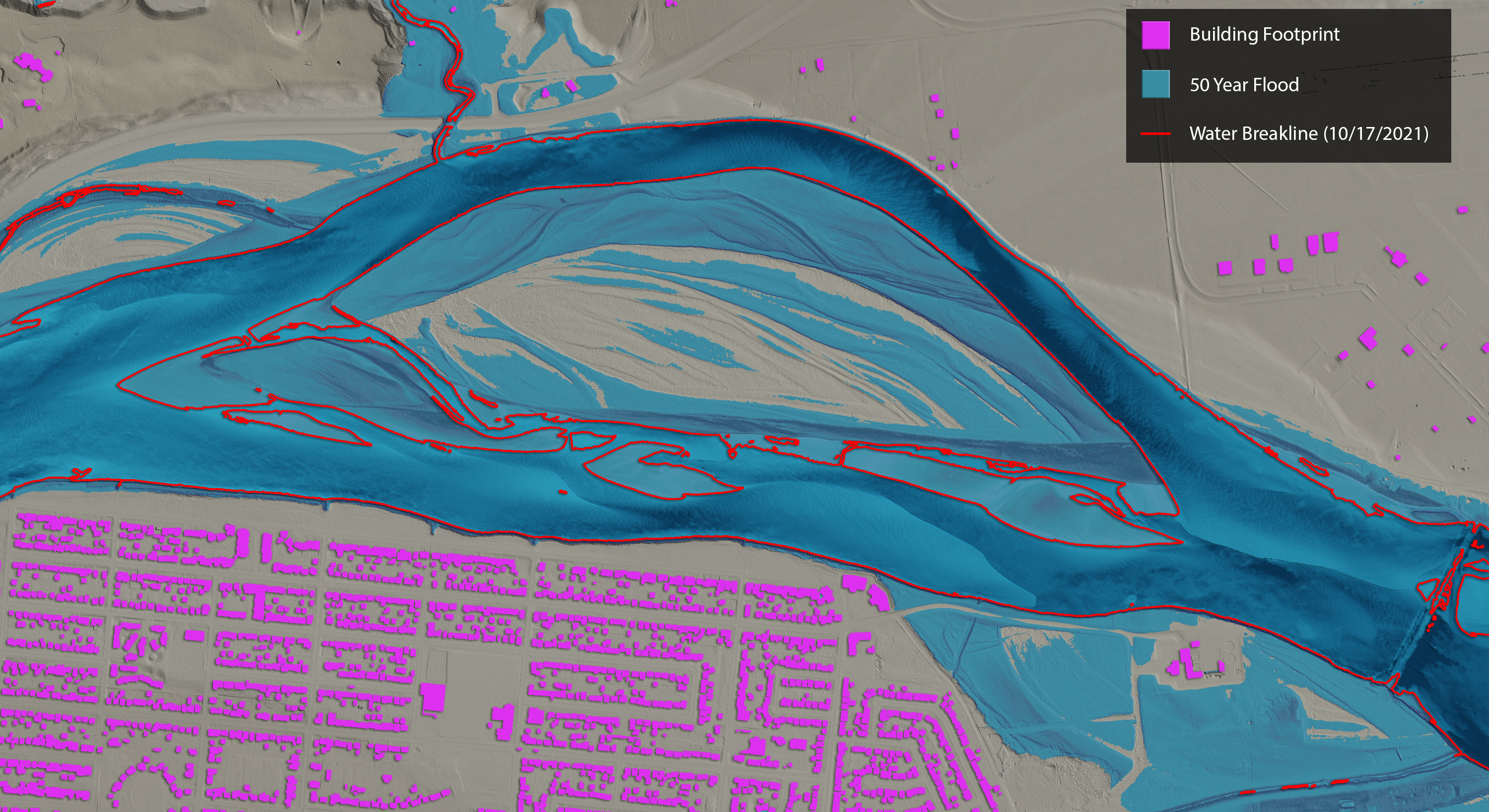 50 year flood simulation of North Saskatchewan River at Prince Albert. Lidar-derived topobathymetric model overlaid with water breaklines and building footprints. Image by Chris Miwa.
Unique control and clarity
The topobathymetric lidar survey of the South and North Saskatchewan Rivers was organized by NRCan and the provincial water management body, the Saskatchewan Water Security Agency (WSA). Following a request for proposals, NV5 Geospatial was selected to conduct the survey and data analysis. This project represented the first topobathymetric lidar survey of the South and North Saskatchewan Rivers, as well as the first topobathymetric lidar survey for NRCan, which produces Canada’s federal airborne lidar data acquisition guidelines and established the high standards of quality for the final deliverables.
The intended survey area of the project was an approximately 500-kilometer stretch of the South and North Saskatchewan Rivers spanning from Gardiner Dam at Diefenbaker Lake to Prince Albert. Because the WSA controls the flow of Gardiner Dam, the agencies and NV5 Geospatial were able to coordinate the ideal water clarity and water level conditions during the survey. Topobathymetric lidar surveys provide accurate models of both the water and the river corridor, providing highly useful ground models beneath the surface of the water.
NV5 Geospatial accomplished the data acquisition by combining an airborne lidar survey with ground control readings. NV5 Geospatial used Leica Chiroptera 4X and Hawkeye 4X topobathymetric laser systems mounted in a Cessna Caravan, enabling bathymetric lidar collection with high repetition pulse rates (up to 900 kHz), high scanning speed, and a wide field of view. Ground control surveys were conducted using a combination of base stations, ground survey points, and land cover class checkpoints to geospatially correct the aircraft positional coordinate data and to ensure quality of the final lidar data.
 Aerial view of downtown Saskatoon, SK taken during the topobathymetric lidar survey. Photo by Noah Edelson.
According to the requirements of the project, NRCan expected NV5 Geospatial to deliver preliminary results of the bathymetric coverage within 72 hours of acquisition. NV5 Geospatial relied on its geospatial data management tool, INSITE, to share data in near real-time with NRCan, making it possible for multiple users to validate the data quality within a simple, easy-to-use platform. The INSITE platform allowed NRCan analysts to make queries based on the preliminary data, with experts from NV5 Geospatial responding quickly and efficiently all within the same system.
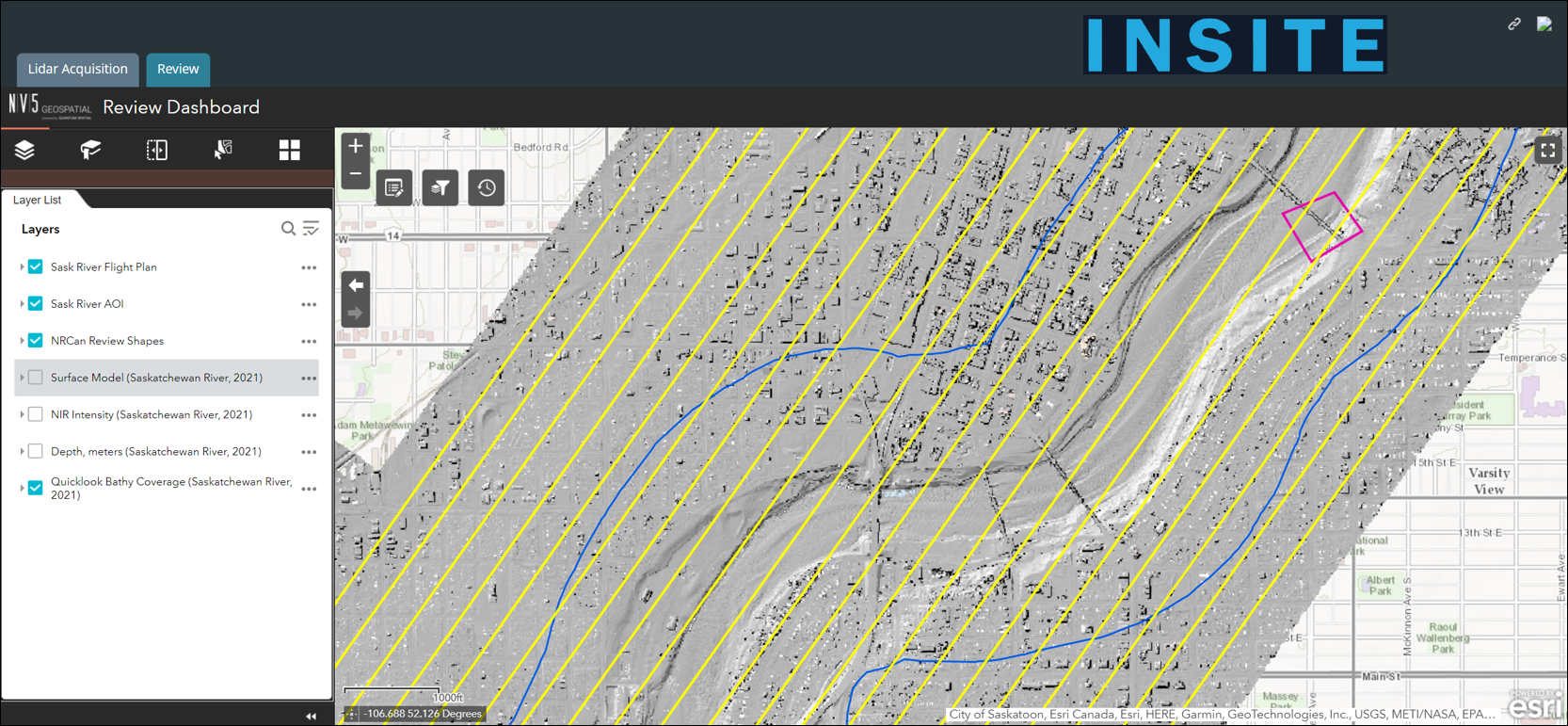 INSITE Data Reviewer by NV5 Geospatial
Precise performance
NRCan has developed Canada’s National Elevation Data Strategy in collaboration with the nation’s provinces and territories, which will result in a comprehensive library of High Resolution Digital Elevation Models (HRDEM) to support effective planning for flood mapping, forestry, climate change, agriculture, infrastructure and mining. The HRDEM consists of a Digital Terrain Model (DTM), a Digital Surface Model (DSM) and other derived data at a resolution of one meter. A seamless national mosaic, the HRDEM Mosaic, is also available on the Government of Canada’s Open Data Portal. Over time, depending on location and needs, the department could conduct new lidar surveys in other areas that could be most impacted by potential flooding or improved water management. The topobathymetric lidar survey should serve as a strong example for future projects in Saskatchewan and throughout the country.
As NRCan and other government authorities continue to develop the nation’s library of geospatial data, coordination with local and provincial water management bodies will be essential to ensuring effective data acquisition. NV5 Geospatial’s collaboration with NRCan and the Saskatchewan WSA demonstrates the ways in which an efficient, receptive water management organization can simplify the survey process and ensure delivery of high-quality data.
Following completion of the project, NRCan conducted data validation according to the federal airborne lidar data acquisition guidelines. The results found that NV5 Geospatial met or exceeded criteria for all parameters, including density, regularity, accuracy and data voids.
“The Canadian National Elevation Data Strategy provides a unique, accurate three-dimensional representation of the country. This work, carried out in collaboration with several partners, plays a vital role in preparing Canadians for the next several decades in terms of planning for potential hazardous weather events, infrastructure development, forestry and agriculture,” said David Bélanger, Project Manager for the Canadian Centre for Mapping and Earth Observation at National Resources Canada. “The topobathymetric lidar data delivered by NV5 Geospatial in the South and North Saskatchewan Rivers project exceeded our expectations, and this project will serve as a valuable example for similar surveys that may be conducted in the future.”
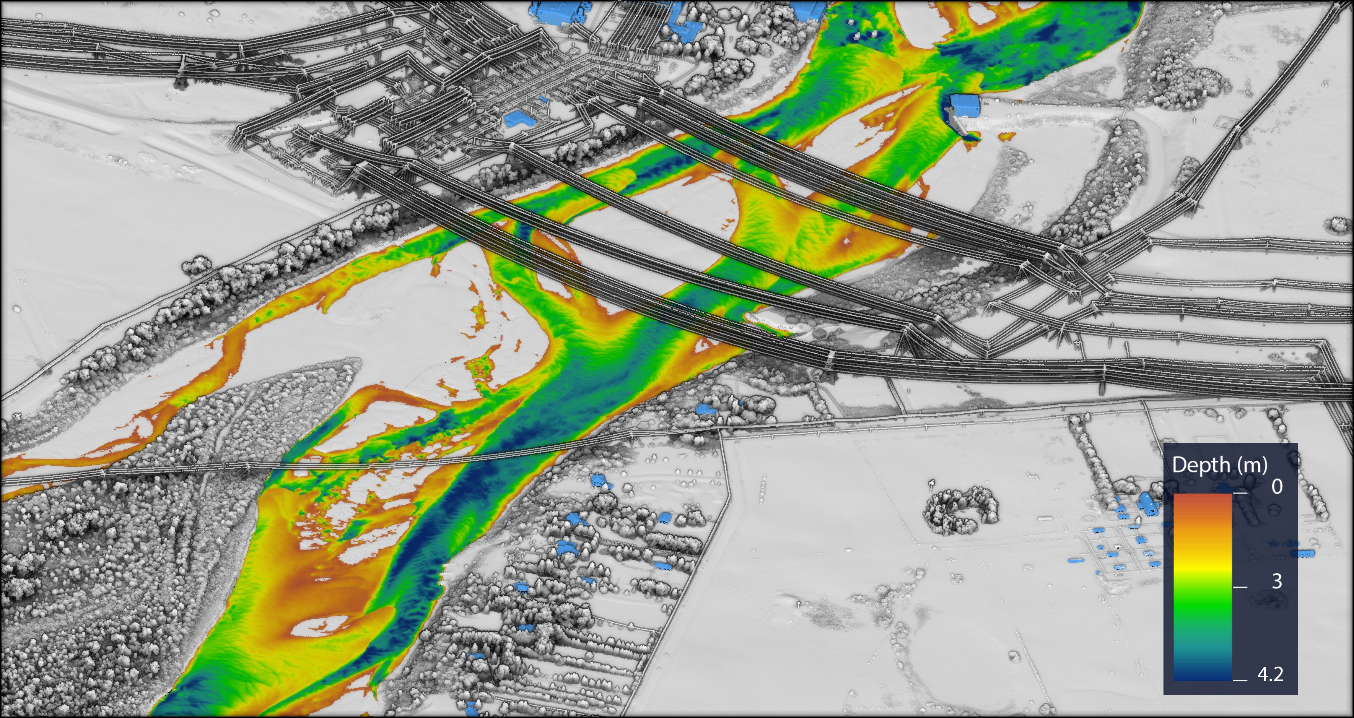 View of Queen Elizabeth Power Station in Saskatoon, SK. Topobathymetric model with bathymetric depth and building classification. Image by Chris Miwa.