Ottawa GoGeomatics Social Nov 25th: Mapping Historic Buildings in Ottawa
This months speaker will be discussing his project mapping historic Ottawa. Kevin Ballantyne, Geomatics Specialist at MDA, will be giving a talk on his work mapping some of the lost parts of our community in the capital. His work includes an analysis of fire insurance maps from the early part of the 20th century. 
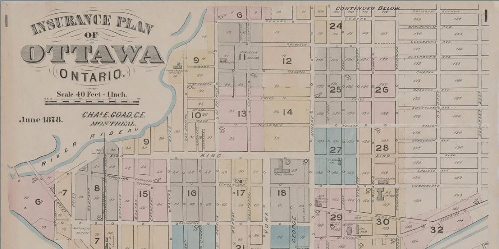
Through the years, Ottawa has seen many buildings come and go. Some were lost to fire, some demolished for the expansion of parkland, roads and other improvements while others were removed to make way for newer buildings. Few original fire insurance maps survive because of a policy that required older versions to be destroyed when up-to-date maps were purchased. The National Map Collection holds several versions including the 1901 and 1912 maps for the Ottawa area. Kevin has breadth of knowledge on historic neighborhoods and buildings in Ottawa. As part of the project the location of each building is based on the 1912 Fire Insurance map sheets found at Library & Archives Canada. Each sheet was georeferenced using software QGIS, GDAL and Google Earth.
Please join us at the GoGeomatics Social in Ottawa as Kevin discusses his use of GIS to uncover Ottawa’s past. These events happen each month in Ottawa and are free for all with in an interest in geomatics.
Wednesday, November 25, 2015
6:00 PM
James Street Pub
390 Bank St.
(corner Bank and James)