
Pioneer of Cybercartography and Indigenous Mapping Fraser Taylor Named to the Order of Canada
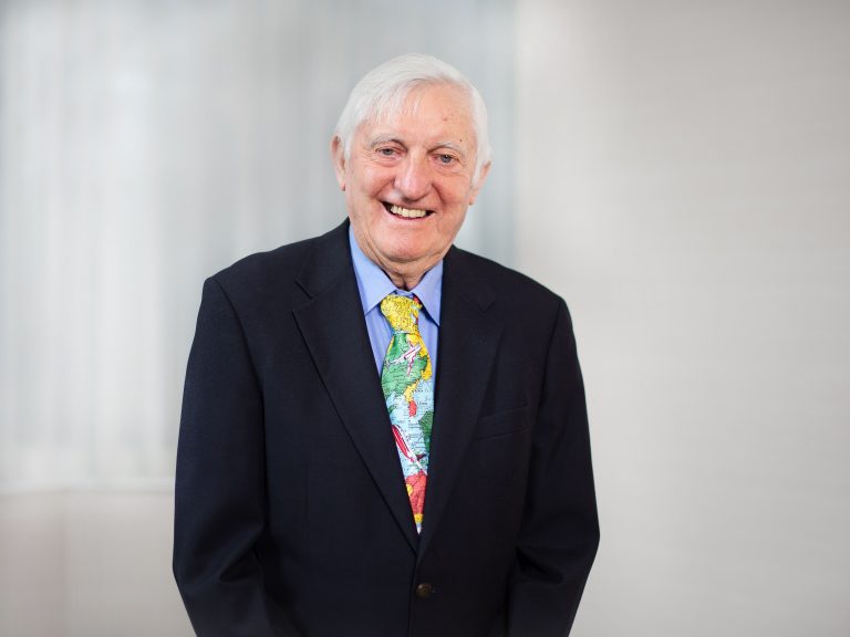
World renowned cartographer and Canada’s very own Prof Fraser Taylor has recently been honored with the Order of Canada, the highest civilian award in the country. The honor comes “for his innovative contributions to cartography, and for spearheading the theoretical and practical development of cybercartography,” read the Governor General Mary Simon’s statement.
“The award of the Order of Canada is one of the highlights of my career. In addition to the personal honor it is good to see the importance of cartography being recognized,” Prof Taylor told Geospatial World in an interview.
Prof Taylor is a Distinguished Research Professor of Geography and Environmental Science, and in International Affairs and Director of the Geomatics and Cartographic Research Centre, Carleton University, Canada.
“Natural Resources Canada is honored to have worked with Dr Taylor and Carleton University. Dr Taylor’s cybercartographic principles of geographic cultural equality across the five senses of sight, sound, taste, smell and touch was socialized extensively across many Canadian and International Cartographic and Governance bodies,” Eric Loubier, Director General, Canada Centre for Mapping and Earth Observation, told Geospatial World.
Loubier added that Dr Taylor’s leadership on mapping with indigenous peoples in Canada epitomized how these principles enable equality and respect. “Today, cybercartographic values are fostered in geomatics communities so we may respond collectively to complex environmental trends, net-zero economy transition, and a journey of reconciliation with Indigenous peoples.”
The many achievements
This is only one of many achievements for a man who has now almost made awards and distinguishments look like normal everyday affair. In 2014, Prof Taylor received the Killam Prize for the Social Sciences, Canada’s highest academic honor, the first for a cartographer; and in 2013 the Carl Mannerfelt Gold Award, the International Cartographic Association’s (ICA) most prestigious acknowledgement, and the first for a Canadian.
But more than the honors, what is significant is the sheer amount of work accomplished by Prof Taylor and how he influenced the understanding of the role and relevance of cartography on a global scale.
“His numerous contributions have steered scientific cartography in accepting new challenges, leading to his holistic and visionary concept of Cybercartography. With this he demonstrated that a theoretical fundament, sound methodologies can lead to innovative applications, such as with indigenous people,” says Dr Georg Gartner, former president of the ICA (from 2011 through 2019)
As well as these activities, Professor Taylor has undertaken research and development and published in areas where his expertise is internationally recognized, namely:
- The theory and practice of cybercartography;
- Electronic atlases, interactive cartographic systems and visualization;
- The preservation and archiving of geospatial data;
- Mapping for the blind and visually impaired; and
- Canada’s international policies towards developing nations.
Dr Taylor continues to keep a tab on the global developments, especially how geospatial as a domain is transforming. “At the macro level we have truly entered the Age of Location. My only observation is that this is much too important to be left only to the geospatial scientists. The technological aspects are tending to dominate our input and although these are important it is the applications to world problems which are even more so,” he says.
In a recent article with Geospatial World, the professor called for developing new strategic approaches to communicating geospatial information.
Global leader in cartography
Prof Taylor was President of the International Cartographic Association for two four-year terms in 1987 and 1991, President of the International Union for Surveys and Mapping from 1989 to 1993, and Chair the International Steering Committee for Global Mapping for a decade. During this time, he made significant contributions and undertaken leadership roles in cartography and geography, in Canada and internationally.
“Professor Taylor has worked tirelessly in research, teaching, publishing and outreach programs. His rigorous research and his enthusiastic approach to furthering scientific knowledge related to cartography and geography is infectious, as is his championing of the inclusion and promotion of young researchers in international activities,” says Prof William Cartwright, former ICA president (from 2007 through 2015).
Then a young cartographer and researcher, Prof Cartwright met Prof Taylor when the latter was the ICA president at one of the early cartographic conferences in late 1980s. “I was involved in research in the application of interactive multimedia to cartography and the visualization of geography, an area that Prof Taylor championed among the international cartographic and geographic communities at that time,” he recalls.
A relative newcomer to the ICA then, Prof Cartwright recalls how during the initial meetings of the ICA’s Commission on Geographical Visualization, Dr Taylor encouraged him to become active in the organization through the activities of this commission.
“His enthusiasm about contributing to international scientific communities was, and remains, infectious and his encouragement to participate in research and development was extremely supportive to young and experienced scientists alike. This introduction to scholarly work in cartography and geography set me on a path of participation and collaboration with the ICA and with international cartographic and geographical communities, leading to my Presidency of the Association from 2007-2011,” he says.
Prof Arup Dasgupta, Managing Editor of Geospatial World and former deputy chief of the Space Application Center at the ISRO (Indian Space Research Organisation), underlines Prof Taylor’s particular interests is the study of local spatial knowledge and its presentation in local languages and dialects.
“His stress has always been on the use of spatial knowledge for development. Apart from geospatial subjects he also interacts with many us on socio-economic matters and takes a keen interest in Indian developments,” he says.
“The naming of Dr Fraser Taylor to the Order of Canada is indeed a great honor to a geospatial professional. I met him through my involvement in various activities related to geospatial systems. A very pleasant person bubbling with ideas, he has advanced many thought-provoking ideas like cyber cartography which presents spatial information in a manner a common person can easily understand,” he adds.
Pioneer in cybercartography
A pioneer in the use of the computer in cartography and in the creation of digital atlases, Dr Taylor first introduced cybercartography as a concept in his keynote address to the ICA conference in Stockholm in 1997.
At that time it was a novel idea and a concept lacking in implementation.
“However, in 2002 I was fortunate to receive a major research grant from the Social Sciences and Humanities Association of Canada which allowed me to put some flesh on the bones and to produce two cybercartographic atlases — The Atlas of Antarctica and an Atlas of Canada’s Trade with the World,” the professor recalls.
The Theory and Practice of Cybercartography was outlined as a book in 2005. What was ground-breaking for the time was his idea that cartography should be multisensory, multimodal, and multidisciplinary and produced by teams rather than individual cartographers.
At that time the emphasis in cartography was on examples which were largely technical in nature, recalls Dr Taylor.
“From a technical perspective, the interactive, integrative, collaborative, and cross-cultural/cross-domain elements identified in his early conceptualization of cybercartography were difficult to implement in the 1990s,” says Peter Pulsifer, Associate Professor at Carleton University.
Over time, the technology caught up with Dr Taylor’s vision and he went on to turn these ideas into real-world implementations. These theoretical and practical development patterns and technologies are now pervasive in cartography and geographic information systems, and helping us solve many of the challenges facing communities and governments.
Dr Taylor continued his work on cybercartography over time, and his thoughts were outlined in subsequent books — Developments in the Theory and Practice of Cybercartography: Applications and Indigenous Mapping in 2014; and two in 2019 Further Development in the Theory and Practice of Cybercartography: International Dimensions and Language Mapping and Cybercartography in a Reconciliation Community: Engaging Intersecting Perspectives.
“The major change which took place [in cartography] was a move from a technological approach to one which recognized the importance of the process of mapping by communities which is just as important, if not more so than the products,” he says.
Global development agenda
In particular, Dr Gartner draws attention to the professor’s role in the application of geomatics to socioeconomic development in a national and international context with special reference to the Canadian North, Africa, Latin America, China, and Antarctica. “[This way] he also advanced regional and rural development theory and practice with special emphasis on sustainable development and indigenous development strategies in Africa and Latin America,” he says.
In a way, Dr Taylor’s interests in cartography and international development issues are often inter-related. His main research interests lie in the application of geospatial information management to the analysis of key socio-economic problems in a national and international context and the presentation of the results in innovative new cartographic forms.
His strong background and interest in international development, supporting the use of geographical information processing, saw his appointment to the United Nations Expert Group on Geospatial Information Management and to the Open Geospatial Consortium (OGC) Global Advisory Council 2009.
Among other activities, Dr Taylor was also the Chair of the International Steering Committee for Global Mapping (ISCGM), an international project by world national mapping agencies of the to produce a 1:1 million digital map of the world to support environmental and sustainable development decision-making, for the past decade. This work supports international collaboration and decision-making by ensuring that appropriate, current and timely geospatial information is available.
He was also the Secretary Treasurer of the Canadian Association of African Studies for fifteen years and received an Honorary Life Membership in the Association for his services to African scholarship.
Mapping indigenous communities
Dr Taylor’s work with the indigenous communities (Inuit and First Nations) can’t be over emphasized.
Today, with a global climate crisis looming when the importance of indigenous knowledge in preserving the planet is being emphasized everywhere, Dr Taylor saw the truth way back. A firm believer that sustainable and holistic development can be achieved by listening to the people of the land, he focused on creating cybercartographic atlases dealing with traditional and local knowledge.
“We have much to gain from listening to indigenous people and our recent atlases are driven from below not above. We give complete control of content to the indigenous communities and what is mapped is a reflection on what is important to them. This leads to new understandings and the mapping of topics which outside cartographers rarely think about. Our atlases give local people voice in new ways,” he says.
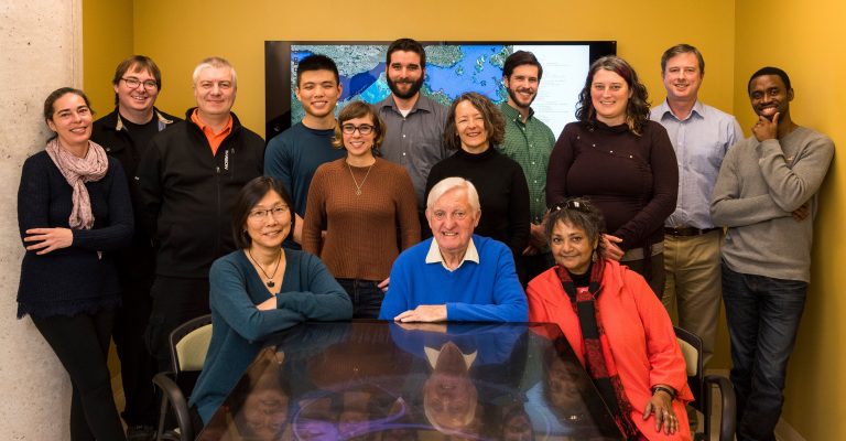
His current research is focussed on the use of cybercartography and the innovative NUNALIIT cybercartographic data management platform to produce a series of atlases on a wide variety of topics, especially in cooperation with Indigenous communities. This includes exploring a range of issues dealing with Traditional Knowledge, including legal and ethical considerations. He is widely published — including books and research papers — and recognized a leader in this sphere.
Above all, a caring, inspiring professor
Despite his achievements and engagements at the highest levels, Dr Taylor was never found lacking in his teaching duties. In fact, like he did on the global stage, his passion and zeal continue to inspire generations of students who have had the good fortune of working with him directly. And this reflects in how they feel and speak about him.
“Even though a very busy individual, Dr Taylor devotes full time attention to the supervision of a number of current and former students with diverse but related research interests,” says Stephanie Pyne, a post-doctoral researcher in the Department of Geography and Environmental Studies at Carleton University.
“In addition to being an excellent mentor to me in the preparation of the funding proposals for the study grants, Dr Taylor continued to provide me with a unique form of guidance that allowed me to exercise my creativity and initiative in my seven years of work as a post-doctoral research fellow at the Social Sciences and Humanities Research Council (SSHRC), to build links through Cybercartography with a variety of individuals and organizations focused on residential schools related commemoration and reconciliation,” she adds.
SSHRC is the federal research funding agency in Canada that promotes and supports research and training in the humanities and social sciences.
Romola Thumbadoo, a postdoctoral fellow at Carleton, who closely works with Dr Taylor as his personal assistant, says the professor supervised her research into the environmental work and legacy of the late Indigenous Elder WIlliam Commanda, incidentally an Order of Canada recipient in 2008.
“William and I met him ten years ago, and we both knew that we wanted to share Elder Commanda’s land-based story on the innovative digital atlas platform that Prof Fraser Taylor was pioneering. Dr Taylor’s passion, focus and drive are inspirational. He has taken me through every step of my academic journey tirelessly, and he has enabled me to present William Commanda’s teachings with integrity to build bridges in the world of spiraling cybernetic loops.”
“He has taken Late Elder Commanda, who jokingly referred to himself as a Kindergarten Dropout, and me, an adult scholar and social activist, through both our doctoral and postdoctoral work, and thus facilitated our leaving a record of some of the knowledge and thinking of an exemplary Indigenous global leader who did not have the usual supports of organization, staff or funds to make his mark on time and space; and our joint creation of the Circle of All Nations, its discourse and its evolving presence as a Digital Global Village.”
Pulsifer, today an assistant professor at Carleton University but initially a private sector employee, says his initial exposure to Prof Taylor’s work inspired him to return to carry out doctoral research at Carleton University under his supervision. “I first started collaborating with Dr Taylor in 1998 when I worked in the private sector developing educational geographic software. From our first meeting, I was fascinated by Professor Taylor’s innovative and forward-looking ideas and practices under the name of cybercartography,” he says.
Over the years, Pulsifer has collaborated with Dr Taylor on many projects, including the start of my career working with Indigenous people and communities in the Arctic and beyond. “His mentorship, drive, compassion, creativity and excellent scholarship provided a foundational me and resulted in my spending a decade further developing my career at the University of Colorado. Having joined the Geomatics and Cartographic Research Centre and the Department of Geography and Environmental Studies at Carleton University in 2019, I now have the pleasure of working with Professor Taylor as a colleague. Any success that I have achieved is, in large part, due to his guidance, support, and innovative ideas,” he adds.
Jenny Jachtorowicz , an undergraduate student at Carleton, who has been working for Dr Taylor since 2017 helping organize his archives, says she is amazed every time about all the work the professor has done. “Prior to the pandemic I enjoyed weekly in person meetings with him where he would just talk about his travels and accomplishments, and it was great to hear it all first hand after reading about them in the archives. I have learned so much from and about him through his work and hope to accomplish even a fraction of what he has done in my career. His never-ending passion is inspiring,” she adds.