

Snowplow trackers making it easier to navigate Canadian winters
Winter is well underway in many parts of Canada and there are a few mapping resources to help you navigate.
After seeing the interactive snowplow map that the Minnesota Department of Transportation has created, I wanted to research maps in Canada. I found that many Canadian provinces have similar maps that can help with that snowy commute. Even the popular live navigation app Waze has added a snowplow tracker feature to their app in Canada.
I was able to find at least one interactive winter road map, each with its own feature, for every province and territory except for Nunavut. While there are a few maps that may not show snowplows, they do show road conditions and/or when a road was last serviced.
This is a guide to interactive snowplow trackers and winter road condition maps throughout the country.
British Columbia
While much of British Columbia’s south coast does not experience the same level of snowfall seen in other parts of the country, BC’s interior is no stranger to heavy snowfall. Cranbrook, BC has a handy interactive up to date map showing when the road was last plowed and sanded.
Alberta
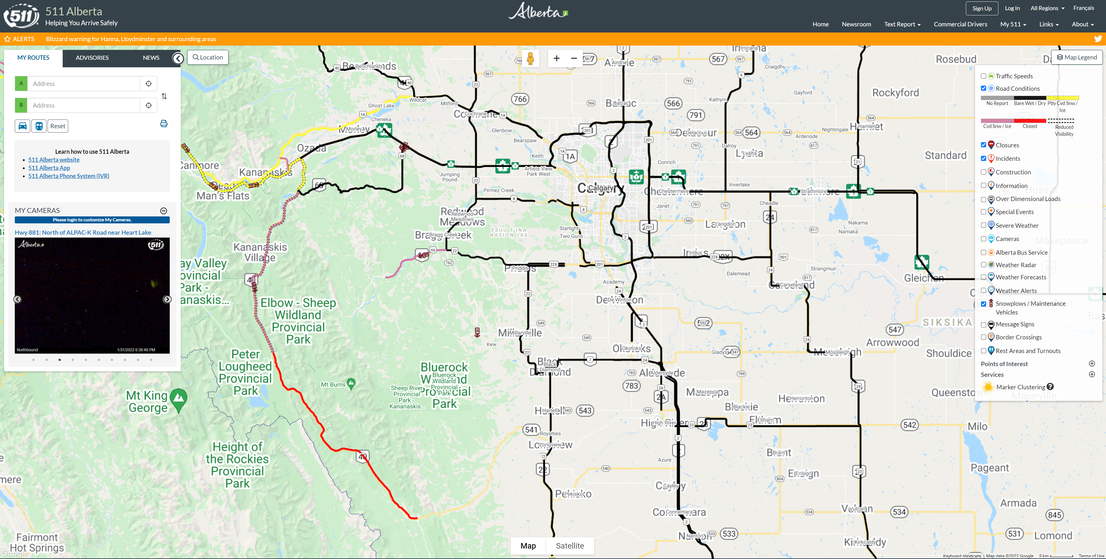
Alberta’s largest resource for road conditions is 511 Alberta. This website displays the location of each snowplow and the direction the snowplow is traveling. This map also allows you to add layers to see road conditions, highway webcams and weather radar so you can keep up to date with how road conditions may be changing. A neat feature of 511 is the my routes tab, where you can enter a route you would like to take and the map will show you what the road conditions are for each section of road you need to drive through.
Saskatchewan
While I could not find a snowplow tracker for Saskatchewan, the province has a highway hotline that provides up to date information on road conditions throughout the province.
Manitoba
The city of Winnipeg in Manitoba has created a snow clearing status map. The map divides the city into three regions and provides an update on completion percentages twice daily.
Ontario
Ontario has the most snowplow trackers by far. 511 Ontario displays road conditions and past locations of snowplows to keep you up to date. The map also shows weather conditions and Waze traffic reports.
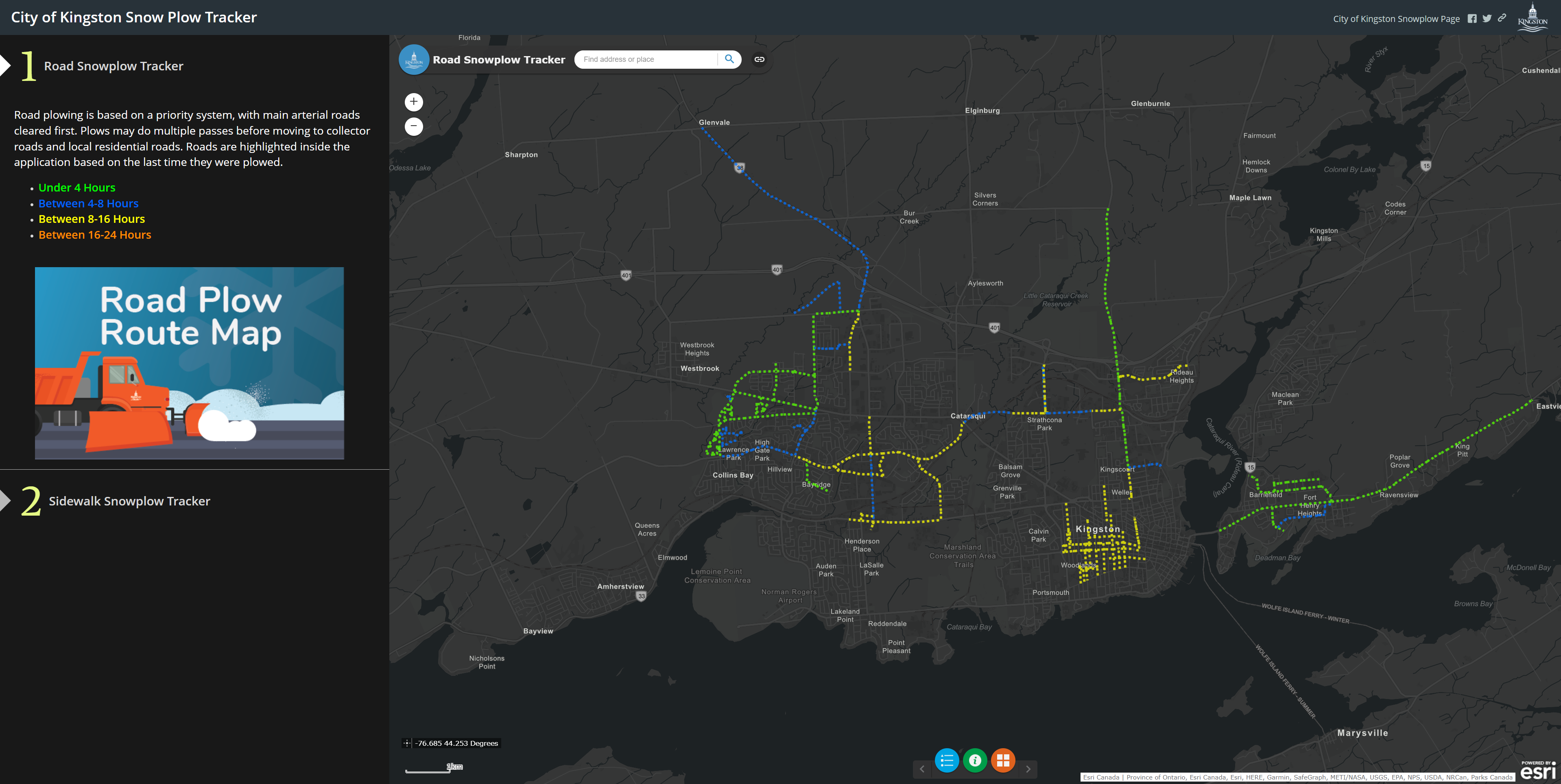
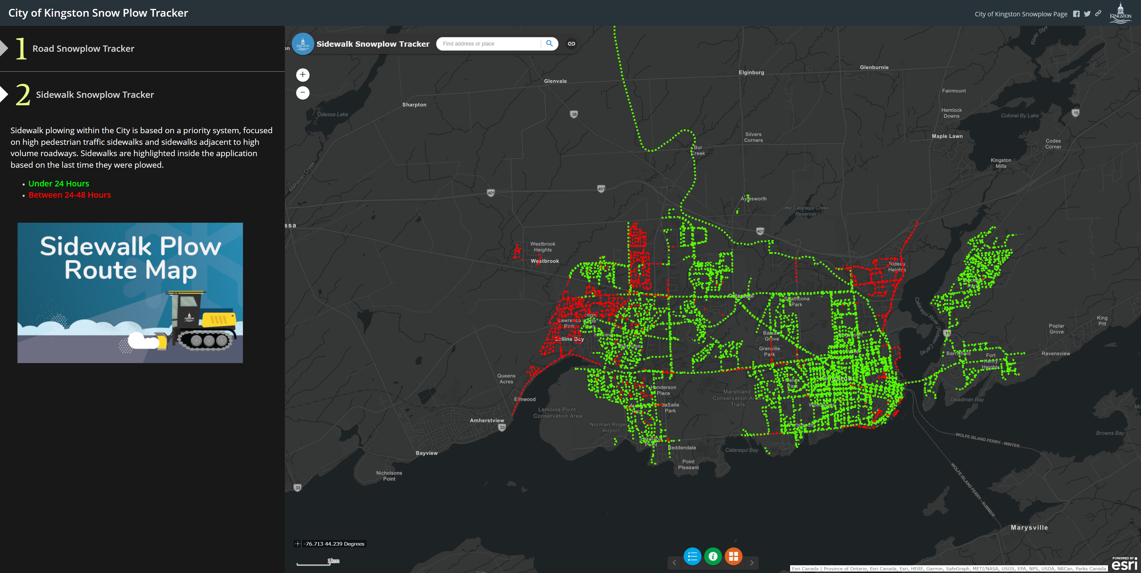
The City of Kingston’s map is a great tool for both drivers and pedestrians as it gives you the option of switching between road and sidewalk snowplow trackers.
The City of Ottawa has a crowdsourced Winter Cycling Map. This is a great resource for cyclists to see which pathways have been cleared and are safe for travel.

Quebec
Montreal has a snowplow tracker app called the INFO-Neige MTL app, available on Google Play and iOS App Store. This app can show the status of snowplows in near real time. Another neat feature is, if you share your position with the app, it will send you a notification once the street near you is starting to be cleared.
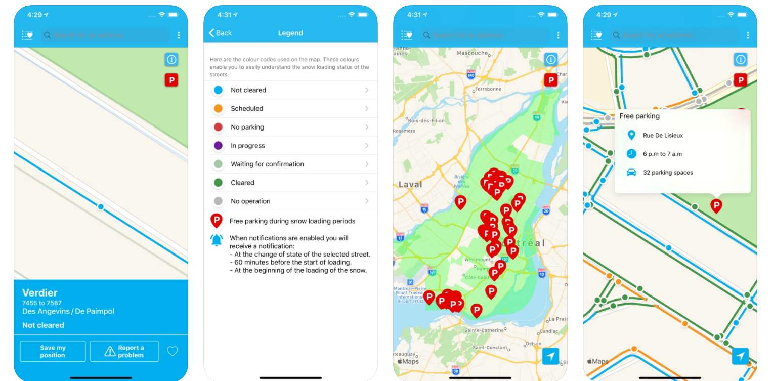
INFO-Neige MTL app
New Brunswick
The City of Rothesay has a snowplow tracker that allows you to identify which roads have been plowed and gives you a time estimate for when those roads were plowed.
Rothesay snowplow tracker showing streets that were plowed 4 hours ago.
Prince Edward Island
PEI’s main road conditions website displays road conditions and highway cameras in near real time.
Nova Scotia
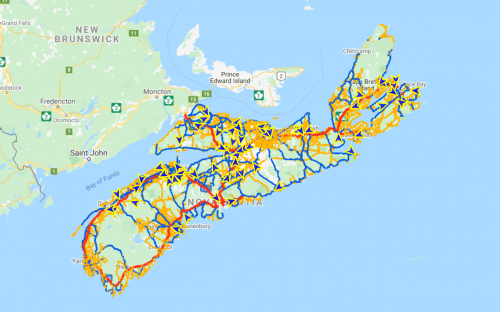
The government of Nova Scotia’s Provincial Plow Tracker is a great resource for drivers across the province. This map interactive shows when the road was last plowed and reveals which roads have winter activity that may cause hazardous road conditions. There is also an option to display the live highway cameras that allow drivers to see what the current road conditions look like.

Nova Scotia’s Provincial Plow Tracker
Newfoundland
Newfoundland’s Provincial Plow Tracker shows traffic cameras, plow events, Environment Canada weather and alerts.
Newfoundland’s Provincial Plow Tracker showing snowplow makers new the town of Gander, NL.
Yukon
511 also has a Yukon page that shows road conditions, incidents, weather alerts and highway cameras.

511 Yukon winter road conditions.
Northwest Territories
The Northwest Territories has a Highway Conditions webpage that shows which roads are open, closed or have an advisory.
Resources:
Canadian cities use live snow plow trackers to keep residents informed
Waze Launches Real-Time Snow Plow Feature for Roads in Canada


