
British Columbia

Canadian BIM and Digital Twin Digest for September 8, 2022
In this Digest: BIM Academy Selected to Deliver Digital Strategy for $1.72 Billion Hospital Redevelopment Project, Kongsberg Digital Transforms Maritime…

Canadian Geospatial Digest for August 1, 2022
Endangered BC Heritage Site Digitally Preserved by University Professors Edelweiss Village, a heritage site in British Columbia (BC), is the…
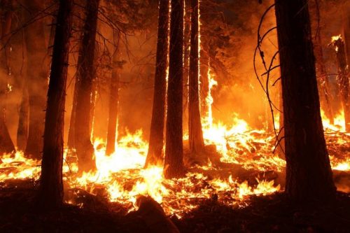
Canadian Geospatial Briefing May 16th: 1. Correlation between BC wildfires and floods 2. NG9-1-1 GIS Validator 3. NRCan migrated petabytes of geo data to the cloud 4. Aerial Imagery Cost-Sharing 5. RCMP using aerial images for missing people
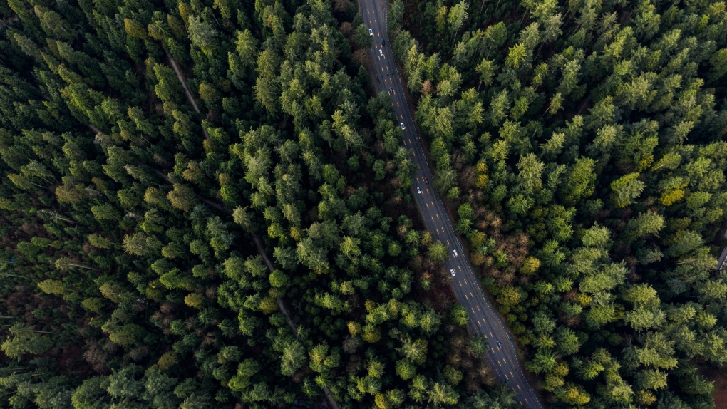
Satellite mapping finds correlation between B.C. wildfires and floods Data scientists at SparkGeo, a geospatial company based in Prince George,…
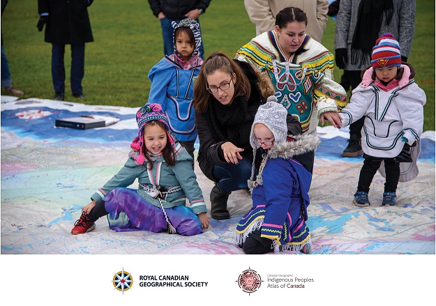
Canadian Geospatial Briefing April 18th: 1. Esri Canada program director’s sudden passing; 2. Kanien’kéha mapping project; 3. Indigenous People’s Atlas of Canada; 4. Vernon floodplain maps; 5. Grassland mapping project
Esri Canada’s Program Director killed in small plane crash on March 21st John Bacon, Program Director in Esri Canada’s Geospatial…
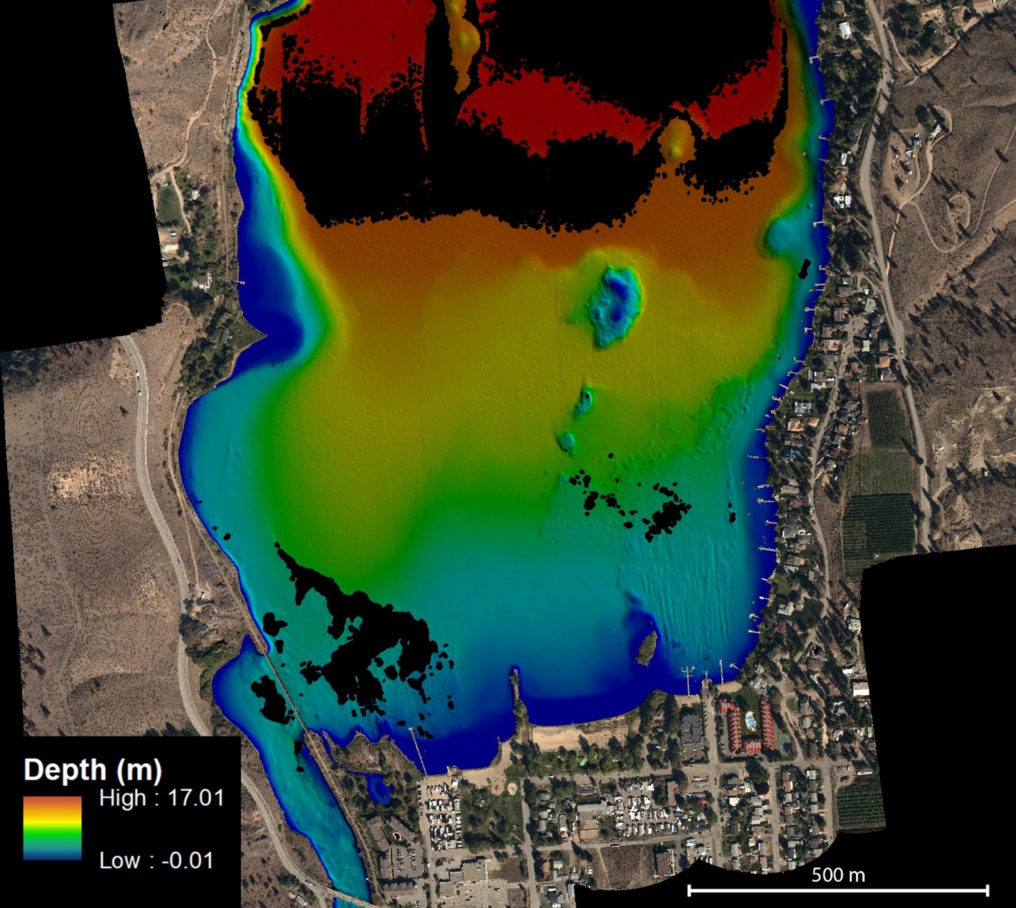
NV5 Geospatial Helps Okanagan Basin Water Board Protect Important Local Communities Through Near-Shore Topobathymetric Lidar Survey
The Okanagan Valley in British Columbia is one of Western Canada’s most attractive tourist destinations, with local communities offering a…

Sparkgeo uses geospatial technology to analyze water hazards caused by BC wildfires
Western Canadian wildfire season is quickly approaching. The increase in wildfire season length, wildfire frequency, and burned area makes it…

Canadian Geospatial Briefing March 7th: 1. MDA to Build 17 satellites to Enhance Globalstar’s LEO Constellation. 2. DDC’s new management. 3. DDC’s update on Canary drone testing. 4. Need for RADARSAT in disasters. 5. Cape Breton Highlands image looks like a kitty.
MDA to Build 17 Satellites to Enhance Globalstar’s LEO Constellation According to MDA’s announcement on Feb 24th, this company is…

British Columbia Challenger Map
See B.C. in all its 3D glory as giant Challenger Relief Map returns to PNE after 23 years The Challenger…
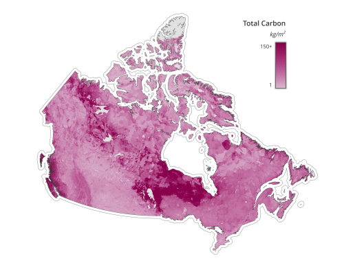
Canadian Geospatial Briefing Nov 29: 1. Mapping Canada’s carbon landscape; 2. Satellite images of Flood in BC; 3. Royal Canadian Geographical Society awards; 4. High-speed internet for rural communities by asset-mapping; 5. Plant health beyond the naked eye
Mapping Canada’s carbon landascape WWF-Canada has conducted new research with the lead of McMaster University’s Remote Sensing Lab scientists to…
Searching for BCIT GIS Practicum & Project Sponsors 2021/2022
What is the sponsorship program about? Mike Hill, the GIS Program Head of BCIT, is searching for potential partners to…
Canadian Wildfire Mapping Resources 2021 Fire Season
Western Canada has been experiencing extreme fire conditions following an intense heatwave since late June. According to BC Wildfire Service,…
Canadian Geospatial Briefing July 19th, Drone spraying research promising; B.C. wildfire map; Manitoba Infrastructure Projects Map; N.B. COVID dashboard; New database of P.E.I. trails maps
Drone spraying research promising Drone spraying would be ideal for touch-ups and misses in a field after a large sprayer…
