
commercialization

Ontario Based SkyWatch raises $17.2M for its Earth Observation data platform
SkyWatch Space Applications Inc. (“SkyWatch“), a Waterloo-based space technology startup, announced today the completion of a $17.2M USD Series B round of financing…

GeoIgnite 2020 Track Announcement: Geospatial Commercialization Track
Geospatial Commercialization Track Our Committee is solidifying a vast variety of diverse and engaging tracks for GeoIgnite 2020. Track Chair:…
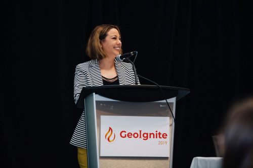
GeoIgnite 2020 Tracks, Summits, and Forums Announced
I’m thrilled to announce our first tracks, forums and summits for GeoIgnite 2020. A big thank our GeoIgnite conference committee…
TECTERRA Board Names Jonathan Neufeld as Next CEO
February 14, 2017 (Calgary, Alberta) – TECTERRA announced the appointment of Mr. Jonathan Neufeld as the Chief Executive Officer. Neufeld…

List of Canadian Geomatics Conferences and Events for 2017
This is our list Canadian geomatics conferences and events for 2017. Here you will find events pertaining to GIS, remote…
TECTERRA Funds $4.9 Million for Geomatics Innovation in Canada in 2015-16
TECTERRA Inc. announced it had committed $4.9 million of funds to support the geomatics technology sector in Canada during the…
Canadian Government Supports Advanced Geomatics Research
Leading Edge Geomatics will be able to develop new and advanced airborne mapping technology thanks to a repayable government contribution…
Canada’s leading geomatics entrepreneurs and start-up companies will meet in Calgary to showcase the latest in geospatial technologies
In less than one week, more than 60 of Canada’s leading entrepreneurs and start-up companies, along with three of Alberta’s…
TECTERRA Funds Additional $4.8 Million for Geomatics Growth in 2014-15
CALGARY, ALBERTA – TECTERRA Inc. announced that it has committed $4.8 million of funds to support the geomatics technology sector…
Remote sensing sheds light on Earth’s surface at UVic
The University of Victoria is partnering with the province to develop new ways of using airborne sensors to gather information…
Government of Canada Unveils 3D Model of HMS Erebus
Data collected by the Department of Fisheries and Oceans’ Canadian Hydrographic Service used to develop models of HMS Erebus FREDERICTON,…
PrecisionHawk and Agri-Trend Partner to Offer First, Full Service Drone and Data Solution to Farmers
Agri-Trend clients will have access to the PrecisionHawk Drone Platform, Sensors and Data Mapping tools with the expectation to fully…
