
Datum

Navigating the Future: The Modernization of Canada’s Spatial Reference System
Significant changes are on the horizon for geomatics professionals in Canada. Everyone involved in the fields of geomatics and its…

COGS NSCC students use Geomatics to explore the history of Black Loyalists & Joggins Fossil Cliff
NSCC students make major impact in two small communities with huge historical significance Students at Nova Scotia Community College’s Centre…

My COGS GIS Education, Part II
In my first article, I introduced the how and why I chose to attend COGS from the fall of 2014…
The Canadian Institute of Geomatics Brings Big Data to Ottawa
Last week I was among an interesting group of participants and presenters who came together to discuss Big Data (June…
Map Tiles and Cached Map Services
The tiling of large maps is an old practice. Large paper maps have always been divided into a series…

2015 Canadian Geomatics Events & Conferences
This is our list Canadian geomatics conferences and events for 2015. Here you will find events pertaining to GIS, remote…

Wanted – A GNSS Puck
“I want it! I want it! I want it!” – “Magic Bus” – The Who The Glass Floor. There is…

How to Ace your next GIS Job interview
GoGeomatics Canada holds career seminars ever so often that are popular for their industry-specific tips and incites. The last time…
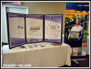
Canadian Geospatial Event: Geomatics Atlantic 2013 Recap
Geomatics Atlantic is a regional conference that switches between the Atlantic Provinces every year, allowing the different geomatics-related professional organizations…

Sheila Churchill: GIS Instructor at British Columbia Institute of Technology
GoGeomatics: Welcome to the GoGeomatics Canada community. To begin, can you tell us where you are from and where you…
Topcon Experienced Canadian Surveyor
We had the opportunity to talk with Mike Strutt about surveying and his career. Mike is one of the most experienced surveyors in Canada . began his survey career in 1974 and managed his first GPS project in 1987 while a field officer with the Geodetic Survey of Canada. Prior to joining Topcon where he now manages RTN Services, Support & Training, Mike spent in excess of 11 years and 10,000 hours delivering instruction on the use of GPS for surveying and mapping.
If you’re thinking about getting into surveying or just more about what a surveyor does this is a must read.
