
Canadian National Geomatics Competition
The National Geomatics Competition is the perfect opportunity to showcase your knowledge, to promote the profession, and to network with…
The National Geomatics Competition is the perfect opportunity to showcase your knowledge, to promote the profession, and to network with…
Transoft Solutions Inc., a global leader in transportation engineering design and analysis software, has partnered with Plexscape, developers of Plex.Earth®,…
GoGeomatics Canada is excited about the first national Canadian Geomatics Competition taking place this February 16 to the 19, 2018.…

The first ever National Geomatics Competition (NGC) is a student led weekend event happening February 16-19, 2018, in Fredericton, New…
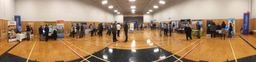
The College of Geographic Sciences (COGS) held the 2017 COGS Industry Expo on March 23 in Lawrencetown, Nova Scotia. COGS…

On March 1st and 2nd land surveyor professionals, as well as industry exhibitors, headed to Ottawa for the 2017 Canadian…

NSCC students make major impact in two small communities with huge historical significance Students at Nova Scotia Community College’s Centre…

What About COGS The Centre of Geographic Sciences (COGS) is one of the best colleges in Canada for learning GIS. …

Creating a new GIS from scratch is a tough undertaking. It involves a lot of innovation. Ecere, a Canadian company…
February 14, 2017 (Calgary, Alberta) – TECTERRA announced the appointment of Mr. Jonathan Neufeld as the Chief Executive Officer. Neufeld…
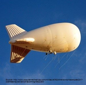
These days drones are all the rage. Nevertheless, there are other ways to collect data from the sky! Blimps, balloons and kites…

It is rare to learn of a GIS company in which much R&D is done up front to create the…
