
2021 Esri User Conference
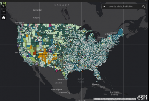
The 2021 Esri User Conference (Esri UC) is a fully virtual experience. Join us at the Plenary Session to hear…

Using drones to study forest canopy in UNESCO world heritage site A recent study led by researchers at the University…
The geospatially-inclined might not typically think of linguistics as within their purview. However, approaching human language from a geographical perspective…

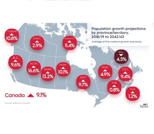
Statistics Canada Statistics Canada is hosting their second virtual GIS Day, featuring a virtual booth, panel discussions, and a live…

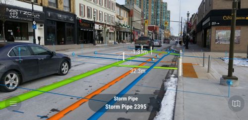
Esri and Autodesk’s New Collaboration Product: GeoBIM Esri’s new software, ArcGIS GeoBIM, allows ArcGIS features to appear in the documents within…

Mapping the hottest temperatures around the world June was an exceptionally hot month for several countries in the northern hemisphere. A…
The 2021 Esri User Conference (Esri UC) is a fully virtual experience. Join us at the Plenary Session to hear…
Here’s Where Apple Maps Cars are Collecting Images in Canada this Summer Two years ago, a fleet of Apple Maps…

The recently held Annual and Executive Board Meetings came out with announcements on new Members, the incoming Executive Board, and…
Interactive Map Recognizes Canadian Places Named for Women A new interactive map called Recognizing Women with Canadian Place Names, was…

The GoGeomatics editors, writers and online managers discuss stories each week that we would like to share with the community.…

Calling all Canadian GIS students! Through the GIS Scholarships program, Esri Canada recognizes Canadian post-secondary institutions that deliver strong, multidisciplinary…
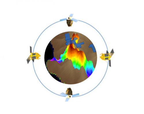
Nowadays, satellite remote sensing comes in handy and can now be employed in our day-to-day activities. This technology, with the…
