
expert

From Technical Expert to Strategic GIS Leader
Elevate Your Impact Are you an experienced GIS professional seeking to transcend the boundaries of traditional GIS practice? Are you…

Sparkgeo Uses a Geospatial Lens to Look at Earth’s Issues on a Planetary Scale
Cadell Asks Us To Rescale Our Way of Thinking The keynote speaker for GeoIgnite, Winter Geo conference on March 2,…

Announcing GeoIgnite 2020 Keynote Steven Ramage
Today GeoIgnite announces Steven Ramage as one of our featured Keynotes and joins us for our popular keynote panel discussion.…
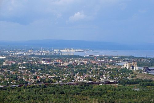
New GoGeomatics Group in Thunder Bay, Ontario
GoGeomatics is excited to introduce the Thunder Bay GoGeomatics group as the newest grass roots effort by local geospatial professionals,…
GIS Open Source versioning tool for a multi-user Distributed Environment (part 2)
Cet article est aussi disponible en français. This article is the 2nd part of GIS Open Source versioning tool for a multi-user Distributed…
Outil de versionnement des données géographiques à code source ouvert pour des environnements multi-contributeurs (partie 2)
This article is also available in English. Cet article est la 2e partie de l’outil de versionnement des données géographiques à code…

Canadian Hydrographic & National Surveyors Conferences: 2018 Victoria, BC: March 26-29
2018 Canadian Hydrographic & National Surveyors Conferences March 26-29, 2018, Victoria B.C. Sponsor and Exhibitor Registration is now opened. You…

UBC Unveils New Masters of Geomatics for Environmental Management
The UBC Faculty of Forestry is excited to announce that the official approval of the Master of Geomatics for Environmental Management…

Interview with Ted Mackinnon: Promoting Canadian GIS & Geomatics on Twitter
GoGeomatics has been actively using Twitter to reach out to the geospatial community since 2009. We have written and hosted…

List of Canadian Geomatics Conferences and Events for 2017
This is our list Canadian geomatics conferences and events for 2017. Here you will find events pertaining to GIS, remote…
High Resolution Mapping Along the Coastal Zone: CIG & GANS Workshop 7 – 8 February 2017
The Geomatics Association of Nova Scotia (GANS) and the Canadian Institute of Geomatics (CIG) Nova Scotia Chapter would like to…

what3words adopted by six national mapping agencies
what3words, the multi-award winning location reference system, has today announced that six national mapping agencies have adopted 3-word addresses. Used…
