
features
Intergraph Geospatial 2013 Complimentary Seminars Demonstrate Power of Unified Portfolio
With more than 60 new products and product upgrades combined, including exciting new capabilities in GeoMedia and the ERDAS product…
Evaluation of the Data BC Portal, GIS Section
The province of British Columbia (B.C.) recently revised their portal. The main page offers a number of services to the…
Evaluation of the Service New Brunswick Geographic Data & Maps Section
Service New Brunswick (SNB) is serving up geospatial data to the community so lets have look at what they are…
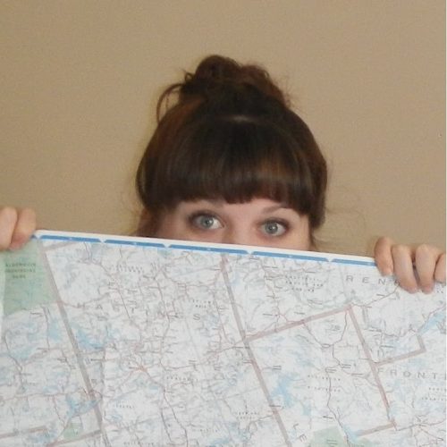
Meghan Miller: Creative Canadian Cartographer
GoGeomatics recently had the pleasure of speaking with a creative cartographer who has a passion for paper maps. Find out…
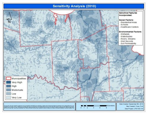
Landfill Assessment and Sensitivity Mapping Project
Project Task: Locate and collect information about open, closed, and historic landfills in order to create a 5 years inspection plan…
Why Free Open Source Software?
The Free and Open Source Software (FOSS) model provides interacting tools, plugs ins and processes with which Geospatial Analyst (GA)…

Vineyard Site Suitability Using Multi-criteria Evaluation
“Wine is light held together by water” – Galileo Preamble…. Beginning in my third year at Brock, I found myself…
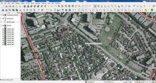
The Ottawa Tree Canopy Cover Mapping Project
The City of Ottawa Official Plan set a target of 30% tree canopy cover for the entire city. To the…
Welcome to the New GoGeomatics Canada!
Here at GoGeomatics Canada, we want to say hello to our new users and “surprise” to our existing members. We…

Timothy Ensom – Environmental Scientist
This time around GoGeomatics Canada is looking to the west to find Hydrologist Timothy Ensom at Golder Associates. Welcome to…
Measuring Tree Canopy Cover in an Urban Environment
To properly and effectively design and manage the city’s tree canopy it is important to quantify the amount and composition…
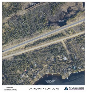
Photogrammetry and Cartographic Specialist
GoGeomatics met with Jenn White a photogrammetry and cartographic specialist to talk about her job hunt and her career. Jenn has worked has worked for the federal government in Ottawa and for industry in the prairies.
Jenn attended the University of Manitoba, where she got a B.A. Advanced with a Major in Geography. In her second year of studies, she took a cartography course and it was from that course, that she became passionate about working with and creating maps. Find out more about Jenn White, a Photogrammetry and Cartographic specialist.
