
flood mapping

Canadian Geospatial Digest for March 25th, 2024
How Indigenous companies are bringing high-tech solutions to the forest sector GIS in Mining: Strengthening Indigenous Communities Flood risk mapping…
International Geospatial Digest for February 19th, 2024
DLR develops mobile station for Satellite Laser Ranging Fathom and World Bank collaborate to enhance flood resilience Black communities are…

FHIMP Invitation for Proposals: Funding Opportunities for Flood Hazard Identification and Mapping Projects
Introduction The Flood Hazard Identification and Mapping Program (FHIMP) is a five-year initiative (2023-2028) led by Natural Resources Canada (NRCan)…

International Geospatial Digest August 14, 2023
Landsat Data and Wetlands Overture Maps Foundation will Release Data US Flood Risk Map Florida Division of Emergency Management Creates…

Canadian Geospatial Digest February 20th, 2023
City of Guelph chosen Canadian city to lead development of next-generation emergency services database First Nations say traditional knowledge should…
International Geospatial Briefing Sept 5
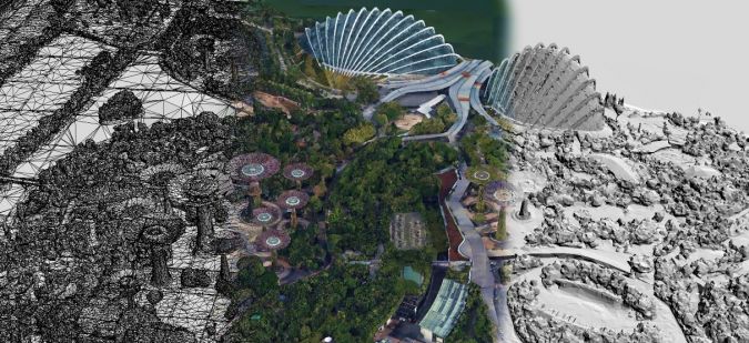
1. Geospatial 3D without VR 2. Geospatial Project Management 3. Singapore’s Digital Twin 4. Cool Spots in Hot Cities Mapped…

Canadian Geospatial Briefing March 21st: 1. Developing a subsurface digital twin for Canada. 2. Putting Indigenous knowledge on the map. 3. Mapping all flood prone areas in the Yukon. 4. Environmental impact of trucker protest. 5. Using AI to measure urban sprawl in Canada.
The Virtual Subsurface Utility Mapping Strategy Forum Conference 2022 presents a panel on developing a subsurface digital twin for Canada…
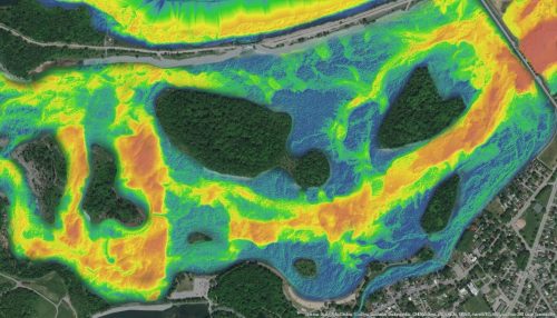
NV5 Geospatial Supports Flood Risk Mapping in Montreal Through Canada’s Largest Riverine Topobathymetric Lidar Survey
The Greater Montréal Area completed Canada’s largest-ever riverine topobathymetric lidar survey inresponse to two major flooding events within the last…

Geospatial Canada Briefing Oct 19: 1. Tsunami mapping; 2. Re-forestation with drones; 3. Vinland Map; 4. Holographic Sonar Displays; 5. Flood mapping; 6. drones in search & rescue
Tsunami mapping provides clearer picture of devastation for NW Vancouver Island A $1.2 million collaboration between five First Nations, four…

International Geospatial Briefing Oct 12: 1. Mapping endangered species; 2. Mixed reality visualization by extended reality; 3. Mapping reef in Australian coast; 4. UN releases flood map after 1985 worldwide; 5. Apple introduces no-code AI for geospatial application
Mapping threats to land mammals, amphibians and birds Climate change and human activities are both causing challenges for different animals…

GeoIgnite 2020 Video : Hydrospatial – Understanding Coastal Flooding, Detection & Response for Tsunami
The GeoIgnite annual conference 2020 was power packed with discussions and presentations about compelling technologies, impressive scientific advancements and upcoming…
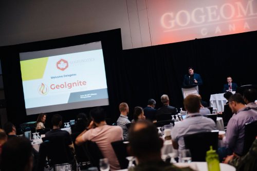
Leadership in Times of Disruption: GeoIgnite 2020 talks at a Glance
Canada’s geospatial community is gathering next week for GeoIgnite 2020. The second annual conference is being held online this year…
