
GeoIgnite

Post COVID Conference Success for the Canadian Hydrographic Community
The 2022 Canadian Hydrographic Conference (CHC2022) took place June 6-9th in Gatineau this month. What a pleasure it was to be…

Collaboration of VertiGIS and Statistics Canada Update Census Program Data Viewer
Overcoming Challenges to Make Complex Data Accessible to All VertiGIS and Statistics Canada presented the collaborated result of the…

SafeGraph Discusses The Importance of Accurate Geospatial Data
The Constantly Changing World Provides Information Challenges Geographer, Briana Brown from SafeGraph, recently presented via livestream at Canada’s National Geospatial…

Sparkgeo Uses a Geospatial Lens to Look at Earth’s Issues on a Planetary Scale
Cadell Asks Us To Rescale Our Way of Thinking The keynote speaker for GeoIgnite, Winter Geo conference on March 2,…

Panelists Discuss Using Geointelligence and AI to Solve Real World Problems
Maxar Sponsors Panel Discussion at GeoIgnite, Winter Geo During a livestream at the GeoIgnite, Winter Geo conference on March 1,…

Making Corporate Decisions using Geospatial Data: Agriculture Agri-Food Canada
Agriculture and Agri-Food Canada supports the Canadian agriculture and agri-food sector through initiatives that promote innovation and competitiveness. In his…
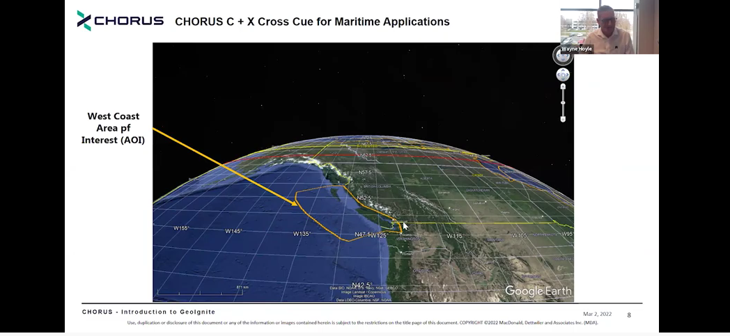
MDA Introduces Its Next SAR Mission: CHORUS
This Statellite Will Change How You See The World At the GeoIgnite, Winter Geo conference on March 2, 2022, during…
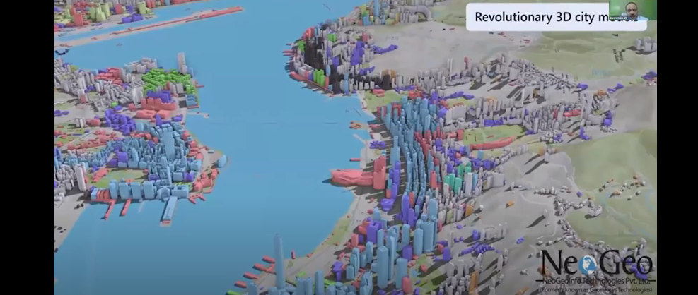
NeoGeo Technologies Ready to Grow in Canada
Award Winning Company Eager to Provide Solutions A livestream on March 3, 2022, from the GeoIgnite, Winter Geo conference, delighted…

Maxar’s Global Technology Shift from 2D to 3D
Maxar Endeavours to use Space and Earth Intelligence for the future of Geospatial Intelligence “Imagery is the foundation of our…

Deploy Software Solutions Fills in the Communication Gap When Needed Most
Improving Communication Between Citizens and Authorities During Disasters During GeoIgnite, Winter Geo livestream on March 2, 2022, Nick Kellet, Founder…
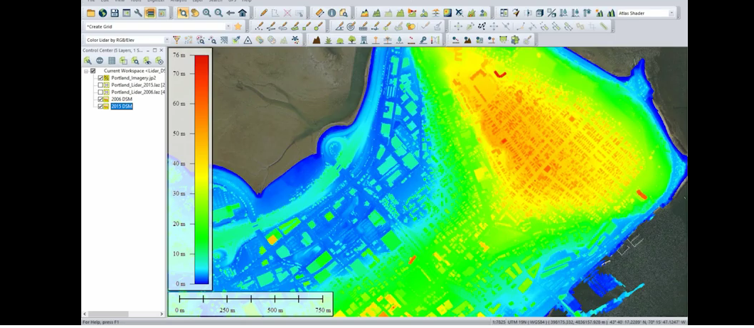
Detecting Change Becomes Easier Using Point Cloud Data
Blue Marble Geographics Gets Hands On With Change Detection On March 3, 2022, David McKittrick, Outreach and Training Manager for…
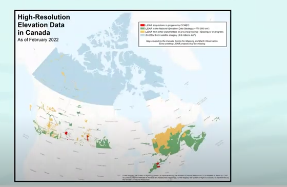
NRCAN Leading Initiative to Increase Canada’s Resilience to Flooding
Geomatic Services Playing Key Role in Initiative On March 1, 2022, Brian Perry, Engineering Advisor for flood modeling with Natural…
