
GNSS

Augview Brings Subsurface Utility Mapping to Life in Real Time
Augmented Reality brings benefits and technical challenges to the world of utility mapping. Michael Bundock, CEO and Founder of Augview…

NavVis Changes the Game with Dynamic Mobile Mapping
During a LiDAR COMEX 2022, live stream on April 5, 2022, participants heard Marek Koltun, Senior Account Executive – Enterprise…

TopoDOT Compares Data and Applications of UAV and LiDAR Point Cloud
On April 5, 2022, LiDAR COMEX 2022 held a live stream presentation on “data comparison and applications of UAV imagery-based…

International Geospatial Briefing – June 6th, 2022: 1. Largest-ever imagery contract handed out by National Reconnaissance Office 2. Are Maps the next big medium? Felt is betting on it 3. Xona’s private GNSS passes critical tests on path to launch 4. New US school shooting map in wake of Texas tragedy 5. Geospatial and the problem of too much climate data
Largest-ever imagery contract handed out by National Reconnaissance Office A new announcement out of the National Reconnaissance Office in the…

Why Build a New GNSS Rover?
With so many types of high precision GNSS rovers on the market, what motivated one company to build a new…
International Geospatial Briefing May 9th: 1. Canopy mapping helps council; 2. Capella Space funding will enhance AI-enhanced geospatial data; 3. Space Force has insatiable demand for geospatial intelligence; 4. A sharper look at the world’s rivers and catchments; 5. Developing a Virtual Laser Scanner for Training and Research; 6. NASA Develops Lidar Backpack Technology
Canopy mapping helps council Capella Space funding will enhance AI-enhanced geospatial data Space Force has insatiable demand for geospatial intelligence…
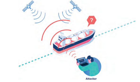
GNSS Jamming vs. Spoofing
On March 17, 2022, the European Union Aviation Safety Agency (EASA) released a safety information bulletin titled “Global Navigation Satellite…

Past, Present and Future of Marine Navigation
I have often wondered how marine navigation works on a roadless map of open seas and oceans. Let’s dive into…
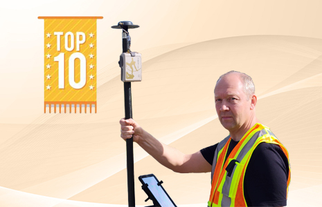
10 Canadian Organizations Using High-Accuracy GNSS for Mobile Mapping
High-accuracy mobile mapping with external GNSS receivers is becoming more of a requirement across industries. In the following article, we…

Low Earth Orbit Satellites for Resilient Positioning, Navigation, and Timing
Xona Space Systems is on track for a dedicated constellation of LEO satellites to provide resilient positioning, navigation, and timing…

Alternate GPS/GNSS/PNT – Orolia
Positional continuity, precise and traceable time, testing and simulation—key elements of multi-layered alternate PNT solutions. What is Alt PNT? What…

Emlid announces NTRIP Caster for Private RTK Networks
Emlid released an enterprise version of its NTRIP caster—Emlid Caster Pro. The advanced caster for commercial use is able to…
