
maps
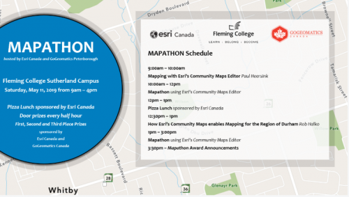
Peterborough GoGeomatics Meetup: May 11th Mapathon
GoGeomatics Peterborough and Esri Canada are hosting a Mapathon at Fleming College to create data for the Region of Durham…
Traces of the Past: 1917 Vimy Ridge Map Project Video Presentation GoGeomatics in Ottawa
Bert de Bruijn is an Ottawa IT security consultant and founder of the WikiWar Project. Bert is passionate about Crowdsourcing…
What is the Canadian Cartographic Association?
The Canadian Cartographic Association (CCA) was founded in 1975 with the aim to promote interest in maps and cartographic materials, deepen…
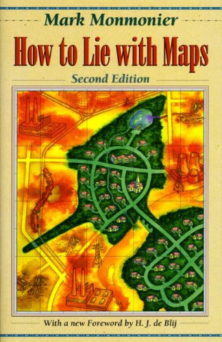
How to Lie With Maps Revisited: The Canadian Perspective
I recently returned to Hamilton after five years of teaching at a Washington DC university, taking a paid partial-sabbatical at…
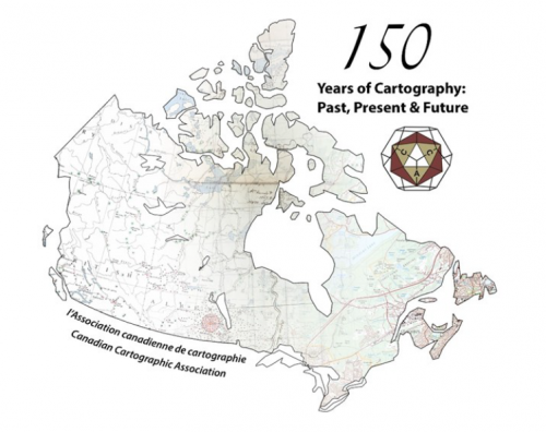
A summary of the 2017 Conference of the Canadian Cartographic Association: “150 Years of Cartography: Past, Present and Future”
The 42nd Annual Conference of the Canadian Cartographic Association was held, May 31st thru June 2nd, at Carleton University. Inspired…
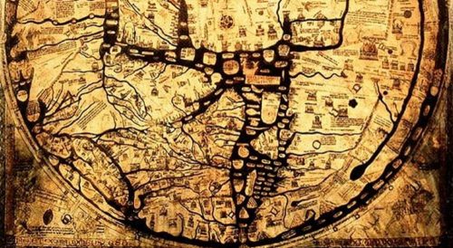
Cartography & Art: Historic and Ancient Maps
As much a science as an art; cartography makes one wonder how the artist or mathematician-cum-geographer captured the most finite…

Google Earth Engine – What is a Data Cube and Why Canadians Should Care
What is a data cube and how is it used for big data analytics? How does a data cube work…

My COGS GIS Education, Part II
In my first article, I introduced the how and why I chose to attend COGS from the fall of 2014…
CCA Ottawa Conference: “150 Years of Cartography: Past, Present and Future”
The 42nd Annual Conference of the Canadian Cartographic Association “150 Years of Cartography: Past, Present and Future” Location: Carleton University,…

Top Ten Climate Change Maps and GIS Applications
Awareness for climate change has been steadily increasing ever since the Green Revolution in the 1960s. There is a plethora…
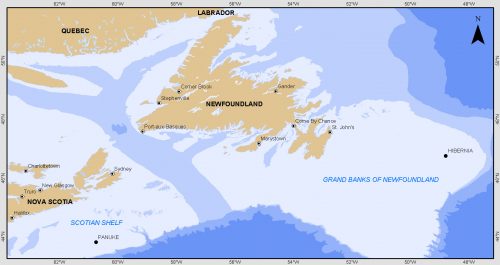
Grand Banks to the Gulf of Mexico: My Canadian Geomatics Career
I often contemplate what it would have been like working at the same job for an entire career. Mind you,…

GNOSIS – A New Geomatics Software Suite
Creating a new GIS from scratch is a tough undertaking. It involves a lot of innovation. Ecere, a Canadian company…
