
marine

Ten Years Later: Interview with Wendy MacIsaac one of Canada’s Top Surveyors
Ten years ago, GoGeomatics interviewed Wendy MacIsaac of Midwest Surveys Inc. in Calgary, Alberta, about her career and being a…
Canadian Geospatial Briefing September 12th
1. Rising temperatures put at least a quarter of marine life around P.E.I. at risk 2. Canadian youth join NASA…

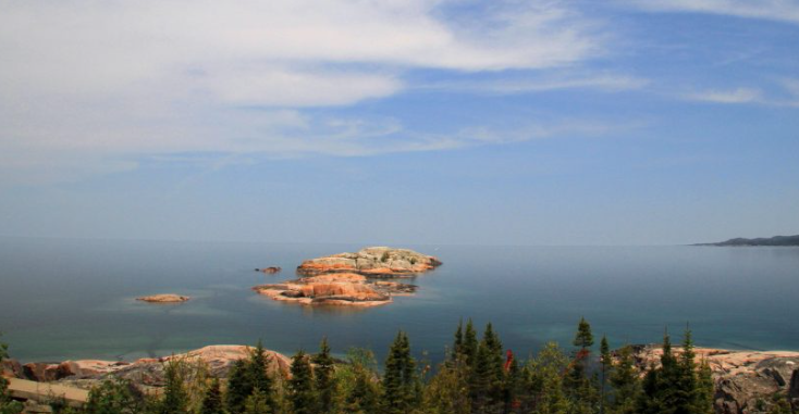
Past, Present and Future of Marine Navigation
I have often wondered how marine navigation works on a roadless map of open seas and oceans. Let’s dive into…
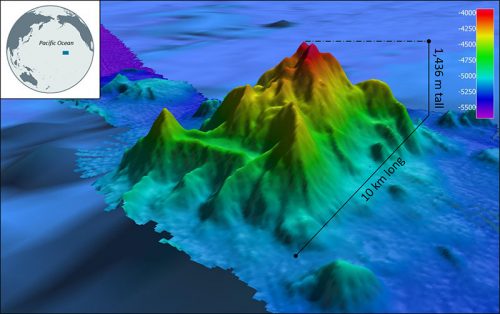
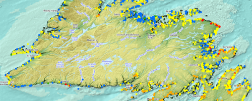
International Geospatial Briefing Nov 22: 1. Two million square km of the seafloor mapped. 2. Importance of marine geospatial data. 3. Using smartphones to map road potholes. 4. Into the metaverse. 5. The Geography of Mysteries. 6. Mapping our human footprint.
NOAA Ocean Exploration Meets Major Mapping Milestone on NOAA Ship Okeanos Explorer The National Oceanic and Atmospheric Administration (NOAA) has reached…
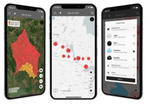
Canadian Geospatial Briefing August 2nd: Honouring Alex Trebek with new Grant Program; Interactive Map Looking at Marine Shipping Safety in Canada; New Canadian Wildfire App; Looking at Vulnerability from Heat Waves in Vancouver and Highlighting Importance of Green Spaces; A Collection of Canadian COVID-19 Dashboards
Alex Trebek honoured with Geographical Society grant program for emerging explorers The National Geographic Society in the United States and…
Your Canadian Geospatial Briefing for July 23rd: Thai cave rescue; TECTERRA LEAP program; data and cannabis; Marine Emergency Response; Behr technologies
Thai Cave rescue aided by Calgary geomatics company Intermap Technologies provided crucial data that helped rescuers reach the 12 children…

M.A. or M.Sc. Opportunity – Environmental Assessment and Resource Mgt
M.A. or M.Sc. Graduate Research Opportunity Department of Geography and Planning University of Saskatchewan Opportunity: The Department of Geography…
Association of Canada Lands Surveyors Develops New Canadian Hydrographer Certification
Canadian Hydrographer Certification Scheme Association of Canada Lands Surveyors The Association of Canada Lands Surveyors (ACLS) has developed a certification…

Free Satellite Imagery For You: Sentinel 1 & 2
Sentinel constellations and data products As the ENVISAT program is coming to an end, the European Space Agency has begun…
WEBINAR March 29: GSDI Coastal and Marine SDI Best Practices
COINAtlantic would like to extend an invitation on behalf of the Global Spatial Data Infrastructure (ASDI) Association to participate in…

My COGS GIS Education
What About COGS The Centre of Geographic Sciences (COGS) is one of the best colleges in Canada for learning GIS. …

Top Ten Climate Change Maps and GIS Applications
Awareness for climate change has been steadily increasing ever since the Green Revolution in the 1960s. There is a plethora…
