
professional
43 Degrees North – Surveying and Mapping Solutions
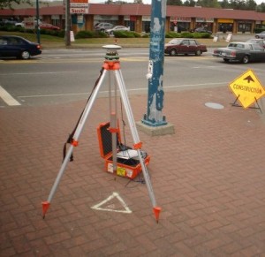
GoGeomatics is continuing the exploration of careers in surveying by interviewing Thomas Hoppe, the founder of 43 Degrees North – Surveying and Mapping Solutions. 43 Degrees North is situated in Cobourg Ontario in picturesque Northumberland County along the north shore of Lake Ontario is a professional Land Surveying and Geomatics company in Ontario Canada. They provide a variety of geo-referenced solutions from boundary surveys, aerial photography ground support, pre-engineering surveys, construction layout, and survey training with an emphasis on GPS applications and technology
Geomatics Entrepreneur – Cardinalus Corporate Consulting
Check out our second interview in our new series on Geomatics Entrepreneurs. GoGeomatics had a chance to chat with with Dennis Nazarenko; President at Cardinalus Corporate Consulting in Ottawa and here is what he had to share …
GIS Team Leader
Pat has worked in both the public and private GIS sectors and we were fortunate to have him share his experiences with us. He is currently the GIS Team Leader for all projects that require GIS services.
The office that he works at is involved in Environmental Management, and there are approximately 50 on-going projects. The work environment and turnaround times are usually very fast pace and it is his duty to make sure that the GIS services are delivered with the best quality possible and on time.
Geomatics Entrepreneur & Founder SpatialBridge
This is the the first part of a new section featuring Geomatics Entrepreneurs with Jonathan Bailey the founder of SpatialBridge a geomatics consultancy in Ottawa, Canada.
Geomatics / DEM Specialist
Greg Druce, a Geomatics Specialist focusing on quality control of DEMs at MDA Corporation. Greg is new to the field, offering views on the attraction of geomatics and finding and developing a career through a nontraditional path. He agreed to discuss his job and career direction going forward.
Spatial Ecologist and GIS Manager
Ted Elliot of LGL Limited environmental research associates helps to better explain and define what a Spatial Ecologist and GIS Manager’s role could be. A key to LGL’s success has been the stability of the company, resulting in low staff turnover. Several staff members have been with LGL for 30 years or more. This experience enables LGL to complete assignments efficiently, on time, and within budget, and with a high degree of scientific competence.
Survey Crew Chief / Geomatics Technician
We would like to introduce Wendy Innes, a graduate of Marine Geomatics program at COGS to help better explain and define what a Survey Crew Chief role could be.
Manager Software Engineering
Dan Eslinger of NavCom Technology Inc was kind enough to talk with GoGeomatics to help better explain and define what a Manager Software Engineering role could be.
Project Manager – LIDAR Surveying
Find out what a Project Manager role with a LIDAR data Acquisition company is like and how you could get yourself into the LIDAR survey business. A very exciting and dynamic role for young people to keep up to date with changing technology and also have a chance to see the world while getting paid to do it.
