
professionals

Canadian Hydrographic & National Surveyors Conferences: 2018 Victoria, BC: March 26-29
2018 Canadian Hydrographic & National Surveyors Conferences March 26-29, 2018, Victoria B.C. Sponsor and Exhibitor Registration is now opened. You…

EnerGIS 2017: Call for Papers & Scholarship Opportunities
EnerGIS 2017 6/5/2017 to 6/6/2017 Suburban Pittsburgh, Pennsylvania. Join us for our 5th annual conference June 5th and 6th 2017!…
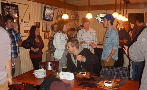
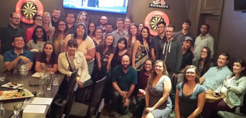
March 2017 GoGeomatics Talks: Toronto, London, Peterborough, Halifax
GoGeomatics Canada has built a thriving geospatial community by creating networking opportunities for our participants. We achieve this by holding free informal…

Remote Sensing QGIS: Semi-Automatic-Classification Plugin (SCP)
Semi-Automatic Classification Plugin Today I’m going to take a quick look at one of the remote sensing plugins for…

GNOSIS – A New Geomatics Software Suite
Creating a new GIS from scratch is a tough undertaking. It involves a lot of innovation. Ecere, a Canadian company…

UBC Unveils New Masters of Geomatics for Environmental Management
The UBC Faculty of Forestry is excited to announce that the official approval of the Master of Geomatics for Environmental Management…
Vancouver Geospatial Career Seminar February 23rd
GoGeomatics Canada is bringing our popular career seminar to Vancouver this February. This is only the second time we have…

Interview with Sam Scovill, GIS Technician and 3 Day Champion on Jeopardy
Every weeknight, my mom and I watch Jeopardy together. Jeopardy always starts with the announcement of the contestants by their…

Software Development – The Key to Ecere’s Success
It is rare to learn of a GIS company in which much R&D is done up front to create the…
City of Peterborough Mapping Talk – February 21 GoGeomatics Social
Tuesday, February 21, 2017 – 6:30 PM One Eighty Hunter Street 180 hunter street, Peterborough, ON This month we have…

Edmonton GoGeomatics Bowling Night Social February 16
Thursday, February 16, 2017 7:00 PM to 10:00 PM Ed’s Rec Room WEM, Edmonton , AB At the West Edmonton…

Atlantic Canada: COGS: Geomatics Professionals Coming to Discuss High Resolution Coastal Mapping
High Resolution Coastal Zone Mapping This collaborative effort by GANS & the CIG will engage the geospatial community & increase awareness on the value…
