
Commercial UAV Expo
Commercial UAV Expo, September 5-7, 2023 in Las Vegas is the premier event for the commercial drone industry focusing on…

Drone solutions from 40 countries spanning the entire UAS ecosystem will be on display Organizers of Commercial UAV Expo, the…
Commercial UAV Expo, September 5-7, 2023 in Las Vegas is the premier event for the commercial drone industry focusing on…
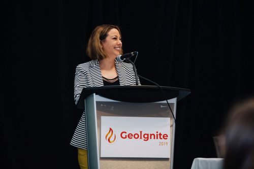
I’m thrilled to announce our first tracks, forums and summits for GeoIgnite 2020. A big thank our GeoIgnite conference committee…

Digital transformation refers to the changes associated with the application of digital technology in all aspects of human society. A…

A federal act to streamline geospatial data The USA recently passed Geospatial Data Act is expected to streamline federal government…

Sentinel constellations and data products As the ENVISAT program is coming to an end, the European Space Agency has begun…
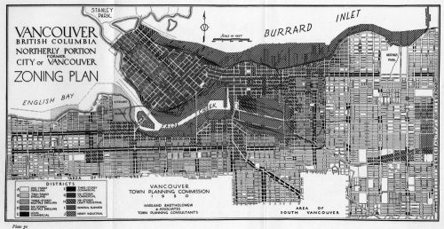
In 1927 a Vancouver bylaw was enacted that limited the height of buildings to a maximum of six stories in…
The Canada Centre for Mapping and Earth Observation invites you to attend the Arctic Spatial Data Pilot Demonstration Webinar. Managed and…
The Federal Floodplain Mapping Guidelines workshop, hosted by Canadian Water Resources Association (CWRA) on behalf of the Government of Canada,…

Please consider submitting an abstract for the CAG 2017 York University, May 29 – June 2, 2017. The last day to submit…

Recently, I read an article about the Canadian Geospatial Data Infrastructure (CGDI) that seeks to explain why the CGDI, among many…

The Canadian Geospatial Data Infrastructure (CGDI) is an initiative of Natural Resources Canada that began in 2001. The CGDI does…
