
Son
Free Webinar March 15th: NRCan, OGC, & USGS Arctic Spatial Data Pilot Demonstration
The Canada Centre for Mapping and Earth Observation invites you to attend the Arctic Spatial Data Pilot Demonstration Webinar. Managed and…
Toronto & Calgary: Federal Floodplain Mapping Workshop March 28th & 30th
The Federal Floodplain Mapping Guidelines workshop, hosted by Canadian Water Resources Association (CWRA) on behalf of the Government of Canada,…

My COGS GIS Education
What About COGS The Centre of Geographic Sciences (COGS) is one of the best colleges in Canada for learning GIS. …

GIS in Action: How Does BC Pinot Noir Express Terroir?
Editors note: In this previously published article, Karl Kliparchuk, BCIT GIS Program Head & Instructor uses GIS to explore the…

Top Ten Climate Change Maps and GIS Applications
Awareness for climate change has been steadily increasing ever since the Green Revolution in the 1960s. There is a plethora…

GNOSIS – A New Geomatics Software Suite
Creating a new GIS from scratch is a tough undertaking. It involves a lot of innovation. Ecere, a Canadian company…

Ten Interesting Facts about the Geography of Canada
This year Canada will celebrate its 150th birthday on July 1st. Most of you, like me, will be out celebrating…

Event Recap: COGS & CIG & GANS Cooperate for Mapping Workshop
The Canadian Institute of Geomatics (CIG) Nova Scotia Branch and the Geomatics Association of Nova Scotia (GANS), two regional professional organizations that foster the application of geographic information within the geomatics sector recently collaborated to host a high resolution mapping workshop at the Centre of Geographic Sciences (COGS) in Lawrencetown, Nova Scotia.

Call for Papers: CAG: Critical Geographies of Migration
Please consider submitting an abstract for the CAG 2017 York University, May 29 – June 2, 2017. The last day to submit…

Vancouver Geospatial Career Seminar February 23rd
GoGeomatics Canada is bringing our popular career seminar to Vancouver this February. This is only the second time we have…
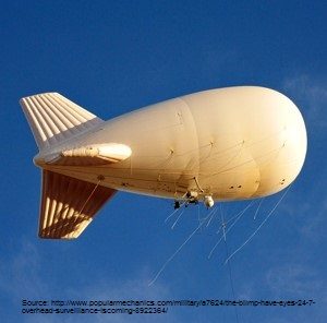
Geospatial Earth Observation Using Blimps, Balloons and Kites
These days drones are all the rage. Nevertheless, there are other ways to collect data from the sky! Blimps, balloons and kites…

New Galileo navigation system is experiencing clock failures
Since December 15, 2016, the new Galileo global satellite navigation system has been up and running. Unfortunately, there are…
