
station

Google Earth Engine – What is a Data Cube and Why Canadians Should Care
What is a data cube and how is it used for big data analytics? How does a data cube work…
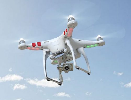
UAV Surveys – How to Ensure Accuracy and Precision
For the past four years, I’ve been involved with the capture and delivery of data derived from drones. My experience…

Free Satellite Imagery For You: Sentinel 1 & 2
Sentinel constellations and data products As the ENVISAT program is coming to an end, the European Space Agency has begun…

COGS NSCC students use Geomatics to explore the history of Black Loyalists & Joggins Fossil Cliff
NSCC students make major impact in two small communities with huge historical significance Students at Nova Scotia Community College’s Centre…

My COGS GIS Education
What About COGS The Centre of Geographic Sciences (COGS) is one of the best colleges in Canada for learning GIS. …

Top Ten Climate Change Maps and GIS Applications
Awareness for climate change has been steadily increasing ever since the Green Revolution in the 1960s. There is a plethora…
Esri Canada Community Maps Program: Why more communities need to take advantage of this
The Community Maps Program (CMP) was introduced by Esri Canada in 2009 allowing organizations to share and host geographic data. …

RAC launches online Canadian Rail Atlas
One hundred and fifty years after Confederation launched the idea of a railway that would unite the country, the Railway…
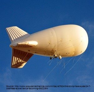
Geospatial Earth Observation Using Blimps, Balloons and Kites
These days drones are all the rage. Nevertheless, there are other ways to collect data from the sky! Blimps, balloons and kites…

The Art of Being a Cadastral Surveyor: Key abilities every surveyor needs
The Art of Being a Cadastral Surveyor: The key abilities every surveyor needs There is an art to being a…

UAVs in Canada – Key Exposures to Loss and Ways to Protect Yourself
This article was written by Mark Sampson for the Association of Ontario Land Surveyors. Mark’s contact details are at the…

How Canadian Remote Sensing Was Made Commercially Successful & Exportable
This piece started as a note on some of my experience as an international consultant in remote sensing specifically and…
