
Topobathymetric LiDAR Survey

NV5 Geospatial Collaborates with Communauté métropolitaine de Québec on Ambitious Topobathymetric Lidar Survey
The earliest French settlers in North America were drawn in the 16th century to the area now known as Québec…

NV5 Geospatial Supports Natural Resources Canada in Topobathymetric Lidar Survey of South and North Saskatchewan Rivers
Over the last decade, a growing number of municipal and regional governments across North America have invested in topobathymetric lidar…
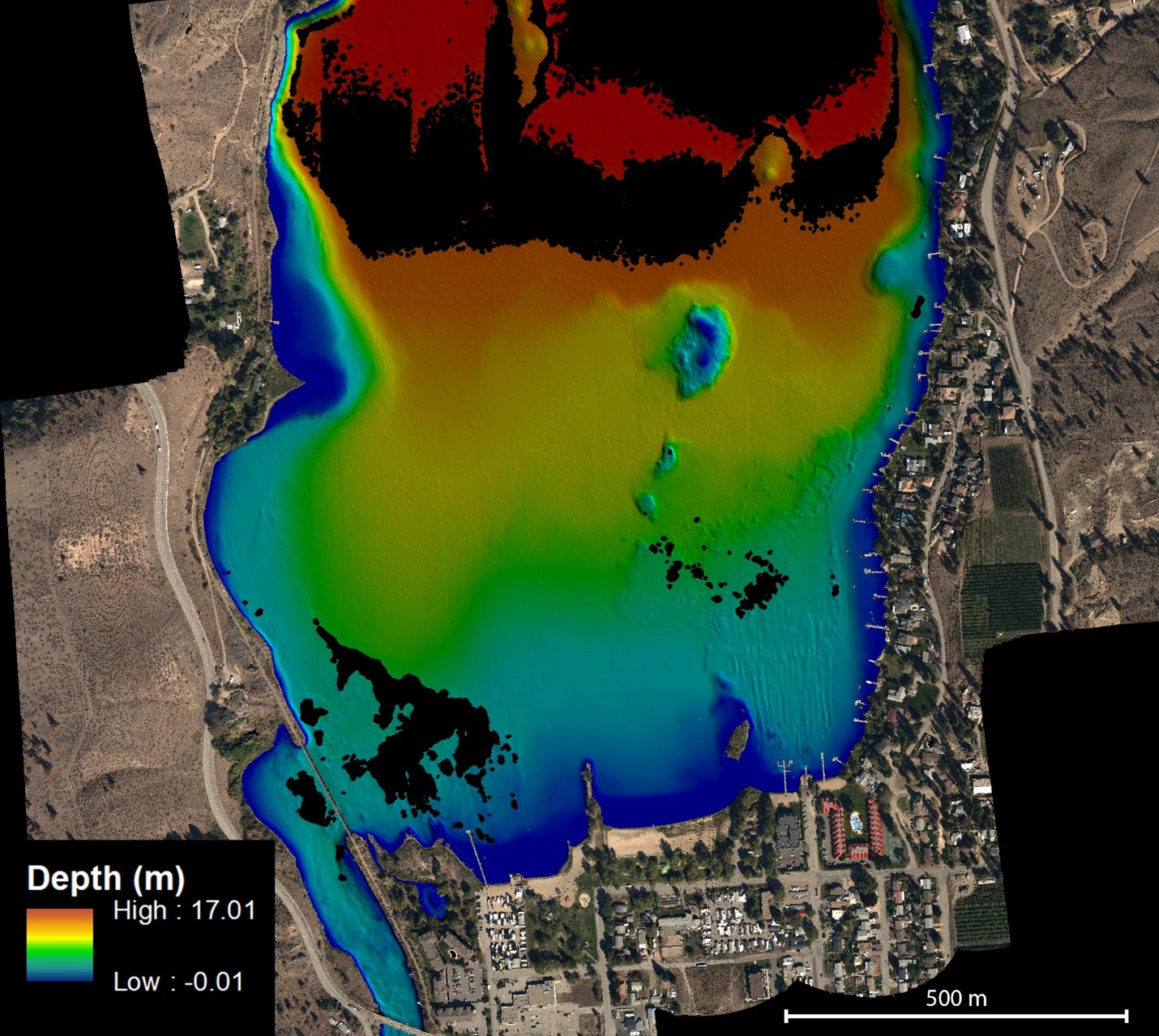
NV5 Geospatial Helps Okanagan Basin Water Board Protect Important Local Communities Through Near-Shore Topobathymetric Lidar Survey
The Okanagan Valley in British Columbia is one of Western Canada’s most attractive tourist destinations, with local communities offering a…
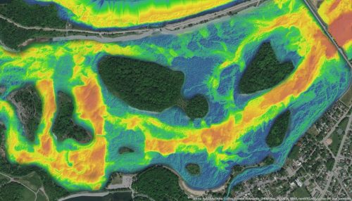
NV5 Geospatial Supports Flood Risk Mapping in Montreal Through Canada’s Largest Riverine Topobathymetric Lidar Survey
The Greater Montréal Area completed Canada’s largest-ever riverine topobathymetric lidar survey inresponse to two major flooding events within the last…
INSITE Lifecycle Project Tracker Enables & Delivers Real-Time Data Updates
When conducting Lidar surveys, efficiency and success are determined to a degree by conditions outside of the surveyors’ control. The…
GeoIgnite 2020 Video: Innovations and Lidar Applications for Trees & Water by Quantum Spatial Canada
The 2020 Geolgnite conference was put online and brought the Canadian geospatial sector together. One of the topics included updates…
