
University of British Columbia
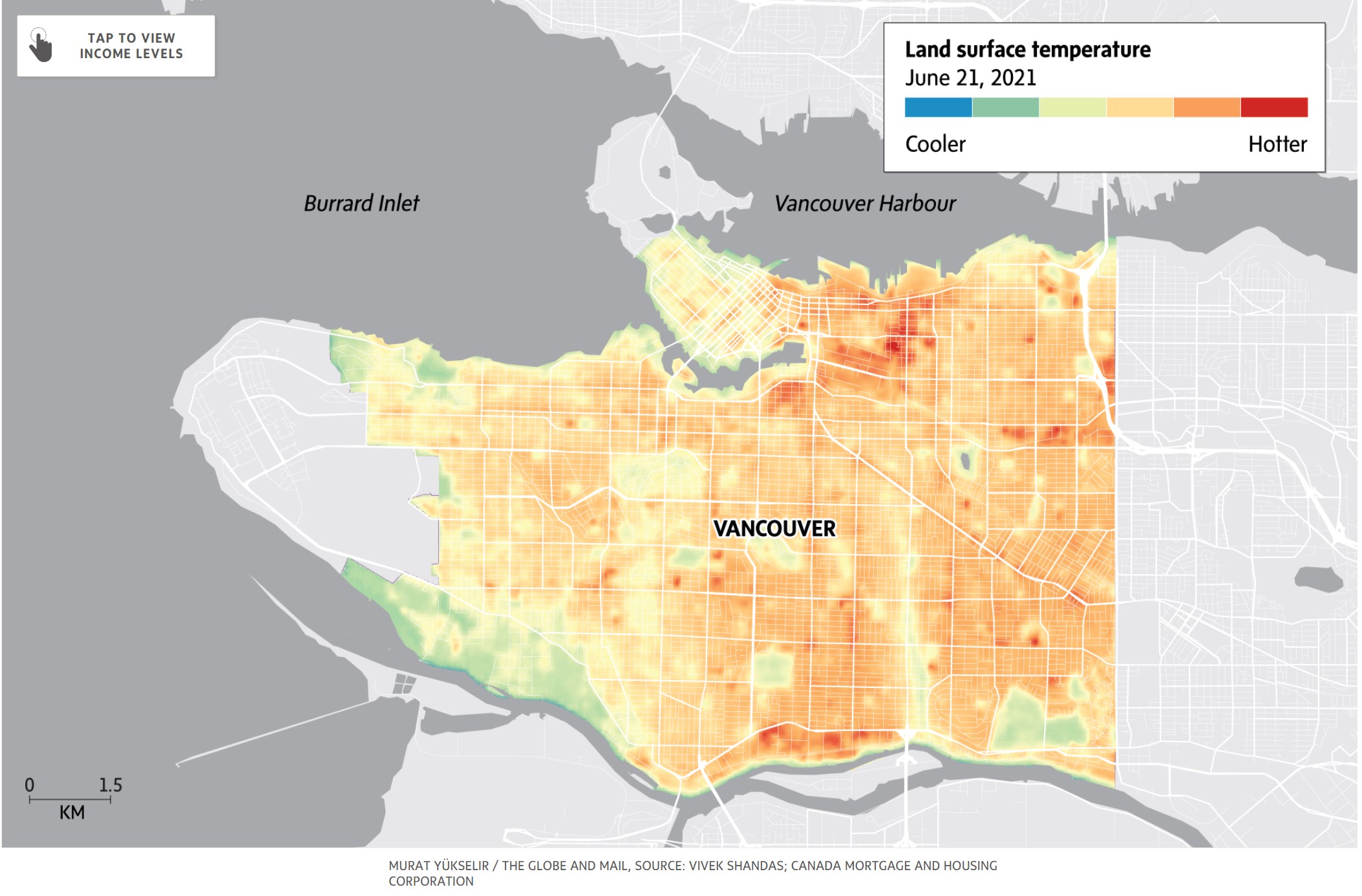
Using Geospatial Technology to Pinpoint Canada’s Hottest Neighbourhoods
Heat waves are seemingly becoming more intense and more dangerous for vulnerable populations. GIS has helped to pinpoint the hottest…

M.A. or M.Sc. Opportunity – Environmental Assessment and Resource Mgt
M.A. or M.Sc. Graduate Research Opportunity Department of Geography and Planning University of Saskatchewan Opportunity: The Department of Geography…

Call to Action: Network of Concerned Geographers
Our growing network – the Network of Concerned Geographers – is pressuring the American Association of Geographers to study and…
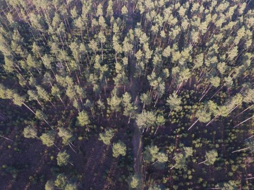
UAV Technology in the Canadian Forestry Sector
The Unmanned Aerial Vehicle (UAV) industry is soaring! Civilian drones are being applied in various global industries ranging from agriculture…
Beyond the Outer Shores
For over fifty years, the islands off the coast of British Columbia and Alaska have been called ‘the outer shores’.…

Speaker Series: LiDAR & Forest Management at the Edmonton Social
*Editor’s note: Due to unforeseen circumstances, the speaker has been postponed for the April Social. The social is still taking…

Career Profile: An Interview with Jackie Woodruff, GIS Technician
Meet Jackie Woodruff. She’s a BC-based GIS Technician with a strong passion for the geomatics community. GoGeomatics recently interviewed Jackie…

ACCURATE SPATIAL DATA: GIS AND TRAVEL ACCOUNTS
Data acquisition is without a doubt one of the most important processes in the implementation of any GIS. As GIS…

Lynn Moorman: Finding the Way with Geo-Literacy
At first glance, navigating the world has never been easier. Getting from Point A to Point B is a snap;…

Tracey Harvey: GIS Instructor, Selkirk College
GoGeomatics: Escaping the occupational hazards of wildland firefighting, Tracey is currently a GIS Instructor at Selkirk College. We would like…
