
water

Water in Focus: Hydrospatial Advances at Canada’s National Geomatics Expo
Join us as we chart the course for a resilient water future, leveraging the power of geomatics and fostering collaboration…

International Geospatial Digest September 11th, 2023
Planning Landmine clearances with UAV LiDAR Mapping pollution from space Tracking dangerous chemicals in the Great Lakes with maps New…
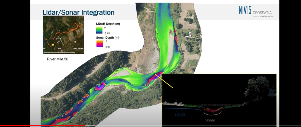
NV5 Geospatial Discusses Remote Sensing and Analytics to Support Hydrospatial Solutions
A “Holistic Understanding of Water in Our World” At the March 1, 2022, GeoIgnite, Winter Geo conference, Sven Cowan, Canada Program…
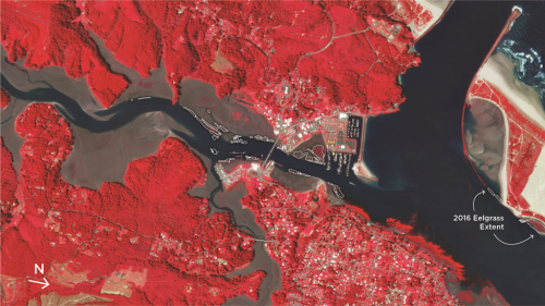
Observing the Peace-Athabasca Delta and Wetland Climate Stress from Space
In the far northern reaches of Canada’s Saskatchewan Province, the Athabasca River and Peace River flow into the Peace-Athabasca Delta,…

Multiple NASA Earth Observation satellites record major freshwater changes around the world
In a first-of-its-kind study, scientists have combined an array of NASA satellite observations of Earth with data on human activities…

One of the Best Geomatics events in Canada: GeoAlberta 2017
I had a chance to attend the 2017 GeoAlberta conference earlier this month in Calgary, Alberta. This was my first…

Master’s Thesis Student Recruitment: Amphibious Housing in Vietnam
University of Waterloo searching Funded Master’s (MA or MES) research project Dr. Carrie Mitchell (UW-Planning) and Dr. Brent Doberstein (UW-Geography…

Free Satellite Imagery For You: Sentinel 1 & 2
Sentinel constellations and data products As the ENVISAT program is coming to an end, the European Space Agency has begun…
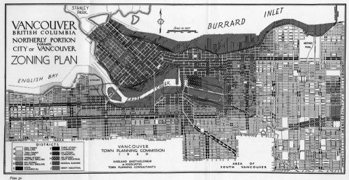
QGIS: Performing Viewshed Analysis on Archaeological Sites
In 1927 a Vancouver bylaw was enacted that limited the height of buildings to a maximum of six stories in…

My COGS GIS Education, Part II
In my first article, I introduced the how and why I chose to attend COGS from the fall of 2014…

Remote Sensing QGIS: Semi-Automatic-Classification Plugin (SCP)
Semi-Automatic Classification Plugin Today I’m going to take a quick look at one of the remote sensing plugins for…
Toronto & Calgary: Federal Floodplain Mapping Workshop March 28th & 30th
The Federal Floodplain Mapping Guidelines workshop, hosted by Canadian Water Resources Association (CWRA) on behalf of the Government of Canada,…
