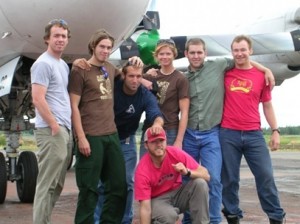
Tracey Harvey: GIS Instructor, Selkirk College
GoGeomatics: What factors drew you to choose to work in the Geomatics field?
Tracey: The challenge was what initially drew me in! After my undergrad I was working in the Forestry industry and found myself by accident making maps and doing fancy mappy stuff; I was trying to build a customized tool that would cut a polygon and calculate areas and do a few other things automatically. It was then that I wanted to pursue formal training in GIS. I also loved mapping out all of my long bike rides, hikes and other outdoor adventures! It was a really good fit.
GoGeomatics: You are a GIS Instructor at Selkirk College in BC. Can you tell us about the types and content of the courses you are teaching?
Tracey: I teach a variety at Selkirk and have done so for the last four years. This year I teach GIS in two areas:Within our core Environment and Geomatics Programs which are Integrated Environmental Planning, Recreation, Fish and Wildlife and Forestry. In these programs I teach an introduction to GIS to expose learners how to think spatially and generate awareness of the vast applicability of our field.I also teach within our Advanced Diploma in GIS and Bachelor of GIS programs; these are more specialized courses like New Media (we build a website and use photohop and illustrator for enhancing maps), CAD (we learn AutoCad and how to move data between CAD and GIS systems), Data Management (including policy, standards, open data, dissemination, access, and ethics), Project Management (understanding the concepts and putting theory into practice), Professional Development, Advanced Applications of GIS (this has two major projects: one is a collaboration with our nursing program and the other a collaboration with our spatial stats course).I love the mix! It’s fun to engage in such broad content and to work with a variety of learners.
GoGeomatics: Could you provide us with a brief background on how your career has led you to your current position? How has GIS shaped your experiences?
Tracey: I’m really lucky to have worked for many different organizations and in different capacities. I feel lucky because my past makes my teaching richer; I believe field experience is essential within a technical program to help prepare learners for what they will encounter when they hit the ground running after graduation.
GIS has given me the opportunity to work within different industries too; it’s been a door opener. I started off working for a Forestry company where I stumbled upon this field. After my GIS training, I went back to the same industry and worked for both a commercial company and then a consulting company. I then worked for Esri Canada which exposed me to applying GIS to more industries. Following Esri, I did municipal GIS for the Town of Banff which is where I was before coming to Selkirk.
Somewhere in there I also did Rapattack (Rappel from helicopters to fight wildfire). I didn’t use GIS in that position, but it’s highly valuable for wildfire response and management. And interestingly that job provided me with many experiences that I still refer to in my professional life. It was the “break” I needed at the time. I need challenge and change and GIS affords me to fuel that fire.
GoGeomatics: According to your LinkedIn profile you have completed Core Alignment Coaching Professional Coach Training. Can you expand on what type of training this is and how you use these skills in your current position?
Tracey: What an amazing experience that was! I have lasting memories of that course and specifically of the founder and best teacher ever, Lori-Ann Demers. We delved into appreciative inquiry and neural linguistics and got to practice “evoking the greatness” in others. The course lasted one year…and it was tough but very fulfilling.
I try to consciously practice positive inquiry when working with learners in my current job, and depending on the unique needs and situation, I go further to help pull out what people are capable of, but often don’t know. It’s so rewarding to notice transformation and the development of new neural pathways in others. That’s pretty much what happens.
GoGeomatics: Geomatics is a growing industry. Do you have any hopes or aspirations for geomatics in general? What would you like to see happen in this industry?
GoGeomatics: Let’s switch gears and talk about the geomatics industry and hiring in general for geomatics. What would you recommend to a new graduate in the field? What’s the one piece of advice that you give to your students in search of a career in GIS/geomatics?
Tracey: It depends what they want to do with it! Do they want to be a GIS person, or do they want to utilize GIS within another field? I’m a firm believer that we can create realities and opportunities that suit us, so the trick is to identify what suits us (or what we want)! We need to be specific.
Beyond that I suggest things like: building an online profile and portfolio, creating networks and communities with like-minded people, and people who you want to work with. Attending events to meet ‘seasoned’ industry people and to further build connections. Research! Research organizations you want to work for and with, and approach them, show them what you have to offer and why they need you. That kind of “detective work” will lead graduates down a path they want to be on.
GoGeomatics: Thank you Tracey for sharing your insight with us. We look forward to hearing from you again!


