

Using GIS to Track Land Use Change in York Region – Urban Growth Centres
Our last article examined the use of GIS technology to track land use change in four Toronto districts. Each district represented an urban growth centre designated by the Places to Grow Act.
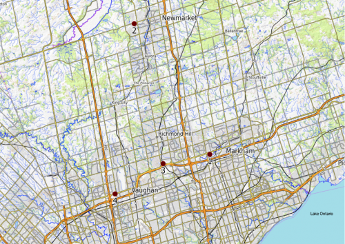
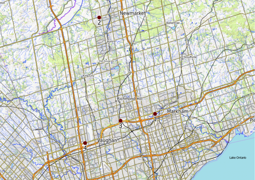
Continuing from our last discussion, this article will analyze four urban growth centres in York Region that will undergo land use change: Markham Centre, Newmarket Centre, Richmond Hill Centre, and Vaughan Centre. GIS technology such as QGIS and ArcGIS and reference information from Google Maps, municipal planning sites (e.g. PLANit Vaughan Application Viewer), developer websites, and Urban Toronto are instrumental in projecting future changes and examining outcomes, challenges and opportunities.

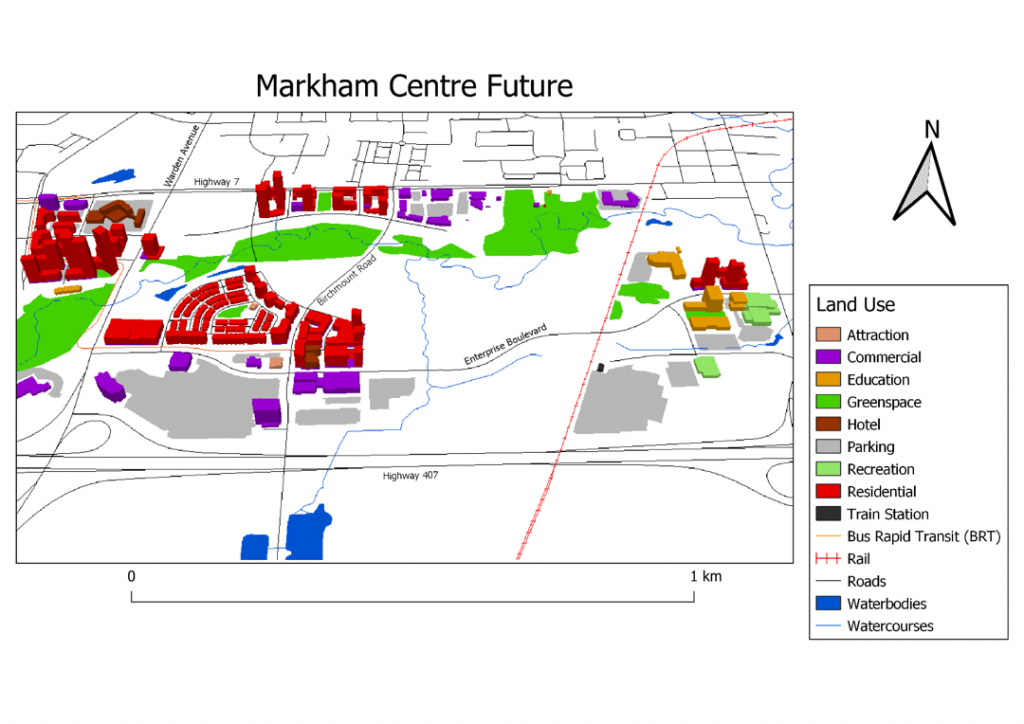
The western half of the Markham Centre is poised to experience land use changes in the coming years. On the west corner of Warden Avenue just south of Highway 7, a parcel of land currently occupied by a parking lot will make way for a community featuring five residential towers, street level retail, outdoor amenity space and a road extension. At the northeast corner of Enterprise Drive and Birchmount Avenue, a master-planned community named Gallery Square Condos will consist of a retail promenade road at its centre and two mid-rise and two high-rise condominiums. Both communities are situated along bus service that runs on Enterprise Drive and connects to the Highway 7 Bus Rapid Transit (BRT) route. Such proximity will provide residents access to the TTC subway line in Vaughan Centre, the Unionville GO Train Station, and the YMCA recreation centre on the eastern side of Markham Centre. Furthermore, residents will be within walking distance of commercial features (e.g. restaurants, theatres) and neighbourhood attractions. The area situated around the YMCA will also undergo changes that includes the development of a York University satellite campus. York students from across the region will have convenient access to the Unionville Station and the YMCA nearby. Future amenities are anticipated for residents, students, and visitors as the Markham Centre continues to develop.
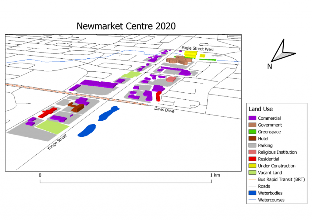
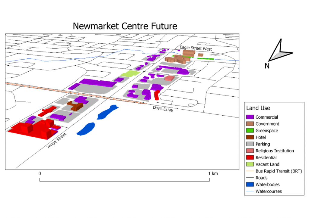
Newmarket Centre is not anticipated to see much change besides the completion of a government complex on Eagle Street West and a condo development at the northeast corner of Yonge Street and Davis Drive. While residents will be close to features within the condo complex, the outer neighbourhood amenities are spaced by parking lots and will require residents some time to access by car, bus service, and walking. With roads in Newmarket Centre originally designed for vehicles, residents will have to cross streets with high traffic volumes to access certain amenities (e.g. shopping, religious institutions). However, residents will have close access to the Davis Drive BRT line which provides service to the Newmarket GO Train Station east of this growth centre. A planned extension of the Yonge Street BRT up to Davis Drive should encourage more compact mixed-use development in this area, with the potential for more proximate amenities and more pedestrian and cyclist friendly streets as the centre intensifies.
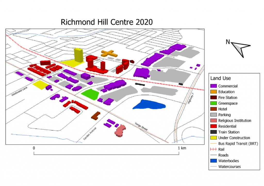
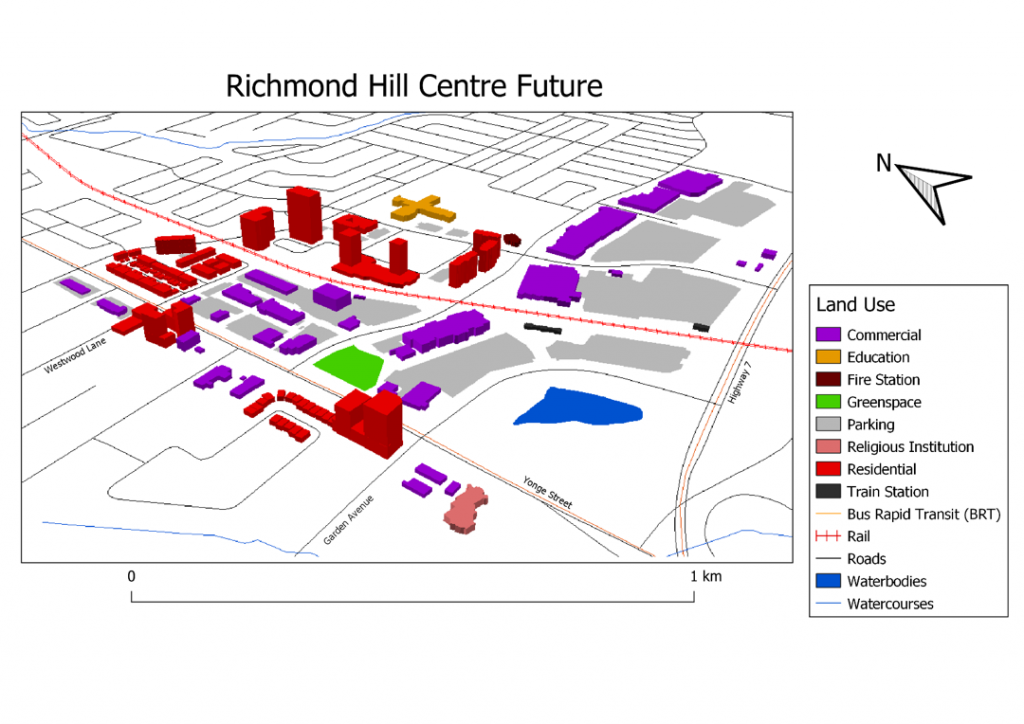
Richmond Hill Centre is poised to experience skyline changes with the completion of several developments, including Westwood Gardens on Yonge Street and Westwood Lane. Although residents living in these developments will need some time to access current amenities surrounded by parking lots, they will have convenient access to the Richmond Hill GO Transit Station and BRT lines on Yonge Street and Highway 7, each of which offers direct access to Toronto and surrounding municipalities. A planned TTC subway extension terminating at Yonge Street and Highway 7 will eventually offer residents additional transit accessibility and spur more mixed used development in this centre.
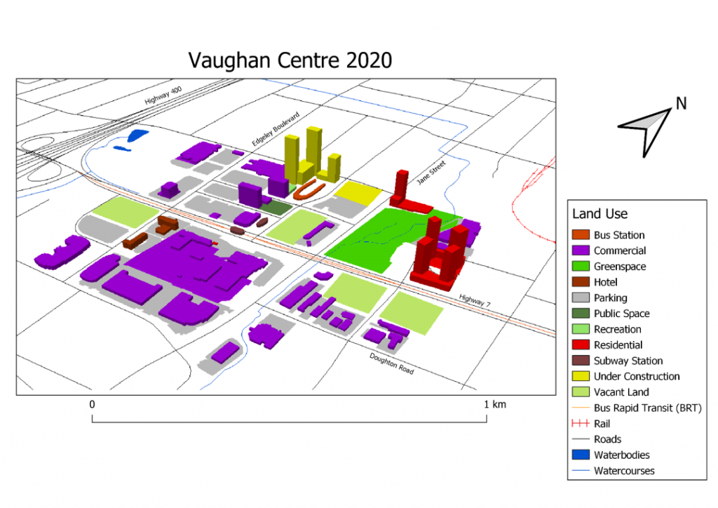
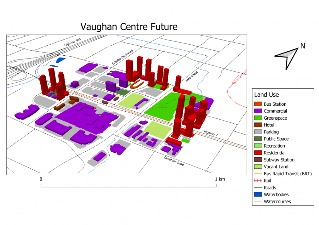
Vaughan Centre is expected to see significant land use change between now and the near future. Much can be attributed to the proximity of Highway 400, the Highway 7 BRT and the Vaughan Metropolitan Centre subway station. Several mixed-use developments are poised to rise in the area, ranging from Transit City Condos near the Viva bus station to Festival Condos on Highway 7 and Edgeley Boulevard. However, such changes are not without their challenges. For instance, the subway stations will offer convenience for area residents but also contribute to overcrowding on the western portion of Line 1 heading to downtown Toronto. Fortunately, there are plans for a subway extension running up Yonge Street to Richmond Hill, which can be accessed from Vaughan Centre via the Highway 7 BRT. Vaughan commuters can use the eastern section of Line 1 to get to work while alleviating crowding for other commuters using the western section of the line.
The next article in this series will concentrate on the land use changes occurring in growth centres in Durham Region.


Hi Jonathan – Interesting! For your series, what is your definition of “near future”?
Hi T Ferus,
My definition of the near future is about 3-5 years from now based on construction projects that are under construction, currently in sales, and have be approved by respective municipalities.