Your Canadian Geospatial Briefing for June 11th: SensorUp; Big Data Toronto; Drone Delivery Canada; Canada Forum on Geospatial Standards; MDA; Smart City Support Program
Drone Delivery Canada chosen for Beyond Visual Line-of-Sight Pilot Project 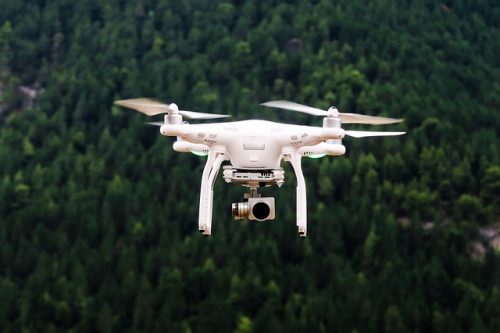
Drone Delivery Canada has been selected to participate in Transport Canada’s Beyond Visual Line-of-Sight Pilot Project. The Pilot Project will further the DDC’s capabilities in Moosonee and Moose Cree First Nation communities in Northern Ontario, as well as advancing its Beyond Visual Line-of-Sight (“BVLOS”) capabilities in Canada. The project will utilize DDC’s FLYTE management system, DroneSpot technology and its Sparrow X1000 delivery drone, and provide innovative new delivery services to meet the needs of remote Northern communities.
Canadian geospatial company SensorUp raises $2M to expand IoT business solutions
SensorUp is a leading Internet of Things (IoT) geolocation company that has just raised the seed funding to accelerate their SensorThings Cloud service and create new IoT solutions for smart cities, emergency responders, and field service. SensorUp is in a position to become the platform of choice for geospatial customers like Lockheed Martin, the American Department of Homeland Security, and Natural Resources Canada. The $2M funding confirms the company’s leading advantage in analytics and IoT data.
OGC announces creation of regional Canada Forum on Geospatial Standards
The Open Geospatial Consortium (OGC) has created the first-ever Canadian forum with the goal to better fulfill the needs of Canadian geospatial data and services. The Canada Forum will also help improve the level of Canadian influence in the OGC geospatial standards process and provide a collaborative environment for Canadian stakeholders—the first formal venue for this purpose.
Charter members of the Canadian Forum on Geospatial Standards include the Computer Research Institute of Montreal (CRIM), ESRI Canada Ltd., Mount Royal University, Natural Resources Canada (NRCan), and Global Grid Systems, among others.
Government of Canada launches the Smart City support program 
On June 7th the Minister of Infrastructure and Communities launched an open call for proposals from not-for-profit organizations eager to deliver the new Smart Cities Community Support Program. The goal of the program is to help Canadian communities navigate the evolving smart cities landscape by engaging residents, encouraging innovation, and providing support to communities through the 2018 Smart Cities Challenge. According to Minister Sohi: “This open and competitive callout provides a unique opportunity for organizations to support the drive to a culture of change, continuous improvement and innovation in communities across Canada.”
MDA receives over $4 million in contracts for Canadian space activities
MDA has been awarded five Space Technology Development Program awards from the Canadian Space Agency. The contracts will allow MDA to continue development of robotics for deep space exploration, space debris removal and satellite antenna advancements. MDA is currently completing development of the RADARSAT Constellation Mission for the Canadian Space Agency, which includes three satellites for maritime surveillance, ecosystems and agriculture monitoring, and climate change data collection.
Big Data Toronto spotlights Canadian data and AI talent

Image by CNW Group/Big Data Toronto
The 3rd edition of The Big Data and AI Toronto Conference and Expo upped its size and scope this year with 4500 participants and 100 speakers, including innovators from Reddit, Uber, Mercedes-Benz, Sidewalk Labs, Shopify, Twitter, Yelp, and Toronto game-changers such as Coinsquare and Layer6. The conference brings Canada’s leaders in Big Data together for two days of education, networking, and product demonstrations designed to help companies take advantage of big data analytics—which can boost their operating margins by more than 60%.