Your Canadian Geospatial Briefing for June 3rd: Mapbox; Location Tech myths; Maxar; Apple Maps; UrtheCast
Mapbox joins GeoIgnite 2019 
GeoIgnite has a new platinum sponsor! Location data platform Mapbox is joining the top decision makers and innovators from technology, government and academia in discussing the current and future of Canada’s location tech sector in Ottawa this June. Mapbox boasts open source technology as one of its core components by working with open data communities like OpenAddresses and OpenStreetMap, and it will be bringing that spirit of collaboration and accessible tech to GeoIgnite. We are thrilled to have their support, and their vision for an automated, connected future at our Ottawa conference!
Top 5 location tech myths
What is location technology? Myths and assumptions abound: some say it’s limited to technology like GIS and mapping software, or analysis of spatial data. Others regard it as a business concept used to improve performance through better spatial awareness. Matthew Lewin at Geospatial World outlines the five most common myths about location technology:
- It’s just GIS rebranded
- It’s not a organizational capability
- It’s just analytics with maps
- It’s only for specialists, and
- It’s not strategic
Maxar to work on Lunar Gateway power and propulsion 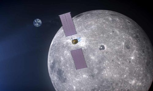
Maxar has won the $375m contract to build the Luar Gateway space station’s power and propulsion element. The Lunar Gateway station will be the dock for astronauts arriving from Earth in the Orion crew capsule. It will orbit the moon and double as a research outpost for astronauts who are not moonwalkers. A company best known for communications satellites, Maxar will be working with Blue Origin and Draper to deliver the spacecraft; the power and propulsion element is scheduled to launch in late 2020. The PPE will power a utilization module which is still to be contracted, as is the lunar lander.
Apple Maps takes Canada
Apple Maps is on the road, surveying Canada. Branded vehicles will be driving across the 10 provinces between May and November, missing the sparsely populated northern territories of Yukon, Northwest Territories, and Nunavut. The data collection is part of Apple’s efforts to rebuild the Apple Maps service, which also includes maps of parts of the United States, United Kingdom, Ireland, Italy, France, Spain, Sweden, Slovenia, Portugal, Croatia, Japan, Andorra, and Puerto Rico. Industry onlookers have speculated that the spatial data could also be leading to the development of a self-driving technology or an Apple version of Street View, though no confirmation had been announced for either project. Apple said in an official statement, “Beginning in May, Apple Maps will be driving across Canada throughout the summer. We’ll be capturing road details, signage and landmarks — all to make the most accurate and useful Maps experience possible.
UrtheCast lands contract with CSA
Urthecast has announced that it will receive the $2.0m contract with the Canadian Space Agency’s Space Technology Development Program. The agreements are for the development of new satellite technologies: the first, “Automated Calibration and Validation of Optical Satellite Constellations,” will create ground-breaking technologies for the UrtheDaily Constellation, while the second, “A Novel Self-Cueing TCPED Cycle for High Resolution Wide Swath SAR Imaging,” will support the next generation UrtheCast SAR-XL Synthetic Aperture Radar. UrtheCast’s CEO Don Osborne said, “We are extremely proud that the CSA has selected our innovative technology proposals through the highly competitive STDP program. This validation of our technology speaks to the Government of Canada’s continued, active interest in our technologies and programs.”