Your International Geospatial Briefing for September 23rd: Geomatics institute in Zimbabwe engages youth in the field; Typography as a platform for smart cities and design; Research Project aims to build geospatial AI for landform detection
Geomatics institute in Zimbabwe engages youth in the field
The president of the Zimbabwe Institute of Geomatics (ZIG) has recently stated in an interview that “the country has many professionals in the sector who are based all over the world and whose skills and exposure could benefit [Zimbabwe]”.
ZIG established Geo-Chat, a platform that is coordinated by their Geomatics Youth Network. This platform allows quick and easy interaction between foreign based specialist and experts in the field, and local professionals and students.
The ZIG membership is currently over 400 individuals.
Geomatics institute engages diaspora based professionals
Typography as a platform for smart cities and design
The Netherlands is currently list as one of the top ten functioning economies with many spatial policies in plan. There is currently a lot of work on creating a Digital Environmental and Spatial Act. This act, along with other policies, float on key registries. One of those is Large-Scale Topography (BGT).
The goal for the topicality of BGT is 6months for roads and buildings, and 18months for rural areas. This goal does however come with its own set of challenges; “When more than 10% of your data has changed, the current situation is usually alright. However, if you see a totally different number come up, it’s advisable to check internally whether that figure is correct. There may of course have been major changes to the map, but it may also be that changes have not been passed on properly or might not have been passed on at all.”
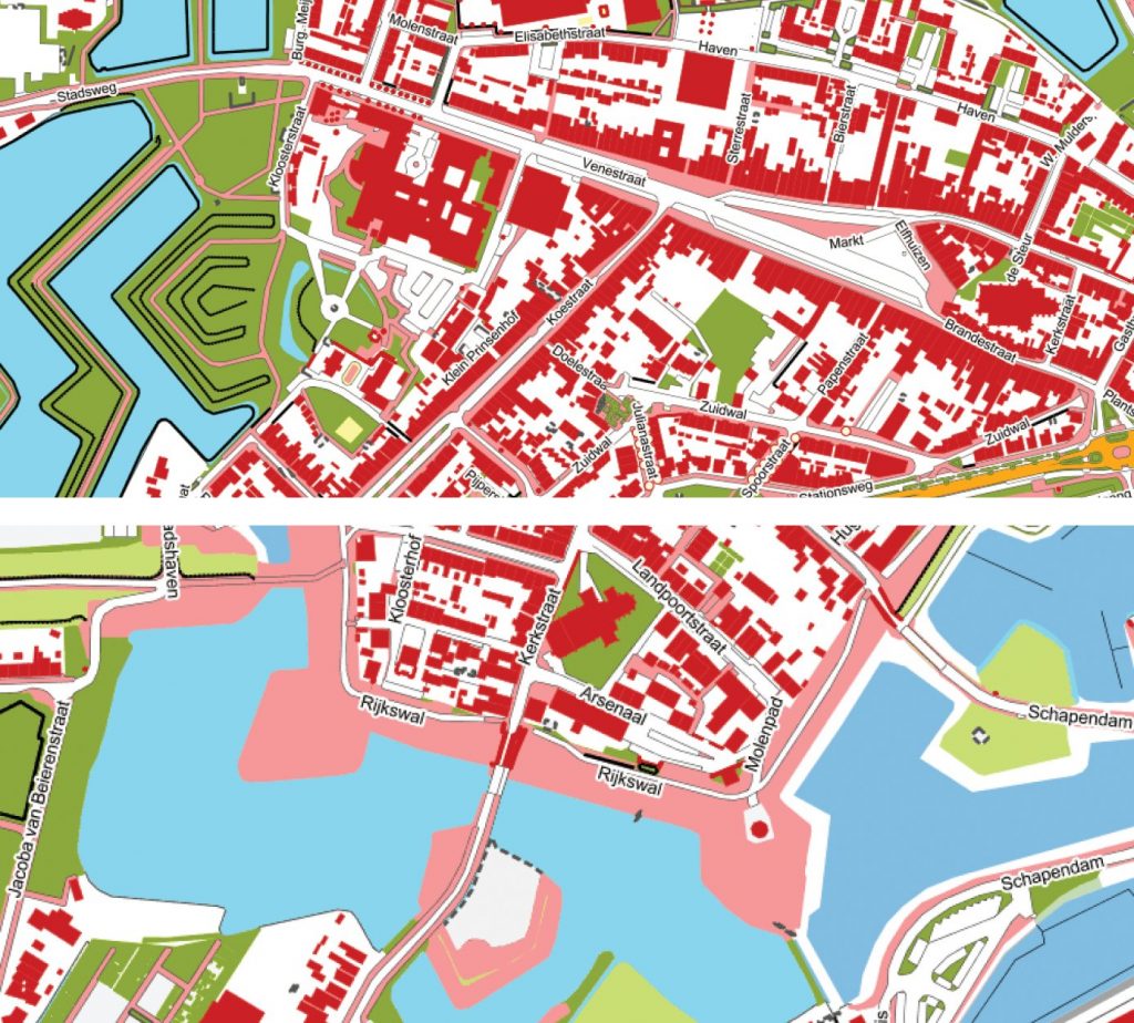
Although the Netherlands have a large quantity of geospatial data of high quality available (like BGT). Companies are seeing the added value one can already create with the implementation of a simple 3D viewer and a 3D planning function. Rick Klooster, Founder and CCO of Future Insight said it best; ““Our viewer is constantly evolving. New examples are constantly being added. The list of applications is endless. Consider, for example, the use of 3D for the environmental law, the energy transition and climate adaptation”.
Topography as a platform for smart cities and design
Research Project aims to build geospatial AI for landform detection
With so many tools at our fingertips to allow us to see the world we live in, it is difficult to believe that there are still part of the world that remain undiscovered. An associate professor from the School of Geographical Sciences and Urban Planning began a new project wanting to use AI to learn more about the world we live in.
Wenwen Li, the associate professor from the School of Geographical Sciences stated; “Today, geospatial data, such as remote sensing imagery, streaming data from internet of things devices, GPS traces from mobile sensors are proliferating. These rapidly exploding data pose significant challenges for traditional analytical tools which were designed in handling ‘small’ and ‘good’ data. GeoAI sheds a light on providing a novel data-driven, theory-free way to mine and discover hidden patterns and knowledge from these data.”
This very important project was recently selected for funding through the National Science Foundation.
Research project aims to build geospatial artificial intelligence for landform detection