
What is the first thing you do when you get to a ski resort? Usually, it would be to grab a printout trail map to be able to spatially orient yourself and to know which trails to take in order to not end up in a hospital. In a world where paper maps seem to be a bygone era and spatial navigation is completely digital, why do you still have the affinity towards grabbing a paper trail map that you have to dig out of your pocket and comb through to locate yourself on?
The world of GIS has already provided a multitude of mobile and web options to be able to seamlessly navigate yourself across any mountain you find yourself on, whether it be open source or a paid option. GIS also plays a role within the safety of your skiing excursions in a way you may not have thought of. This is the ski bum’s guide to GIS and how you can even contribute to the world of it to make it even easier for your fellow skiers to navigate their slopes with ease!
SkiLynx – For Families or groups of friends – Mobile
Are you tired of wondering where your friends or your kids are on the mountain? Or you’re constantly playing phone tag with them to meetup? With SkiLynx it provides you with real-time location tracking of your friends or family members on the mountain. If you need to see exactly what run or lift each person in your group is on or riding, you can just check the app to see where they are at all times or how far down the run they’ve made it!
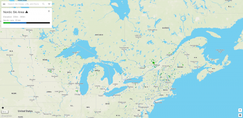
OpenSnowMap / OpenSkiMap / OpenStreetMap – For people who want to get involved in the world of GIS or explore – Desktop or Mobile
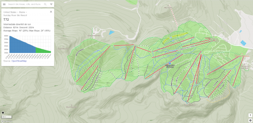
This online web map is completely free of charge comparative other mobile or web applications and you can even contribute to the project and add your local mountain no matter how small! With this crowdsourced web mapping application, you’re able to add or edit features and attribute data about the mountain. For example – the level of difficulty of the runs, green, blue or black, the vertical elevation, the number of chairlifts etc. Think of this web mapping application as the Wikipedia of ski maps that you can use to locate yourself while skiing with data that you potentially created yourself! Open-ski map also uses another open-source product in Mapbox and their JavaScript libraries are used to be able to display the on-click attribute data of the mountain like in Figure 2.
Fatmap – For the Adventure Seekers and planners – Web and Mobile
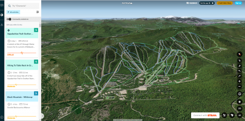
Fatmap is a unique entry into this list in terms of GIS with its 3D web and mobile mapping application. It provides you with tiled high-resolution satellite imagery and the ability to plan unconventional routes in advance. It allows you to navigate these routes on an interactive 3D map, something a paper map for sure can’t do! You’re also able to download these maps offline and access them wherever and whenever you need them and can even see the 3D dimensional shapes of runs, dips, twists and turns. Ski Trail information from Fatmap is provided from OpenStreetMap so the data that you edit can be viewed from this 3D mapping application!
GIS as a safety tool for skiers and rescuers.
If you’re ever caught out down an unfamiliar path or take a wrong turn, GIS can play an important role within your safety. For example, if you make a phone call for help, a GIS analyst can pinpoint your location using latitude and longitude coordinates. Once rescuers can determine your position – a GIS analyst can also track the locations of the rescue team using ArcGIS Tracking Analyst and can give them real time updates of their position and possible difficult terrain that they can circumvent or bypass in order to get to the person in distress faster.
So the next time you’re planning a ski adventure, think twice about picking up a paper map and consider downloading a GIS-based app, using a web application or even contributing to OpenSkiMap for your own personal GIS-based adventure!


Be the first to comment