
The GIS market has grown in size every year for the past decade. With a current capitalization of over USD 8 billion, the industry is expected to reach USD 14.5 billion by 2025. This is facilitated by increasing urbanization, development of smart city technologies, cloud services evolution, business intelligence advancement, and dozens of other factors.
Geographic Information Systems in Canada
Just like GIS is thriving worldwide, it thrives in Canada. Local governments are actively using geography-based information to maintain services like public works, safety, strategic planning, and other municipal-related fields. Most local governments in Canada have their own GIS departments, which in many cases are developing unique GIS applications and collecting data independently.
Though GIS solutions are often used for governmental purposes in Canada, that doesn’t mean that businesses and non-profit organizations aren’t benefiting from it. The market is full of solutions that offer all sorts of GIS assistance, from implementation to configuration. However, the industry’s development isn’t going as smoothly as expected. It’s fair to say that the industry is encountering significant challenges that it can’t afford to ignore.
Challenges to solve
According to a survey conducted by Aspectum, the biggest issues plaguing the GIS community are the overcomplexity of GIS tools, poor data quality and accuracy, lack of coding skills that are often required for data management, and data compatibility restrictions.
The overly complex nature of GIS software makes it challenging to master all of their vast functions, even for professionals who spend years working with the same software – and the learning curve for beginners is immense. This problem is aggravated by coding skill restrictions. Many GIS platforms require users to know at least the basics of Python or other programming languages to conduct data analytics. GIS users also encounter dataset compatibility issues when working on their projects. It is not always clear which format of data to use with your GIS in order to run it seamlessly.
Solving these issues became a cornerstone for the Aspectum development team when creating a next-generation GIS platform to satisfy the industry’s desire for change. The California-based company specializes in geospatial business solutions, interactive map development, and data visualization for both profit and non-profit purposes. Aspectum partners with leading companies across industries in North America and Europe to apply their best GIS practices for enhanced mapping and data analytics worldwide. So what exactly does Aspectum brings to the table?

Aspectum GIS in use
Aspectum is easy to start, requires no pre-installation or coding skills to use, has a wide range of free tools, supports widgets, has a user-friendly interface, offers decent-resolution satellite imagery, supports in-house OSM dataset search engine, carries powerful 3D data visualization, and provides convenient multi-format data sharing. But those are just pleasant additions to what Aspectum is really capable of. Let’s review some of its implementations.
- Business development. This includes a wide range of activities from transportation logistics optimization and object recognition to assessing supply/demand ratios to retail chains analytics. For instance, using satellite and spatial data, traders can compare data from various periods to estimate tanker load and predict oil prices. In turn, investors can have an upper hand in stock market operations from analyzing data like parking lot traffic or manufacturing capacity to have a hint of a company’s performance before any official statements are released.
- Retail store mapping. To control and track processes around retail stores, Aspectum helps map deliveries, customer behaviors, finding optimal locations for new stores, analyze competitors, optimize supply chains, and locate problem spots before they can do significant harm, all in one big comprehensive picture.
- Human mobility tracking and demographic analytics. Demography is key to understanding buying behaviors, finding additional marketing insights, or studying social dynamics. Demographic analytics can evaluate customers’ numbers, their cultural and religious affiliation, age, level of income, education, buying activity, etc. This information can be used to infer their needs to, say, design better ad campaigns. Human mobility, in turn, can point out certain social patterns. For instance, Aspectum recently partnered with Predicio to research the spread of the COVID-19 disease in Paris by relying on human mobility data. This helped build infection spread patterns.
- Commercial real estate analytics. Aspectum is capable of using location technology to assess local parameters that affect quality of life and real estate prices. This includes average distance to closest recreational and infrastructural objects, air and noise pollution levels, crime rates, cultural influence parameters, and many other sources of data for real estate agents to benefit from.
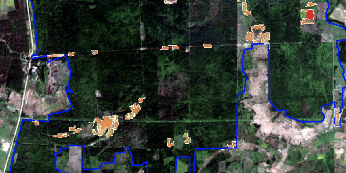
- Environmental impact and change detection. Climate change and nature conservation are two major concerns that GIS can assist with. Assessing environmental impacts means estimating how current or future projects such as construction works will affect the surrounding nature, groundwaters, pollution levels, etc. Sometimes this overlaps with change detection technology which tracks Earth’s surface changes over time by analyzing satellite images. Change detection allows us to see a greater picture to measure deforestation, urban growth, pollution, assess natural disasters impact, glaciers meltdown, and many other non-obvious processes.
- Public safety. Aspectum can greatly contribute to public safety efforts too with its data analytics. This includes but not limited to disaster mapping, crime rate and social unrest monitoring, epidemics spread mapping, and so on. Mapping environmental, natural, or economic crises helps to evaluate damage inflicted, plan rescue operations, and create a more effective emergency response to floodings, wildfires, earthquakes, industrial disasters, etc. During the current pandemic, Aspectum tracked the coronavirus infection spread throughout the U.S., hospital capacity, and other healthcare system data. Once vaccines are available, it could track vaccination progress.
To use or not to use
The presence of GIS technologies is constantly expanding and intertwining with a wider range of industries. Therefore, it’s only a matter of time before GIS finds an application in your business. The list of fields of use for spatial data analytics in Aspectum goes on and on, but let’s just conclude with the benefits an average user will appreciate.
Aspectum is friendly to non-professional users since it requires no coding skills in most cases and features an intuitive user interface. The platform is cloud-based, meaning it does not require installation or any computing power from your device. And finally, there are multiple subscription plans to fit any budget, including completely free basic features. To find out more about the platform and try some of its functions, visit aspectum.com


Be the first to comment