
GoGeomatics Canada
GoGeomatics Canada’s Online Magazine is your source for the latest news in the Canadian geomatics sector. We publish articles about technology, projects, events, Canadian companies, and interviews with industry leaders. To submit an article to the GoGeomatics Magazine, please email your pitch to info@gogeomatics.ca.
Articles by GoGeomatics Canada

International Geospatial Briefing for Sept 28: Chinese launch failure; HERE Data access; Free Aerial Imagery basemap of New Zealand; SpaceX internet 700 satellites; GIS is powering solutions; Teaching disaster management through GIS games
China’s launch of new satellite fails Jilin-1 Gaofen 02C, the new Chinese satellite failed to enter the preset orbit on…

Geospatial Certifications Survey: GIS, Remote Sensing, Surveying, and Geomatics
GoGeomatics is hosting a survey to ask your opinion on the different certifications available. GoGeomatics is hosting two live events…

Your Canadian Geospatial Briefing for Sept 22: First woman to head CSA; Polar Bears’ GPS Collars Reveal Hidden Histories; Data Crisis in Covid-19; What Would The Impact of the Beirut Explosion Look Like on Maps of Canadian Cities; Should You Get a GIS Certification?
Lisa Campbell becomes the first woman to head the Canadian Space Agency – CBC The Government of Canada announced earlier…

Your International Geospatial Briefing for September 14th: Where the GISP’s are; China’s new Earth Observation Sattelite; COVID-19 push to aerial surveying; Interdisciplinary data-driven approach; Interactive historic map that shows your hometown’s location 750 million years ago
A Look at where the GISPs are Dr Dapeng Li, an assistant professor at South Dakota State University, and a…

Introducing New GoGeomatics Online Community Managers : Tanya, Celso, Paul, Rosette and Elizabeth
GoGeomatics Canada is over 7000+ subscribers strong with over 1,000 published articles. Our community managers are passionate and committed to…

Your Canadian Geospatial Briefing for September 7th: UofC’s research on glacial lakes; Canadian youth in space sector; Remote Sensing reasons out orange dusting in N.W.T; USask’s AI contribution to agriculture; Calgary woman’s Park story map
Dramatic growth reported in glacial lakes – A study by University of Calgary Dr. Dan Shugar, an associate professor at…
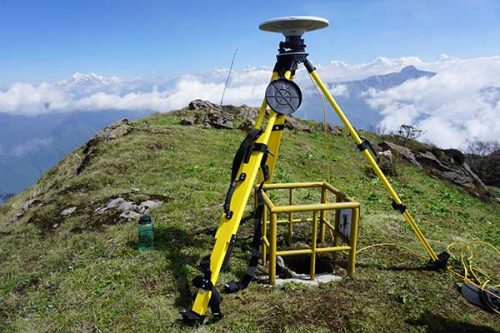
Your International Geospatial Briefing for August 31st: Trimble and Totalmobile Awarded HS2; Everest survey succeeds; Underwater heat blob growing in the Arctic; China Launches Beidou; Amazonian Tribe Applies Location Intelligence
Trimble and Totalmobile Awarded HS2 Contract from Civil Engineering Contractor EKFB Trimble and Totalmobile have developed the first cloud-based vehicle…

Your Canadian Geospatial Briefing for August 24th: Tracking Canadian migratory birds; New platform to give a voice to minorities; Before and After of Rocky Mountain; Aquaculture Company goes paperless with Survey123; New Canada-wide COVID-19 data project; GeoVerra, a new Canadian geomatics firm
Migrating breeding populations of Canada warbler clogged by geolocators To determine migratory routes of multiple breeding populations of Canada Warblers,…
Your International Geospatial Briefing for August 17th: NZ Government investment in agritech; AWS unveils new space business segment; Measure local parks using geospatial data; Amazon rainforest cleared in July in Brazil; ESAIL Maritime Sat ready for launch
Government to invest $11.4 million in agricultural technology The New Zealand government undertakes investment in developing the country’s agritech sector,…
Your Canadian Geospatial Briefing for August 10th: Initiatives help youth address climate change; Mapping mask-mandatory businesses; Vancouver Island First Nations roll out tsunami mapping; COVID-19 mapping resource
Groundbreaking initiatives help Canadian youth address climate change Two Canadian charities are taking a stand and inspiring action against climate…
Your International Geospatial Briefing for July 20th: Penn State with new online master’s degree; Virtual wall for concrete wall; New book in archaeology and GIS; Mapping tar when recycling asphalt
New online master’s degree in spatial data science Pennsylvania State University has launched a new online master’s degree in spatial…

The Exciting Geospatial Leadership Panels for GeoIgnite 2020 July 22-24th
Registration for GeoIgnite closes July 20th so claim your ticket now. This year’s GeoIgnite features two panel discussions on key…
