
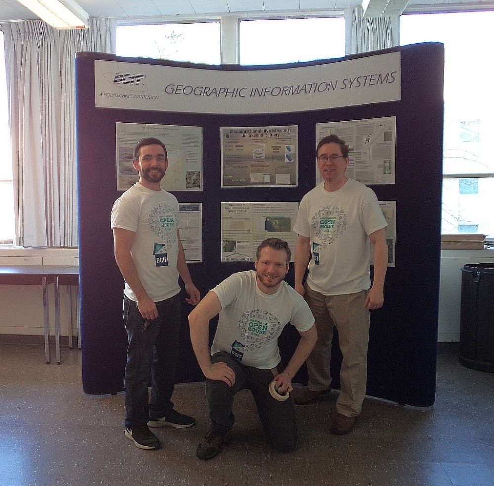
 The BCIT GIS department has been graduating students for 25+ years. Our students come from BC, but as well, across Canada and international. Our program is known to be very demanding, and creates students that can think through their spatial problems, manage their time, speak in public, and work together in group environments. The BCIT GIS program uses Esri software, together with PCI, AutoCAD, and other closed source software, but also teaches the use of open source software such as MapServer, QGIS, OpenLayers and more. The students that have graduated have moved from entry level GIS technicians up to GIS managers. Municipalities, private companies, as well as the software providers, like Esri have all hired our graduates. We have a large cadre of graduates over the 25 years that work here in BC and also span the globe.
 The current year of BCIT GIS students will be starting classes this September. Part of their course load is to locate a sponsor (a company or government agency), who will undertake either a project or practicum with the student in the January – May/June 2017 time-frame. I am contacting you, to see if you would consider having a BCIT student undertake either a project or a practicum with you. We would like to have the students assigned to a sponsor by the end of October at the latest.
A BCIT GIS Practicum or Project offers a valuable opportunity for sponsors to play a role in GIS technology education while benefiting from the student’s knowledge and skills. There is no cost to the sponsor for a GIS Practicum or Project. Liability for students will be covered under the Institute’s Coverage For Students On Approved Industry Project Practicums.
Here is the link to the Project / Practicum PDFs that have the application form on the last page.
https://rho.athena.bcit.ca/wp/index.php/gis-student-projects-and-practicums/
Project vs. Practicum Overview
A practicum is suitable for a sponsor who has technical expertise and time sufficient to provide detailed work supervision for the work undertaken by the student. The practicum uses an employer/employee mentor relationship for a paradigm, with the student working in your office. Companies/agencies that have had students work in their office in production setting have included:
- Environment Canada: applying GIS to Watersheds, Sub-watersheds and Catchments in BC and Bi-national Basins,
- World Wildlife Fund Canada: performing day to day GIS tasks pertaining to various Marine and Freshwater projects,
- Township of Langley: applying GIS skills to tasks in a municipal setting, and
- Selwyn Chihong Mining Ltd: creation of 3D workspaces showing the progression of a mining property development.
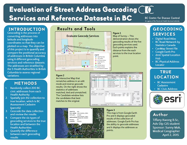
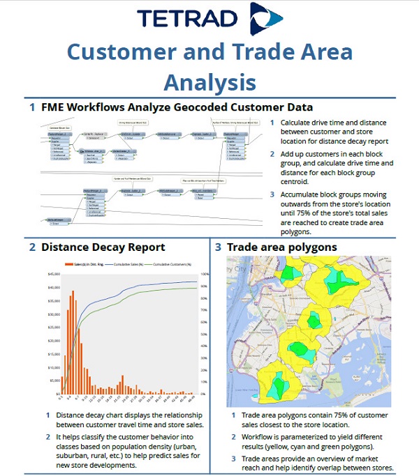
A project is a unit of work carried out independently by the student here at BCIT. The Project sponsor will approve the project, will be advised of the Project status on an ongoing basis, and will review the completed project. BCIT faculty provides technical direction and project supervision. Past projects have included:
- E-COMM 9-1-1: converting a situational awareness application from Flex API for ArcGIS to ArcGIS API for JavaScript,
- DGE 3DMM: develop a process to classify road conditions from LiDAR point clouds, and
- City of Kelowna: using LiDAR and building outlines, determine the solar potential of buildings.
Both models can be flexibly defined to achieve an optimal solution for the three stakeholders: BCIT faculty, students and sponsors. You may also find a great student that you would like to hire after they graduate!
Please do not hesitate to ask me any questions about the program. I hope we can have an opportunity to have a GIS student work with you.
Karl Kliparchuk, M.Sc.
BCIT GIS Program Head & Instructor
Room: SW3-2090
Tel. 604-432-8737
Twitter @bcit_gis


Be the first to comment