
The University of Calgary Geomatics Engineering Program and the SAIT Geomatics Program have come together to host two days of talks, discussions and research within the expo that will showcase the best from students, faculty and researchers.
Presentations & Discussions in the Expo
5 Years of Canada’s National Geomatics Competition
Since 2018, students from geomatics programs across Canada have been participating in the annual National Geomatics Competition. Now in it’s 5th year, the University of Sherbrooke will be hosting the next iteration in March. We invite you to participate in this discussion around the opportunity for industry and academia to meet at NGC 2024.
The Growing Need for Hands-on Education in Geomatics

Geomatics is growing technically and economically at a rapid pace. The need for skilled, knowledgeable workers is higher than ever. Some may argue that the technical advancements of the industry reduce the need for skilled workers and will remove the event of human errors. Others will argue that the very technology that is reducing human error can lead to increasing other errors and be a cause of delays on projects if the person operating the technology is not perceptive to the key elements of geomatics. Education plays a role in reducing on-the-job errors as well as reducing the risk of delays to projects.
University of Calgary Inaugural GIS Hackathon – Solutions from the Top Teams
The Geomatics Engineering Students’ Society at the University of Calgary proudly presents its inaugural GIS Hackathon for first-year engineering students. This unique event aims to stimulate innovation and creative problem-solving while also promoting geomatics education among first-year students. On the day of the competition, teams are presented with a problem of current societal relevance and challenged to create a solution using geospatial technologies in under 24 hours.
Geomatics Engineering Education and Research at the University of Calgary
Founded in 1979 to support the mapping and land surveying needs in Western Canada, the Department of Geomatics Engineering at the University of Calgary has been a renowned international leader for innovation in education and research over four decades of rapid technological advancements. The department has kept pace with its outstanding achievements during a multi-stage transformation of the geomatics industry that disrupted and shifted the focus from the traditional surveying and mapping methods of the 1970’s to the technological advancements in positioning and navigation systems, satellite and earth observation systems, web mapping systems, geospatial data science, and geospatial intelligence.
Presentations & Discussions in the Career Fair
Navigating the Future: Unlocking Opportunities in High-Demand Geomatics Careers
Discover the Department of Geomatics Engineering
The Schulich School of Engineering is a leader in engineering education and research innovation. We draw on our combined strengths in teaching and research to offer students rich and diverse learning experiences and create a dynamic research environment that encourages high-caliber research by world-class scholars.
GIS & Geospatial Job Seekers Career Talk
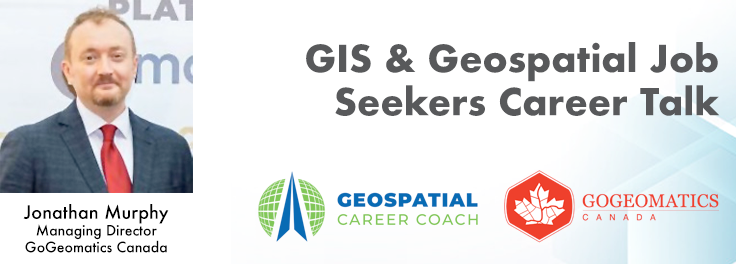
This talk focused on those seeking work in GIS, cartography, remote sensing, programming, and other related geospatial fields. Jonathan Murphy, Managing Director of GoGeomatics Canada and geospatial career coach, will be sharing his valued tips and insight for your job search. He is an expert geomatics professional with close to 20 years of experience. Jon’s career has ranged from the oil fields of Alberta to projects with the United Nations in Switzerland.
Discover the Surveying & GeoSpatial Program at Lethbridge College
Explore the high school requirements to enter a nationally and internationally accredited program in surveying and geospatial technology. Learn about the courses, timeline and costs of a two-year diploma and transfer to a degree. An overview of college student supports will be presented. Become familiar with the technology used in the program and industry. Hear about the career options and industry demand for graduates.
The SAIT Connector: Using the Power of Tech & Interdisciplinary Learning
The SAIT Connector is an active learning space for all apprentices and students at SAIT. It acts as a drop-in space and learning hub where students and faculty from any SAIT program can learn to apply high-tech equipment like drones, XR, 3D scanners, high-grade sensors, cameras and any other specialized equipment you may be interested in to solve problems and challenges. Thanks to industry partners, our collection of aerial and terrestrial data capture hardware along with advanced software platforms has greatly expanded over the past 12 months – all in-house and ready to use!
Discover the Department of Earth & Environmental Sciences at Mount Royal University
Environmental Science integrates our understanding of chemical, physical and biological processes to study natural and anthropogenic influenced environments, and provides solutions to environmental problems deemed significant to society. Discover the origin of mountain ranges, the evolution of life and climates through time, the formation of gems and ores, ocean floor volcanos, the assembly of continents, and the meaning of rock strata with a Bachelor Degree in Geology. The General Science major allows you the flexibility to choose the science courses that meet your specific needs and interests.
Discover the Geomatics Engineering Technology Diploma Program
Geodesy and geomatics engineers map the ocean floor, create 3D models and develop and test navigation systems to better understand the Earth. Our program features hands-on learning opportunities in geomatics and surveying.
Discover the Centre of Geographic Sciences (COGS) Programs
The Centre of Geographic Sciences (COGS), one of two locations that make up our Annapolis Valley Campus, is Canada’s largest geomatics-focused learning environment. COGS programs prepare you to start or continue your career in the global geomatics sector. At COGS, you’ll meet students from around the world learning about surveying and mapping land and the ocean floor.
Discover the Geomatics Engineering Technology Diploma Program
The Geomatics Engineering Technology program will provide you with extensive practical skills combined with a broad theoretical background to acquire tools and techniques used in land surveying, remote sensing, cartography, geographic information systems (GIS), global navigation satellite systems (GPS), photogrammetry, geography, and digital mapping.


Be the first to comment