
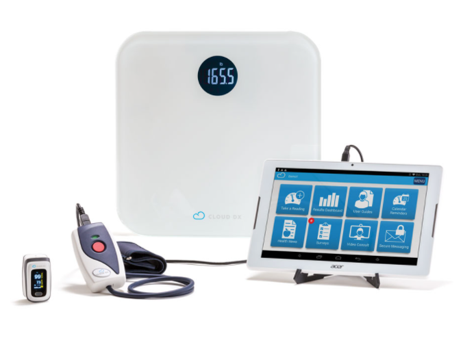
Cloud DX is Using a Virtual Care Platform to Help Patients Get Better Sooner
The Kitchener-based startup has partnered with Medtronic Canada ULC to deliver virtual healthcare across the country. Patients can leave hospitals with the wrong medication, while others recovering from surgery or chronic conditions need increased supervision. Cloud DX provides a remote monitoring platform called Connected Health, which will update doctors on their patient’s conditions. Heart rates, breathing, brain waves, blood sugar, oxygen levels, and more can be evaluated at home.
To find out more, click here.
How Sampling Mushkegowuk Peatlands Supports Indigenous Land Stewardship
Most of the stored carbon in Canada is actually underground: the Mapping Canada’s Carbon Landscape project uses a machine-learning algorithm to predict terrestrial carbon stocks across the country, and concluded that there is twice as much carbon stored in peatlands than in forests. WWF staff and partners from Mushkegowuk Council led carbon sampling projects throughout Mushkegowuk territory in order to provide a clearer picture of the carbon storage provided by peatlands. This research will support community efforts to steward the land and reinforce actions to meet Canada’s climate change commitments. The full story is here.
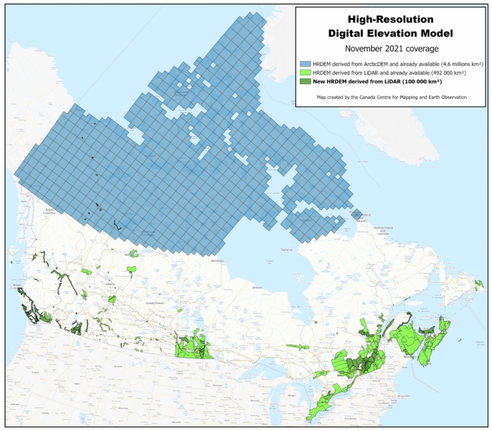
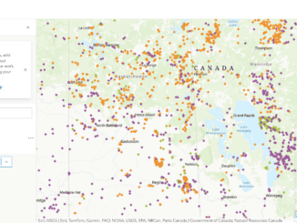
New High-Resolution Digital Elevation Model and Building Footprints Derived from LiDAR Data Available on Open Maps
Natural Resources Canada (NRCan) is pleased to announce the release of a range of new LiDAR-derived data on Open Maps – with data from numerous government organizations across the country.
More than 100,000 km2 of new High-Resolution Digital Elevation Models (HRDEM) have been added to the HRDEM and HRDEM Mosaic products. New data are located in the provinces of British Columbia, Manitoba, Ontario, Quebec, Prince Edward Island, and the Northwest Territories. The total coverage of LiDAR-derived HRDEM and HRDEM Mosaic data is now nearly 600,000 km2 and covers 84 of the 100 largest Canadian cities.
In addition, a new visualization tool for the HRDEM Mosaic product is now available and provides quick and easy access to the HRDEM Mosaic and all of its derived products. For more information on the HRDEM product, consult the product specifications or the download procedure. The HRDEM Mosaic product specifications are available here.
Google Maps Holiday Trends Worth Mulling Over
Google is taking a look at trends in Canada through Google Maps: the busiest times at popular places, transportation routes, and shopping trends are all under the microscope. This can help users skip the line, quickly locate stores, or find amenities in airports. Users can also look up popular dishes and cuisines. Hopefully, this type of information can help take the stress out of the holidays. Take a look at it here.
Giant Floor Map Gives Elementary Students a Look at Canada’s Pre-Colonial History
A giant floor map based on the Indigenous Peoples Atlas of Canada is helping elementary students in Vancouver learn about pre-colonial history.
The map, part of a national program created by the Royal Canadian Geographical Society in collaboration with Indigenous educators, has traveled to schools across the country giving teachers and students a chance to take a different look at Canada. The map, which measures 11 by eight metres and is loaned to educators two weeks at a time, details Indigenous communities across the country using their languages. Learning the history of where Indigenous peoples lived helps current processes of reconciliation, healing, and understanding.
Ottawa Maps Equitable Access to COVID-19 Vaccines for the Homebound
Delivering COVID-19 vaccines to the homebound is a complex operation that involves detailed coordination of people, transportation, and supplies. Due to the limited amount of time that vials can be out of freezers and with some homebound recipients living in rural and remote areas, it is critical to map out precise and optimal delivery routes.
To ensure access to the vaccines for the homebound in an organized and efficient way, Ottawa Public Health (OPH) and the Geospatial, Analytics, Technology, and Solutions (GATS) group collaborated to create a vaccine delivery program using Esri’s ArcGIS technology. The OPH team was able to increase efficiencies with booking and planning routes. Since the program started in February, just over 1,500 homebound clients have been vaccinated. Learn more here.
Release of the 2021 Atlas of Canada World Map
Produced by the Canada Centre for Mapping and Earth Observation (CCMEO), the 2021 World Map combines the latest scientific and geopolitical data with profound cartographic expertise, resulting in a modern, digital reference that is freely available for anyone to view and download.
The 2021 World Map represents the CCMEO’s commitment to demonstrating the social and economic value of geographic information. Significantly updated, the 2021 World Map features the most recent global geopolitical data, a clean new design, and a modern map projection that more accurately captures the perception and location of different continents. The colours and type used throughout the map were inspired by the look of aged paper maps and the printing technology of early Atlas of Canada folios. This version replaces NRCan’s 2005 map of the world.
The 2021 World Map is freely available for download through the Government of Canada’s portal for open geographic data and information, Open Maps.
Be the first to comment