
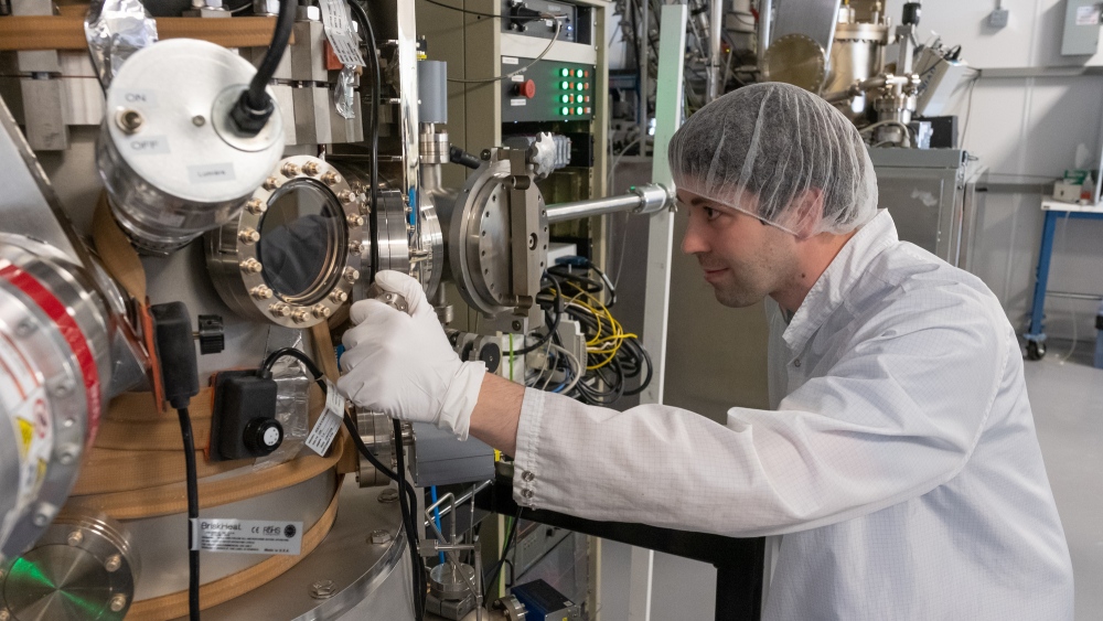
Archaeologist Brings 18th Century Fort to Life with LiDAR and 3D Modeling.
Dr. Jonathan Fowler, a Canadian archaeologist at Saint Mary’s University in Halifax is using historic maps combined with a modern terrain model of Fort Anne, Nova Scotia to bring back to life one of the oldest European settlements in North America. Golden Software’s Surfer surface mapping was used to create a 3D representation of Fort Anne using airborne LiDAR data. To create this 3D map, Dr. Jonathan Fowler first created a ‘bare earth’ terrain model that was used to display the topography of the area as it exists today removing any vegetation or buildings. Next, he overlaid digitized historic maps on the terrain model to create a 3D view of Fort Anne. Through this, Dr. Jonathan Fowler was able to create a model of Fort Anne just as it looked in 1706.
Fort Anne is Canada’s oldest National Historic Site. To learn more about Fort Anne click here.
To read more about Dr. Jonathan Fowler’s research, visit LinkedIn and Facebook.

Article can be viewed here
Self- driving shuttle bus coming to campus.
A research team of engineers at the University of Waterloo have spent the last four years working on the autonomous bus project called WATonoBus. This self driving bus will run as a shuttle and is expected to start operating once students return for in-person classes. The bus will initially have a driver on board to take control if required, however, the WATonoBus is already capable of merging into traffic, stopping at intersections and steering clear of pedestrians and cyclists. The autonomous bus project will be a free service that also includes an app that will provide the time of arrival at each stop on the route. This bus can drive itself by enabling instrumentation that include cameras on the front, back and sides, three LiDAR units and wireless communication systems. While this project is the first of its kind at a Canadian academic institution, Dr. Amir Khajepour, the research team lead says that this technology can be used for self driving shuttles at resorts, airports, on city bus routes, in mining and manufacturing, and anywhere vehicles have a fixed route.

Article can be viewed here
EagleView and Esri Canada Announce New Integration Within Cityworks Platform
This new integration allows users to view the high-resolution aerial imagery provided by EagleView directly in the Cityworks platform. This integration will save time and money by eliminating numerous field visits. EagleView uses oblique imagery at a 45-degree angle, to easily view assets in the field and assist with land management. This integration allows public works and asset management personnel to better collaborate with many departments in local government, such as engineering, fire, and parks and recreation.
Rick Sereda, Director of Public Services, in Leduc, AB, describes the benefits, “Functions such as remotely measuring roads, bridges and other key infrastructure will save time and money, and the additional capability available with oblique imagery will reveal greater detail of structures, traffic signals, fire hydrants, and other critical municipal infrastructure.”
Article can be viewed here
University of Sherbrooke receives more than $28 million for artificial intelligence research.
The University of Sherbrooke is receiving $28 million from The Canada Foundation for Innovation (CFI) to assist in artificial intelligence research. This funding will go towards acquiring specialized equipment that will be used in three projects. One of the projects that Dr. Rejean Fontaine at the Faculty of Engineering is working on aims to reduce the massive ecological footprint left by data transmission by distributing artificial intelligence in small objects. The funding will also go to the Multidisciplinary Observatory for Monitoring Climate Change and Extreme Events in the Arctic (OMCCA). Dr. Alexandre Langlois at the University of Sherbrooke’s Department of Applied Geomatics leads the project to research the reaction in the Arctic to climate change to improve humanity’s adaptation. Lastly, Dr. Jerome Claverie at the Faculty of Science will lead a project building a database on polymers at a level of detail not yet seen and developing new polymers by providing a research tool on polymers.
Article can be viewed here
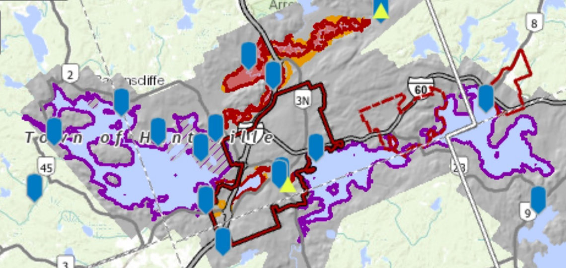
Real-time water levels now available on District web mapping portal.
As we move out of winter and into spring the risk of flooding increases as more severe weather, heavy rain and rapidly melting snow occurs. The District Municipality of Muskoka, Ontario wants to remind its residents to prepare for the 2021 spring thaw by having an emergency plan, putting together an emergency kit and monitoring water levels.
If you are seeking more information and resources on preparing for a flood visit muskoka.on.ca/flooding.
Monitoring water levels has been made much easier, as you can now monitor water levels and view flood plain maps in Muskoka in real-time by visiting Muskoka GeoHub. A new feature has been embedded in the GeoHub Floodline and LiDAR mapping application that allows you to view the water level stations to observe water levels in real-time. This information will be useful for the residents of Muskoka as it allows them to compare current water levels with the previous day to note any changes.
The district of Muskoka has also launched a few how-to videos for how to access and interpret the real-time water levels. That can be accessed here: muskoka.on.ca/gis.
Article can be viewed here
Whole new agricultural revolution beckons best, brightest minds.
Dr. Claude D. Caldwell, a professor in the Faculty of Agriculture at Dalhousie University illustrates the need for new approaches when it comes to “how we produce, distribute, and utilize agricultural products”.
Dr. Claude D. Caldwell lists our current critical challenges in global agriculture,
- “Increasing demand for food. By 2050, world population will reach nine billion. This growth is further exacerbated by changes in consumption trends; worldwide, there is an increasing demand for meat and animal protein.”
- “Weather chaos due to climate change. Fossil energy use, much of it in the role of producing food and fibre, has caused an imbalance in CO2, CH4, and N2O, the impacts of which we are feeling all over the globe.”
- “Decreasing quality and quantity of fresh water. Fresh water (potable and usable water) accounts for less than 0.02 per cent of the total amount of water on Earth. Recent human activity, much of it aligned to agricultural production, has deteriorated water quality and quantity, leading to widespread water insecurity.”
- “Human livelihood disruption. We are experiencing continuing societal shifts towards business and capital. Financial return takes priority over human livelihood. This tends to degrade the natural ecosystem, and also erodes humanity’s potential to achieve global peace and harmony.”
Dr. Claude D. Caldwell stresses that innovative strategies to these challenges will result in a positive future and that “a re-imagined, sustainable agriculture and food system would be the catalyst for success in all four areas.” These innovative strategies consist of,
- “We need a new truly “green” Green Revolution in agriculture that can quickly respond to the requirement for doubling of available food by 2050.”
- “This must be a climate-smart food production strategy that can increase available food while lowering GHG emissions.”
- “Changes will include a water-adapted agricultural model that can produce food with extreme efficiency of water use, and greatly decrease degradation of our freshwater resource.”
- “Another key will be ecology-oriented, co-ordinated value-chain development that can enhance productivity, decrease waste, and provide meaningful employment.”

Article can be viewed here


Be the first to comment