
Satellite mapping finds correlation between B.C. wildfires and floods
Data scientists at SparkGeo, a geospatial company based in Prince George, BC, produced a series of maps to point out 2021 wildfires and damaged highways by November floods. Check out the maps on the Sparkgeo Wildfires and flood damage Story Map
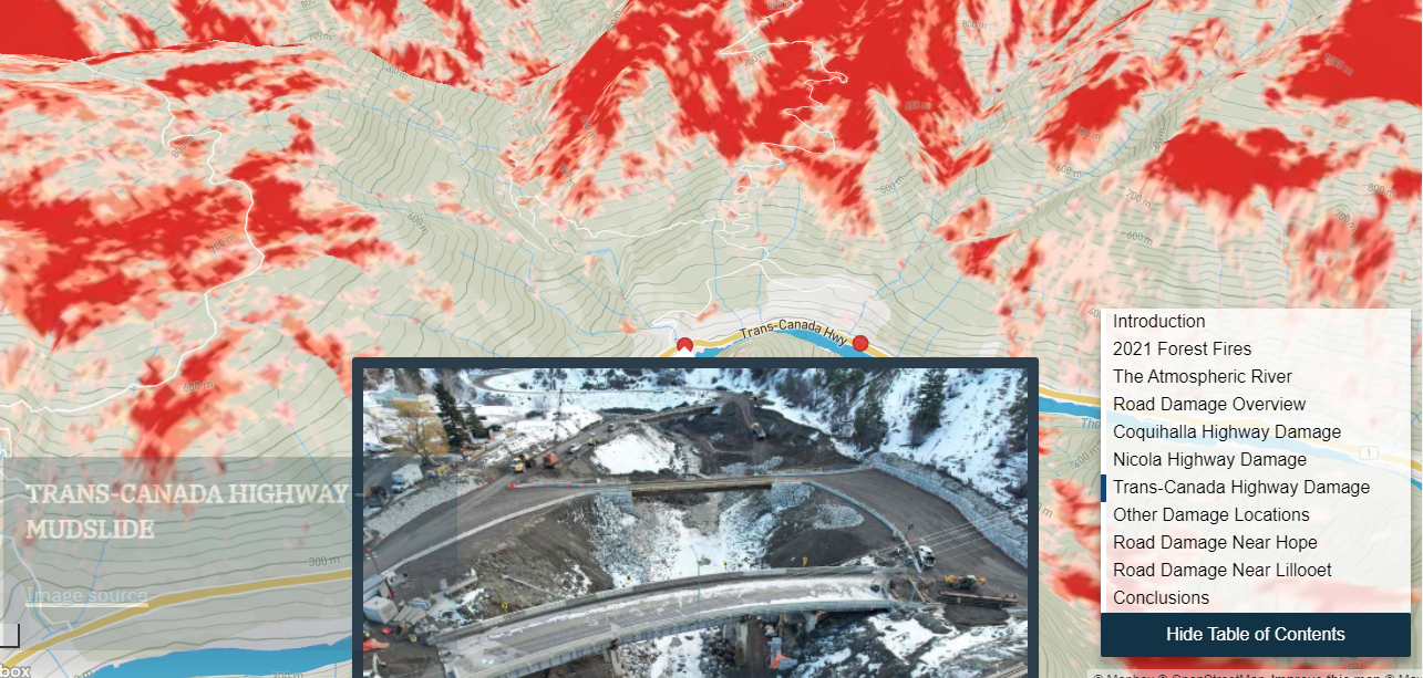
These maps helped SparkGeo team to find a likely correlation between the wildfires in 2021 and the November flood damage. They also believe that more analysis is required to definitively demonstrate the wildfire impact on the costliest flood damage in the province’s history. Read more about this story here
Esri Canada releases free app to help municipalities get ready for NG9-1-1
NG9-1-1 GIS Validator application has been released on May 10th by Esri Canada. This free online application helps Canadian municipalities complete the 9-1-1 new location data requirements in Canada. In other words, The NG9-1-1 GIS Validator is used to compare location and geographic information system data against the nationally adopted standards for next-generation 9-1-1 to efficiently determine data for revision.

This application is created due to the Canadian municipalities’ demand in the Emergency Services Working Group. Read more details about this free app here.
How Natural Resources Canada migrated petabytes of geospatial data to the cloud
Canada Centre for Mapping and Earth Observation (CCMEO) at Natural Resources Canada (NRCan) has got an Earth observation data archive exceeding two petabytes since 1971. Now, NRCan has four satellite antennas in Inuvik, Prince Albert, and Gatineau and, the Earth Observation Data Management System and Emergency Geomatics Service. NRCan has decided to use Amazon Web Services to respond to clients’ requests faster and in an efficient way. The geospatial data migration to the cloud has been possible using Amazon Web Services Snow Family
More information is available here
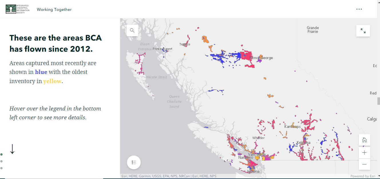
Aerial Imagery Cost-Sharing Program 2022
The RCMP trials using satellite and hyperspectral aerial imaging to locate remains of missing persons
For the first time, the RCMP’s National Centre for Missing Persons and Unidentified Remains is using satellite and hyperspectral imaging technologies to help find human remains. These imaging technologies gather and analyze data from across the electromagnetic spectrum from reflected sunlight, getting information that is not visible to the human eye. These technologies help identify places, where human remains, may have been discarded, partially buried or hidden in shallow graves.
In the week of May 9, The pilot has begun with an aircraft that covers two areas in British Columbia. Read more information on the RCMP website and CTV News


Be the first to comment