
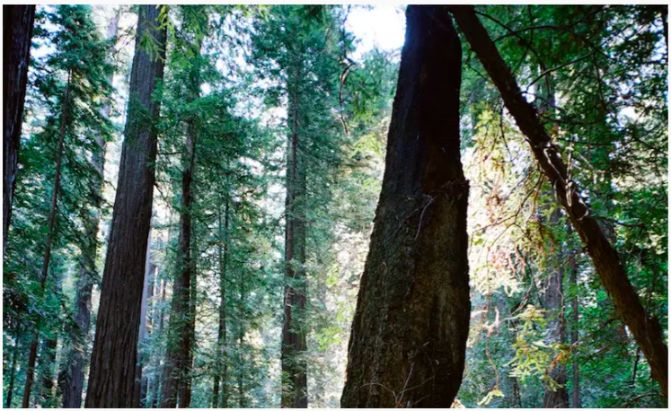
- New Trimble Forestry Lab at the University of British Columbia
-
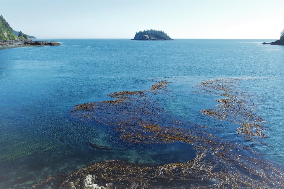
Mapping the health of kelp forests
-
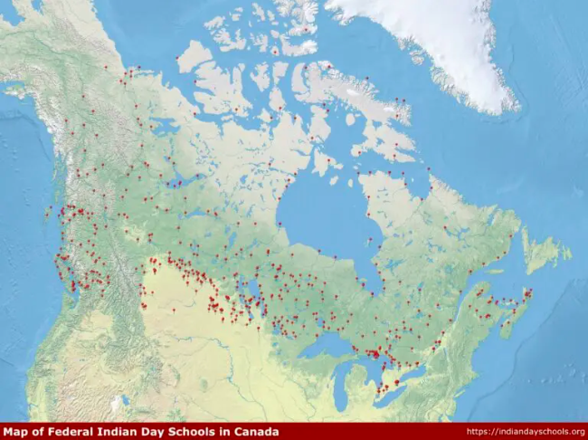
Raising Awareness About Canada’s Indian Day Schools With Digital History
-
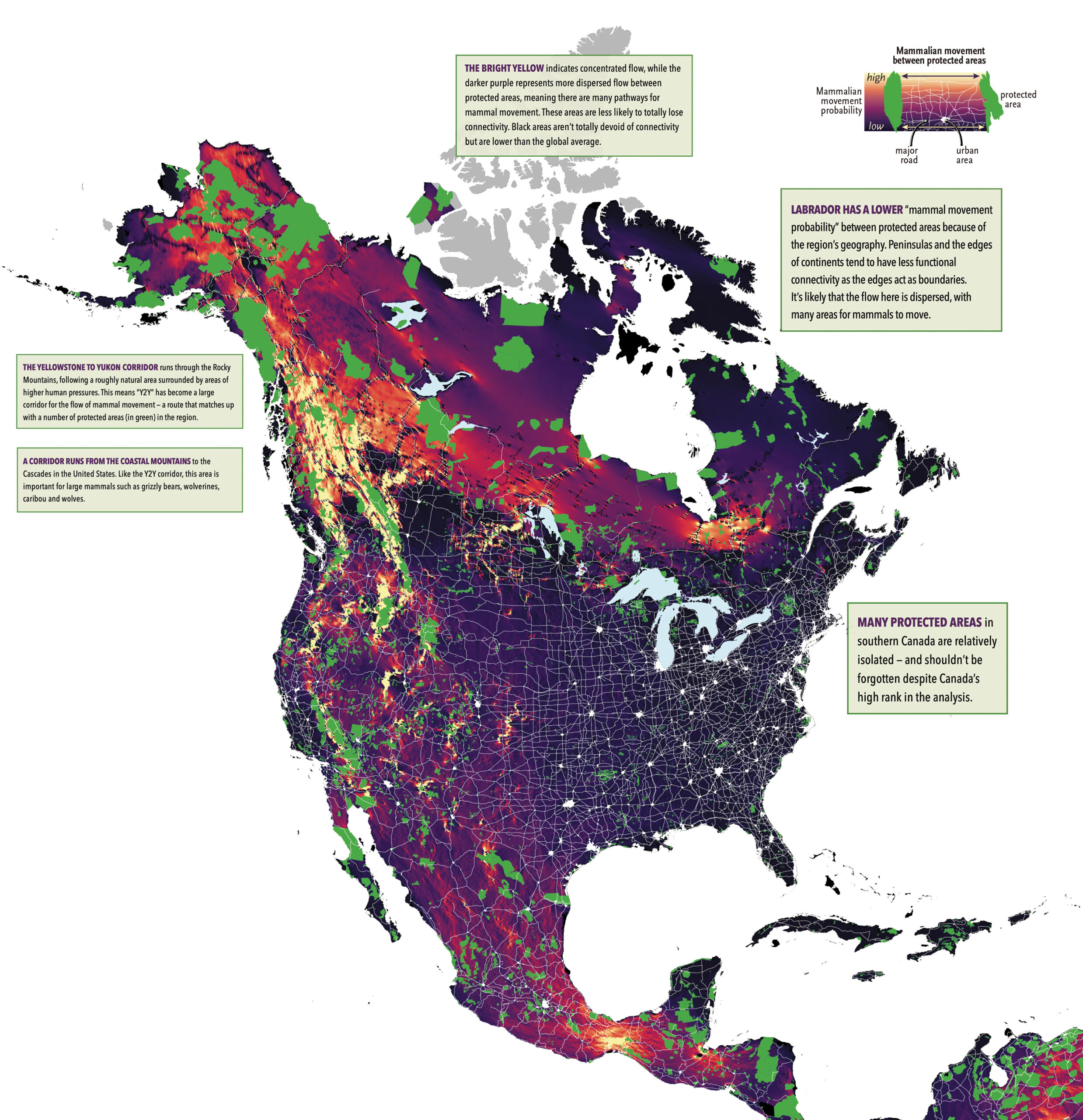
Global map depicts mammal movement between protected areas
-
‘An amazing moment,’ says team leader as satellite built in Nova Scotia launches into orbit
-
A recap of 2022 Canadian additions to the Living Atlas
New Trimble Forestry Lab at the University of British Columbia
The University of British Columbia has teamed up with Trimble, one of the leading global GNSS and GPS hardware and software suppliers, to build a forestry centred lab program on campus. Forestry has seen many technological integrations to improve sustainability tactics as well as production methods. This new forestry focused lab is also the first of its kind within Canada and has the potential to pave the way for even greater improvements. Read more here
Mapping the health of kelp forests
Research is being conducted on kelp forest resilience and decline based on stressors and ecosystem interactions. Maycira Costa, UVic geographer and Remote Sensing specialist, is collaborating with Indigenous communities and the Pacific Salmon Foundation, as well as many other conservation and resilience groups to help identify areas of potential protection and possible restoration for kelp forests. Read more on the historical and modern data uses here
Raising Awareness about Canada’s Indian Day Schools With Digital History
Last year, several reports of mass graves of Indigenous children who died at “Indian Day Schools”. This article sources a database to help map these tragedies. It wasn’t just schools involved, but also “sanatoriums and tuberculosis hospitals” as well. Read more here, and use the intractable map here
Global map depicts mammal movement between protected areas
The article focuses on how biodiversity not only needs vital habitat space, but also the ability to connect through migration patterns. A global map was developed to showcase migratory patterns of “where mammals are most likely to move between protected areas”. However, the biggest note to take from these findings is “that Canada is both a world leader in connectivity and home to many areas critical to animal movement”. Read more and check out the related map here
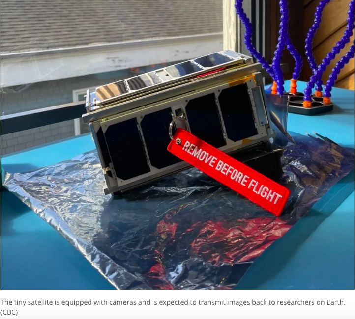
‘An amazing moment,’ says team leader as satellite built in Nova Scotia launches into orbit
Around 300 Nova Scotia students from the Dalhousie Space Systems Lab were able to launch a satellite with help from NASA. This satellite, which is no bigger than a shoe box, is one of many satellites built as part of the Canadian CubeSat Project and this particular one is the first made in Atlantic Canada. Read more here
A recap of 2022 Canadian additions to the Living Atlas
This article is more of a collection of maps than a traditional piece, but still just as interesting based on the wide variety of topics and the potential to use as resources for projects or other means. This recap focuses on the Canadian additions and awards granted through the living atlas. Read more here


Be the first to comment