
- Canada’s Efforts to Protect Southern Resident Killer Whales Mapped
- Saving Roads by Restoring Wetlands
- Ottawa Bike Maps
- Mapping Ontario’s High-Speed Internet Projects
- Hamilton Beach Chosen for a Collaboration Between Mohawk College and Transport Canada for Drone Test Site
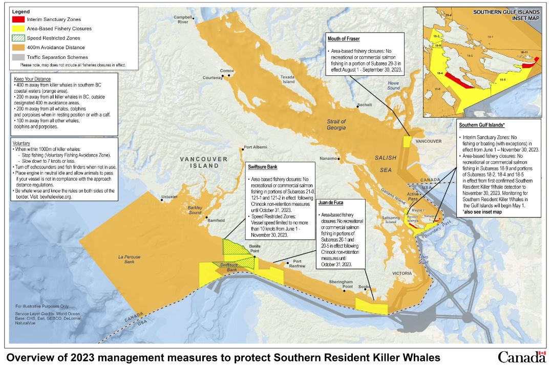
Canada’s Efforts to Protect Southern Resident Killer Whales Mapped
Fisheries and Oceans Canada released a few maps that document management measures in the Southern Pacific region to aid in the protection of resident Killer Whales. Some measures include activities such as fishery closures, traffic separation, restriction of both recreational and commercial fishing of salmon. These measures contribute to the protection of killer whales which are a cultural significance for Indigenous Peoples and coastal communities. Read More and check the maps out.
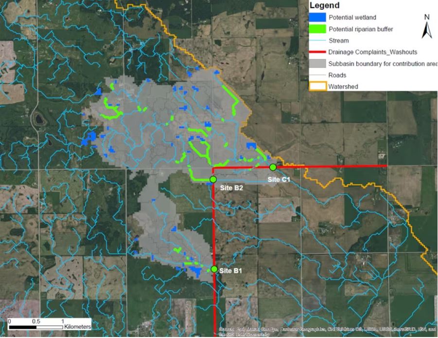
Saving Roads by Restoring Wetlands
By mapping out reoccurring road wash outs and streams that floods during heavy rains, one research group decided to go for the root of the problem. This involved the restoration of some upstream wetlands that can hold water. Resultantly, fewer roads need to be repaired multiple time in the long term. Read More.
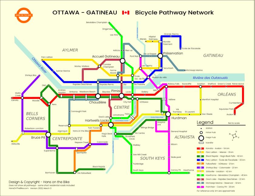
Ottawa Bike Maps
Think exploring Ottawa on a Bike this summer? Hans on the bike has it all mapped out. Using a subway style map, bike routes, coffee shops, restaurants, light rail stations are complied into your one stop shop for a city adventure! Read More.
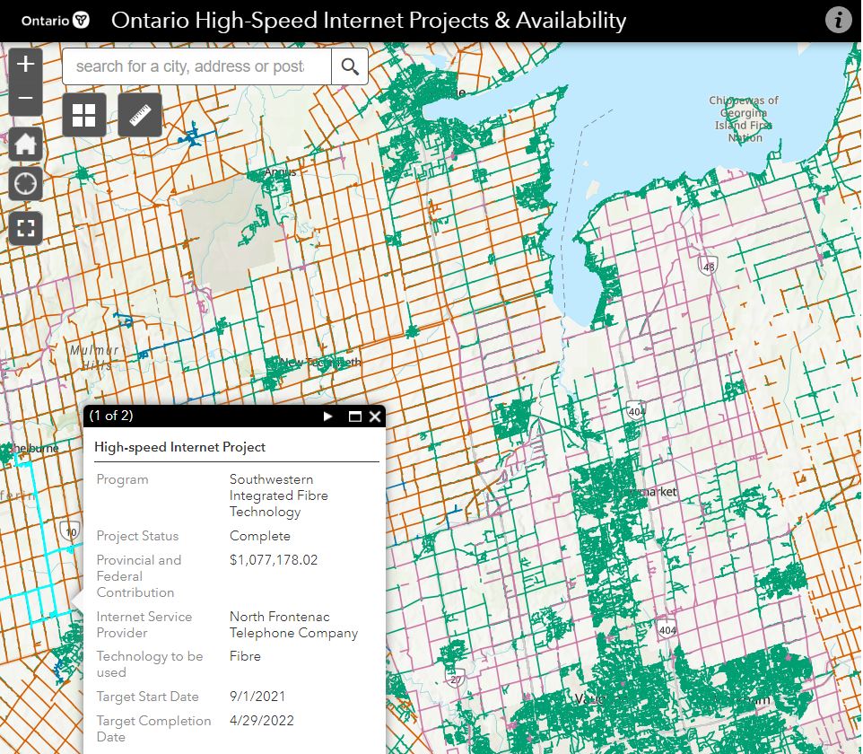
Mapping Ontario’s High-Speed Internet Projects
Wondering where in Ontario one can get high speed internet? This map shows projects that are either government funded, pending, completed and currently available high speed internet in communities throughout Ontario. In addition, dates, internet providers, technology used and monetary values can be reviewed. Read More.
Hamilton Beach Chosen for a Collaboration Between Mohawk College and Transport Canada for Drone Test Site
As the UAV industry grows, so does the development of multiple use cases. By securing a safe space, emerging technologies and flight training can be conducted to further develop the industry. This site will be managed by the Unmanned and Remote Sensing Innovation Centre. Read More.


Be the first to comment