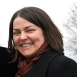
In honor of international Women’s day on March 8th, GoGeomatics will feature interviews and articles by women about women in our field. GoGeomatics Canada is honored to welcome Tammy Sikma, Manager of GIS, County of Peterborough to the community!
GoGeomatics Canada: Welcome Tammy and thank you for your contribution to Women in GIS. Let’s start with a brief introduction. Can you please provide a short bio for our readers?
Tammy Sikma: Hello GoGeomatics Community! Thanks for the invitation to share my love for geomatics. I grew up in Hamilton, Ontario, and completed a degree at the beautiful University of Guelph before getting my serious hands-on geomatics training at Sir Sandford Fleming College. My career has involved working with municipalities, although I gained good experience with the Bruce Trail Association’s maps as a student intern.
GoGeomatics Canada: Is there a specific memory or experience that led you to choose a career in GIS / geomatics?
Tammy Sikma: I think I’ve always loved maps. I fondly remember Mrs. Robertson’s grade 3 mapping unit where we turned a sketch of a stream with rapids into a map. It made mapping tangible for me for the first time, but it was the University of Guelph’s Dr. Janet Mersey that got me hooked. Her interest in cartography and recommendations for several Canadian technical schools led me to choose Fleming College for my hands-on training.
GoGeomatics Canada: You graduated from Fleming with a Cartographic Technician / Technologist Diploma. What do you think you gained from this program and how have you applied it throughout your career?
Tammy Sikma: This is a hard question. What didn’t I gain here!? I had the benefit of learning under several terrific instructors. Dave Opie taught me the traditional cartographic basics. I learned how to create hillshades with a pencil, how to use a light-table, scribing tools, and photographic equipment to carefully build up a map from many layers. The technology has changed but, there isn’t a single piece of theory about communicating your message clearly to a reader that was wasted. It impressed upon me the importance of displaying only what the reader needs, whether through text placement, legend development, or map detail. I also credit Tony Bonnici with teaching me the value of scripting to reduce redundant work and Chris Yu for introducing me to the power of GIS. I still look at the work we produce at the County to see that it adheres to the cartographic principles we were taught.
GoGeomatics Canada: Currently, you are working as the Manager of GIS for the County of Peterborough. Could you describe how your department uses GIS?
Tammy Sikma: I was fortunate to join the County just as GIS was being adopted here 10 years ago. Thanks to the foresight of other County staff and a terrific contractor, we were on the forefront in delivering GIS capabilities out to the many rural County & Township offices via the Internet from the very beginning. Early dial-up connections forced us to deliver data & tools as efficiently as possible. Today, we continue to deliver information via the web, but unlike when we began, we can’t beat the file transfer by hopping in the car and driving the data to the server!
Today we work primarily with County and Township planners, building officials, public works staff to capture and analyze the location of properties, infrastructure, and projects to help these people make the best decisions possible.
GoGeomatics Canada: In May, 2011 you won a URISA-Ontario Gold award for Innovation in GIS for www.Trip-Click.com GPS journey through Peterborough, Kawartha Lakes and Northumberland (sounds fabulous – my husband is from Cobourg I love this region). Congratulations! Can you explain to our readers about the project that won this award?
Tammy Sikma: Trip-Click is a versatile tool that offers visitors a way of designing a trip around their interests. Start with a suggested list of tour sites that suit your interests (e.g., great food, local arts and culture, historic collectibles or locales) and/or include additional gems to make the trip complete. The site works seamlessly in mobile and desktop environments to allow visitors to plan ahead or on-the-fly. Each site includes contact information and a description of what makes it worth the trip! Search for the “Giant’s Hearth of Sandy Lake”, “Wild Rice”, or “Rice Lake Drumlin Islands” for a sampling of some of my personal favourites. I was so fortunate to be supported in the development of www.Trip-Click.com at every step of this project. Senior administration and Council at the County supported the early development of a tourism map prototype through partnerships with Fleming College and Trent University. The students were able to demonstrate the value of creating a site that could engage travellers by providing them with stories and images about many of the terrific businesses and places of interest throughout Peterborough County & City. The local tourism organization, GPAEDC, was impressed enough to partner with the County on a commercial development of this site in 2010. Since then, Kawarthas Northumberland tourism (RTO8) has expanded the site tremendously by including many great places to explore in the City of Kawartha Lakes & Northumberland County.
 GTEC awards (Canada’s Government Technology Event 2011)
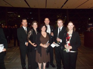
Trip-Click Team (L-R): Bryan Weir, Tammy Sikma, Janis Mussat, Adam Putter, Andrew Finlay, and Stephanie Whyley
GoGeomatics Canada: Have your experiences as a technician helped you in your position as a manager? What would be the top three strengths you gained from these positions that you carried over into a managerial role?
Tammy Sikma: I do appreciate having a good understanding of the technical work my team undertakes each and every day. I believe the top three things my years of technical experience offers me as a manager are: (1) an understanding of when the simple tasks are hard/time-consuming and the hard tasks are simple helps to balance workloads, (2) an ability to review projects objectively, technically, and aesthetically, and (3) a network of excellent colleagues throughout the industry that I can call on to help answer questions or offer advice on issues we’re facing at the County of Peterborough.
GoGeomatics Canada: Has your gender played a positive role in your career? Have you had to overcome any gender-based obstacles?
Tammy Sikma: I have been fortunate to be judged on the merits of my ability throughout my career and not my gender. There are often a lot of men in the room when you’re dealing with technical issues, however there are quite a few women, too. Very rarely have I had a client has looked to a male colleague when I’ve been the technical lead. When it has happened, I’ve simply kept on acting competently and professionally. Gender has never been a career limitation.
GoGeomatics Canada: As a woman in the industry, do you have any tips/suggestions for young women starting out?
Tammy Sikma: My advice for a young woman is the same as for a young man — work hard, keep learning, and love what you do. It can be hard to break into the market these days, but take any and every opportunity you can get. Volunteer when you can’t find work, take contracts when you can’t find full-time, and believe that if you’re doing the very best you can do that it will pay out in the end. Do what you love to do and you’ll do it well; the money will find you.
GoGeomatics Canada: What about for women who are mid-career and looking to transition from a technician-focused role into a management position?
Tammy Sikma: It was a leap of faith for me to move into management. An opportunity opened up and I felt compelled to try for it. This career change, like any other, required time and energy to grow into. I was fortunate to have a supportive husband who has helped to balance work pressures with the personal & family commitments that make it all worthwhile.
GoGeomatics Canada: What would be the wackiest / strangest job or project where you’ve had to apply your GIS/geomatics skills?
Tammy Sikma: Some unique projects I’ve had included: (1) mapping the landowners along the Bruce Trail and staying in the homes of a few kind & generous strangers while in the field, (2) using my (cartographic) design skills to develop interpretive signage at the Paletta Mansion in Burlington, and (3) working with a wide variety of interest groups to develop Trip-Click.
GoGeomatics Canada: GIS is a growing industry and still not utilized to its full potential. Can you envision areas where GIS could play a transformational role? What would be your dream GIS job?
Tammy Sikma: Health care. Thematic cartography began with Dr. Snow’s cholera map in 1854, but is used so little today to analyze the distribution of disease. Compare distribution and density of disease against any number of potential environmental causes and do so spatially and temporally and I think we can start to infer more about causes. It’s difficult data to collect, but this is an area I hope will be explored more soon.
GoGeomatics Canada: Canada has been blessed with rich resources but it is sparsely populated. Based on our geography, can you comment on how GIS may help Canadians address any future issues? (E.g., an ageing population, immigration, climate change, water-use, or arctic resource exploration)
Tammy Sikma: Almost every issue is a matter of place. As geomatics professionals, we can contribute to solutions by helping others to think about things in ways they haven’t been able to before. Many people don’t turn to GIS to help find solutions — not because they don’t trust them, but because they’re not aware of them. Sometimes it’s worth spending the time to draft an example to demonstrate the value of a geospatial analysis just to open up new opportunities.
GoGeomatics Canada: Are you on Twitter or do you follow any map / geomatics related blogs?
Tammy Sikma: I’m a very recent Twitter convert who was drawn in by Chris Hadfield’s daily tweets. My main source of social media updates come through LinkedIn groups. My list of groups includes the GIS Group, GIS Fusion, Esri GIS, URISA Ontario Chapter.
GoGeomatics Canada: If so, are there any industry people you like to follow or blogs to read…besides GoGeomatics Canada of course.
Tammy Sikma: I’m fortunately to live & work in an area where there is a wealth of skilled GIS professionals. While I don’t follow any specific technical blog regularly, I do read the URISA newsletters, Municipal World magazine, LinkedIn group discussions, and most importantly… I talk to my many skilled friends & colleagues. I love to hear about the Python automation my husband builds into his repetitive tasks and other colleagues’ use of Esri data models and solutions. There are great things happening throughout the industry.
GoGeomatics Canada: Specifically, do you recommend any women GIS industry leaders our readers can follow through social media?
Tammy Sikma: I honestly don’t pay much attention to gender when it comes to qualifications. My parents told me I could be anything I wanted to be a long time ago and I still believe this is true. What’s hard it being everything you want to be. It takes a lot of support to be successful in business, recreation, and home. I’d suggest following anyone in whom you have an interest, regardless of gender. I believe as women we’re working to be considered by our merits in the same way men are. If that’s true, it shouldn’t matter who you learn from.
Learn, grow, and believe in yourself. If you’re confident in your abilities, others will be too.


Be the first to comment